Key Points
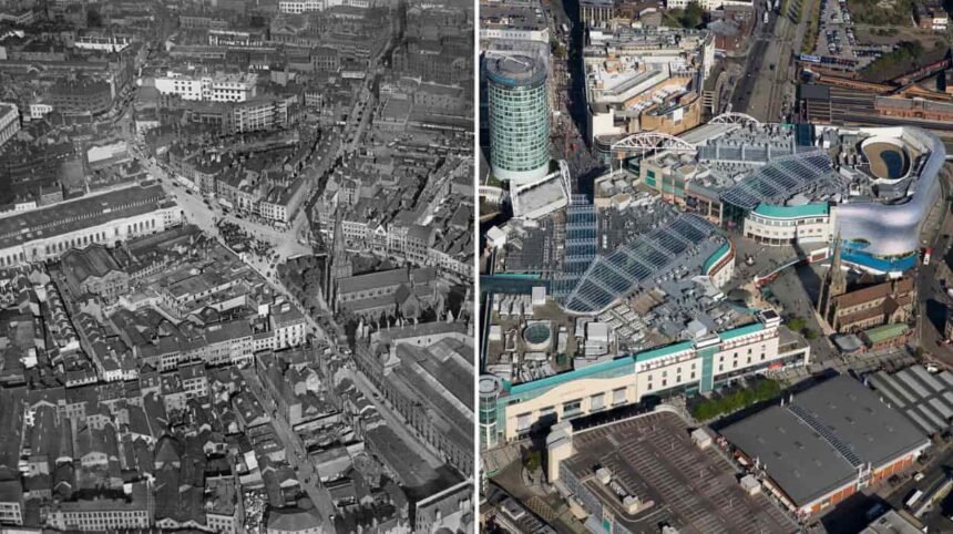
- Historical Image Archive: Six historic aerial images taken in a 26 year time period from 1949 until the mid-1970s have been uncovered in the archives of the Tyne and Wear Archives and Museums.
- Modern Comparison Images: Current aerial photography using drone technology provided by photographer Simon Greener for ChronicleLive allows a direct visual comparison of changes in the area.
- Featured Locations: The photo set includes six important locations in the area including Newcastle Quayside and its River Tyne bridges, Gateshead, Central Station, Baltic Flour Mills, The Hoppings fun fair and Byker.
- Technological Progression: Comparison of old post World War Two aerial photography technology and modern drone technology.
Newcastle upon Tyne (Newcastle Times) September 21, 2026 – A visual retrospective featuring comparative aerial photographs has highlighted the structural and landscape evolution of six iconic North East locations across several decades. Combining archival images dating from 1949 to the mid-1970s with contemporary drone photography, the collection documents urban development across Newcastle and Gateshead. The historical records provide a clear perspective on post-war industrial changes, infrastructure shifts, and residential redevelopment throughout the region.
- Key Points
- What Do the Historical Aerial Photographs of the North East Reveal?
- How Has Aerial Photography Technology Evolved in the North East?
- Background of the North East Aerial Archive Development
- Prediction: How Will This Photographic Comparison Affect Local Residents and Regional Heritage Enthusiasts?
What Do the Historical Aerial Photographs of the North East Reveal?
As reported by staff writers at ChronicleLive, a new photographic comparison showcases how six renowned North East locations have transformed over the past seven decades. The historical images, sourced directly from the Tyne and Wear Archives and Museums repository, capture key sites across a 26-year timeline extending from just after the Second World War in 1949 through to the mid-1970s.
The curated selection focuses on landmarks central to the region’s industrial and cultural heritage. The six locations featured in the archive and drone comparison include:
- Newcastle Quayside and the River Tyne Bridges: Capturing the river traffic, quay infrastructure, and historical bridges connecting Newcastle and Gateshead.
- Gateshead: Documenting urban development and industrial zones along the south bank of the Tyne.
- Central Station: Depicting the extensive rail network lines, platform layouts, and surrounding city streets in central Newcastle.
- The Baltic Flour Mills: Showing the industrial grain mill operational period on the Gateshead bank before its modern conversion into a contemporary art centre.
- The Hoppings Funfair: Highlighting the scale and layout of the traditional annual fairground gathering on the Town Moor.
- Byker: Illustrating the residential streetscape prior to and during major post-war redevelopment efforts.
Explore More Local Newcastle News
Tyne Bridge Overnight Closures Announced for Major Restoration Work Newcastle 2026
Newcastle Great Park Living & Property Review | Newcastle
How Has Aerial Photography Technology Evolved in the North East?
As detailed by ChronicleLive, the comparative project illustrates not only physical changes on the ground but also a major shift in media visual technology. While mid-20th-century aerial photographs required specialized light aircraft or helicopters equipped with heavy archive cameras, the modern images in the series were gathered using unmanned aerial vehicle (drone) technology.
Photographer Simon Greener of ChronicleLive utilized drone equipment to capture matching contemporary perspectives of the six historical sites. The side-by-side presentation enables viewers to evaluate how architectural planning, transport infrastructure, and green spaces have shifted across Newcastle and Gateshead since 1949.
Background of the North East Aerial Archive Development
The preservation and publication of historical aerial media in Tyne and Wear rests upon archival preservation programs managed by regional institutions. The Tyne and Wear Archives and Museums (TWAM) maintains historic glass plate negatives, film rolls, and prints documenting local council developments, industrial shipping along the Tyne, and municipal engineering projects.
Post-WWII aerial surveys were frequently commissioned by local planning authorities, transport boards, and industrial concerns to map land use, monitor urban density, and plan infrastructure such as the Byker Wall development and central rail expansions. The digitization of these physical archives over recent years has enabled media outlets to cross-reference historical spatial records with real-time digital drone photography, offering public access to regional heritage records.
Prediction: How Will This Photographic Comparison Affect Local Residents and Regional Heritage Enthusiasts?
The publication of comparative aerial visual series is expected to influence local interest across several key demographics in the North East:
- Local Residents and Historians: The accessibility of high-resolution “then and now” spatial imagery provides clear historical reference points for residents, urban planners, and local history societies evaluating post-war urban renewal, housing changes in Byker, and the transition of industrial zones like the Baltic Flour Mills into cultural quarters.
- Regional Tourism and Cultural Engagement: Public visibility of archived collection items from Tyne and Wear Archives and Museums typically generates increased engagement with local museums, archives, and digital heritage databases, encouraging broader public support for regional preservation initiatives.
- Visual Journalism and Local Media: The successful combination of archived physical media with modern unmanned aerial vehicle (UAV) photography sets a practical precedent for local news organization formats, encouraging continued use of visual mapping tools to cover regional development and municipal history.