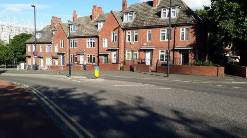
Arthur’s Hill is a residential neighbourhood in the West End of Newcastle upon Tyne, Tyne and Wear, England. Getting around the area involves using local bus services, walking along residential streets, finding suitable parking, and connecting with nearby destinations such as Newcastle city centre, Fenham and the surrounding West End.
- What should visitors know about getting around Arthur’s Hill?
- Which bus services connect Arthur’s Hill with Newcastle city centre?
- How should passengers check bus routes?
- How do bus journeys into the city centre work?
- What should passengers know about bus fares and accessibility?
- How can visitors travel from Arthur’s Hill to Newcastle city centre on foot?
- How should pedestrians plan a route?
- What are the main walking considerations in Arthur’s Hill?
- How can pedestrians reach local parks and green spaces?
- Where can drivers park in Arthur’s Hill?
- How can drivers identify legal on-street parking?
- Do residents need a parking permit?
- Where should visitors park when visiting a home in Arthur’s Hill?
- How can drivers reach Arthur’s Hill from other parts of Newcastle?
- Is Arthur’s Hill accessible for people with mobility needs?
- What should wheelchair users and people with limited mobility consider?
- How can families travel with pushchairs?
- Can people cycle around Arthur’s Hill?
- How can travellers combine buses, walking and parking efficiently?
- What is a practical approach for commuters?
- How should visitors plan trips involving several destinations?
- How do weather and seasonal conditions affect travel around Arthur’s Hill?
- Which official resources provide reliable travel information for Arthur’s Hill?
- How can residents make everyday journeys around Arthur’s Hill easier?
The neighbourhood’s street layout, housing density and connections to main roads influence how residents and visitors travel. Walking is practical for short local journeys, while buses provide connections to destinations across Newcastle. Drivers need to consider parking restrictions, residential access and the availability of legal parking spaces before travelling.
This guide explains how to get around Arthur’s Hill, Newcastle, using public transport, private vehicles and pedestrian routes. It covers journey planning, accessibility, road safety, parking considerations and the information travellers need to check before setting off.
What should visitors know about getting around Arthur’s Hill?
Arthur’s Hill is a residential neighbourhood in Newcastle upon Tyne’s West End, where walking, local buses and road connections support everyday travel. Journey planning depends on the destination, time of day, mobility needs and current transport information.
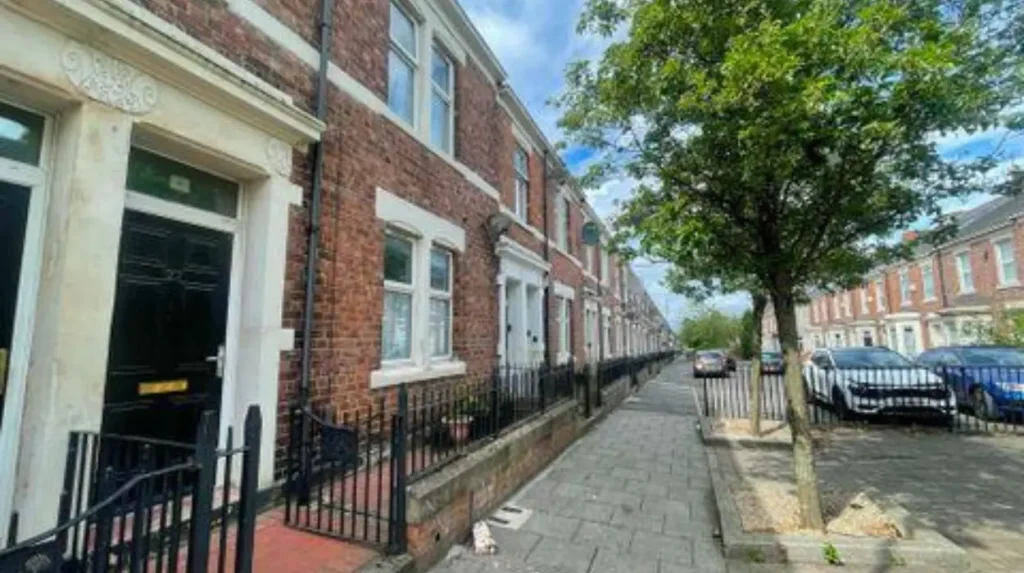
Arthur’s Hill sits within Newcastle’s wider urban area, where residential streets connect with local shopping areas, community facilities and major routes into the city. Its built environment includes traditional terraced housing, local businesses and streets serving daily residential activity.
The neighbourhood is not a single transport interchange. Instead, people use nearby bus stops, walk along local streets or travel towards larger roads to reach destinations beyond the immediate area. The most suitable travel method depends on the distance involved and whether the journey continues into central Newcastle.
For short trips, walking provides direct access to nearby shops and services without requiring a parking space. Bus travel offers an alternative for journeys across the city, particularly when carrying shopping or travelling longer distances. Cars provide flexibility for journeys involving several destinations, although parking availability depends on the specific street and any applicable restrictions.
Travellers should distinguish between Arthur’s Hill itself and the wider West End. A bus serving a nearby corridor does not necessarily stop on every residential street. Similarly, a parking space in a neighbouring district does not automatically provide convenient access to a particular address.
Newcastle City Council publishes information about local roads, parking restrictions and transport-related services. Nexus, the public transport organisation serving Tyne and Wear, provides information about buses, Metro services and journey planning. These sources help travellers confirm current arrangements rather than relying on outdated timetables or general descriptions.
Which bus services connect Arthur’s Hill with Newcastle city centre?
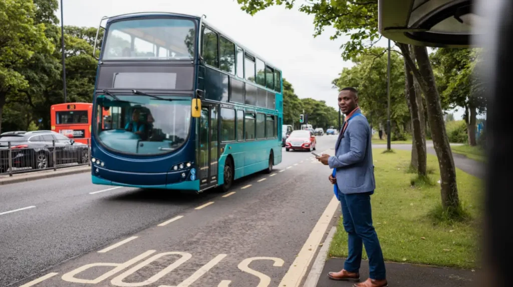
Bus travel connects Arthur’s Hill and Newcastle’s West End with destinations across the city. Passengers should identify the nearest suitable stop, check the route and direction, and confirm current departure times through Nexus or the operator before travelling.
Buses are an important part of everyday travel in Newcastle upon Tyne. They connect residential neighbourhoods with shopping areas, employment centres, education facilities and transport interchanges. For Arthur’s Hill residents, the appropriate service depends on the starting street and the destination.
The nearest bus stop is not always the most convenient one. A stop on a main road can offer a different selection of routes from a stop on a residential street. Travellers should compare walking distances to nearby stops before deciding where to board.
How should passengers check bus routes?
Nexus provides public transport information for Tyne and Wear, including bus journey planning and service updates. Passengers can use its official website to check routes, stops and timetable information before travelling.
Start by entering the journey’s starting point and destination. Select the relevant departure date and time, then compare the available options. Check the direction of travel and the location of the destination stop, particularly when the journey involves a change of bus.
Use the official Nexus website to access transport information. Operators also publish timetable details and service announcements. These sources are more reliable for current arrangements than an old timetable displayed on an unrelated website.
How do bus journeys into the city centre work?
Passengers travelling from Arthur’s Hill towards Newcastle city centre should select a service that serves their nearest stop and the required destination. The most suitable route depends on where they board and whether they need to reach a particular part of the centre.
Newcastle city centre includes several distinct destinations, such as Haymarket, Monument, Central Station and the Grainger Town area. A service that approaches one part of the centre does not necessarily provide the most direct access to another.
For a journey to Newcastle Central Station, for example, check whether the bus stops within a convenient walking distance of the station entrance. For a visit to shops or offices, compare the final walking distance from the bus stop with any alternative route.
Passengers should also consider the return journey. Evening services, weekend timetables and temporary diversions differ from some weekday daytime arrangements. Confirming both directions before leaving reduces the risk of a long wait at the end of the trip.
What should passengers know about bus fares and accessibility?
Bus fares, payment arrangements and accessibility features depend on the operator and the service. Travellers should check the current fare before boarding and confirm whether contactless payment, mobile tickets, concessionary travel or other payment methods apply to their journey.
Passengers using concessionary travel should check the rules associated with their pass, including the relevant travel times and participating services. Eligibility and conditions depend on the type of pass and the applicable scheme.
People travelling with wheelchairs, mobility aids, pushchairs or heavy luggage should check the accessibility information for their intended service. They should also consider the approach to the bus stop, including pavement width, kerbs and pedestrian crossing arrangements.
How can visitors travel from Arthur’s Hill to Newcastle city centre on foot?
Walking from Arthur’s Hill to Newcastle city centre involves following connected neighbourhood streets towards the central urban area. The route and journey time depend on the exact starting point, chosen destination, walking pace and conditions along the way.
Walking provides a practical option for people travelling between nearby destinations or combining several local errands. It removes the need to find a parking space and allows travellers to adjust their route as they move through the neighbourhood.
However, the distance to central Newcastle varies considerably depending on the starting street and final destination. Haymarket, Newcastle Central Station and the Quayside are separate destinations, so each requires a different route and walking-time estimate.
How should pedestrians plan a route?
Begin with the exact property, street or landmark where the journey starts. Enter the destination into a current mapping service and select walking directions rather than driving directions.
Compare the suggested routes before setting off. A shorter route on a map does not always provide the easiest journey for someone using a wheelchair, walking with a child or carrying shopping. Pavement conditions, road crossings, gradients and temporary works affect the practical route.
For a journey towards the city centre, pedestrians should follow the mapped streets towards their chosen central destination rather than assuming every route into the West End leads directly to the same place.
Allow additional time when walking during busy periods, in poor weather or after dark. Check for roadworks and pedestrian diversions when a route passes a construction site.
What are the main walking considerations in Arthur’s Hill?
Arthur’s Hill has a residential street network that serves homes, local businesses and community destinations. Pedestrians share the wider road environment with residents’ vehicles, delivery vehicles, cyclists and buses on the relevant streets.
On narrow pavements, people walking in opposite directions should allow space for one another. At junctions, check for vehicles turning across pedestrian crossings and avoid stepping into the road between parked cars where visibility is limited.
People unfamiliar with the area should use street names and verified map directions rather than relying on a destination’s approximate position. This is especially useful when a business entrance sits on a different street from its postal address.
For everyday journeys, walking is particularly useful when the destination is close enough to reach comfortably and the route provides suitable pedestrian access. Longer journeys are easier to plan by combining walking with a bus service.
How can pedestrians reach local parks and green spaces?
Local green spaces provide opportunities for recreation, exercise and short outdoor trips. The appropriate route depends on the particular park or playing field, its entrance and the pedestrian connections from the starting address.
Before leaving, identify the public entrance rather than simply navigating to the centre of a green space. Large parks often have several entrances, and the nearest point on a map is not always the entrance accessible from the surrounding street.
Check the opening arrangements where relevant and consider the return route before walking after dark. Uneven paths, wet surfaces and reduced lighting affect how comfortably pedestrians travel, especially during autumn and winter.
Where can drivers park in Arthur’s Hill?
Parking in Arthur’s Hill depends on the street, the signs displayed, road markings and any local parking controls. Drivers should check restrictions at the exact location, leave access clear and confirm whether a permit or payment is required before leaving a vehicle.
Arthur’s Hill is primarily a residential neighbourhood, so parking demand comes from residents, visitors, local workers and people travelling to nearby facilities. The availability of a legal space varies by street and time of day.
Drivers should not assume that every kerbside space is available for unrestricted parking. A road can contain permit bays, waiting restrictions, loading areas or other controlled spaces. These arrangements apply according to the relevant signs, markings and traffic orders.
Newcastle City Council provides official information about parking permits, restrictions and parking services. Its parking permits guidance explains the available permit types and how to establish eligibility.
How can drivers identify legal on-street parking?
Read the signs and road markings before parking. Check the days and hours when a restriction operates, whether a bay is reserved for a particular group of users and whether a maximum stay applies.
Yellow lines indicate waiting restrictions, while marked bays can have specific conditions. The precise restriction depends on the applicable signs and traffic regulations. Drivers should never rely on the appearance of a space alone.
Avoid blocking driveways, junctions, dropped kerbs and pedestrian crossings. Keep enough space for emergency vehicles and other road users. A space that appears wide enough for a car is not necessarily a lawful or considerate place to park.
If the signs are unclear, choose a different space until the restriction is understood. This is more reliable than assuming that a restriction does not apply because other vehicles are already parked nearby.
Do residents need a parking permit?
Residents need to check whether their particular address falls within a Newcastle City Council permit parking scheme. A permit is not required everywhere, and eligibility depends on the property and the relevant zone.
The council explains that resident permits apply to eligible properties in designated permit areas. A permit normally authorises parking only in the applicable scheme zone and does not provide unrestricted access to every controlled parking space across Newcastle.
Newcastle City Council
+1
Residents can use the council’s official resident permit service to check eligibility, application requirements and current charges.
Visitors should not assume that a resident’s permission to park automatically covers a guest’s vehicle. Newcastle provides visitor parking arrangements for eligible households in relevant schemes. Residents should check the conditions and arrange the appropriate permission before a visit.
Newcastle City Council
+1
Where should visitors park when visiting a home in Arthur’s Hill?
Visitors should confirm the parking arrangements with their host before arriving. Ask whether the property is in a permit-controlled area and whether a visitor permit, scratchcard or another arrangement applies.
If suitable on-street parking is unavailable, check for a legitimate alternative in the surrounding area. Confirm the walking distance, operating hours, payment requirements and any maximum stay before committing to a car park.
Do not use a private driveway, business car park or reserved bay without permission. Private parking conditions can differ from council-managed parking arrangements, and unauthorised parking can result in enforcement action.
People visiting during busy periods should allow time to find a lawful space. This is particularly important when an appointment has a fixed start time or when the visitor needs accessible parking close to the destination.
How can drivers reach Arthur’s Hill from other parts of Newcastle?
Drivers approaching Arthur’s Hill should use current navigation directions and check the destination street before entering residential roads. Route choice depends on the starting location, traffic, roadworks and restrictions, while the final approach requires attention to parking and local access.
Arthur’s Hill forms part of Newcastle’s West End road network. Its connections to the surrounding urban area make it accessible by car, but the most appropriate route differs for someone arriving from the city centre, another residential district or a location outside Newcastle.
Drivers should navigate to the actual destination rather than selecting a broad neighbourhood label. A destination pin placed at the centre of Arthur’s Hill can lead to a different street from the one required for a home, shop or community facility.
How should drivers plan the final approach?
Enter the complete address into a current navigation service. Review the proposed route and check the final turns before reaching the neighbourhood.
Residential streets can involve parked vehicles, junctions with limited visibility and narrow sections. Drivers should reduce speed where conditions require it and give pedestrians sufficient space, particularly near shops, crossings and bus stops.
If the destination is on a restricted or permit-controlled street, identify the parking arrangements before arrival. Navigation software provides route guidance but does not establish whether a particular parking space is lawful.
How do traffic and roadworks affect journeys?
Traffic conditions change throughout the day. Commuter movements, school-related travel, deliveries and local activities influence how easily vehicles move through urban streets.
Roadworks and temporary traffic orders can change access, introduce diversions or close a road section. A route that worked on a previous visit is not guaranteed to remain available.
Drivers should check current road information before an unfamiliar journey. When a diversion is in place, follow the official signs rather than attempting to bypass the closure through an unsuitable residential street.
Allow extra time for parking and the final walk to the destination. This is particularly useful for appointments, visits to local businesses and journeys involving passengers who need additional assistance.
Is Arthur’s Hill accessible for people with mobility needs?
Accessibility in Arthur’s Hill depends on pavement conditions, crossing facilities, bus-stop design and the entrances at each destination. Travellers with mobility needs should check the complete journey, including the walk to transport, boarding arrangements and access at the destination.
An accessible journey requires more than a bus or vehicle that accommodates a passenger. The route between the starting address and the transport stop also matters. Narrow pavements, uneven surfaces, parked vehicles and kerbs affect how easily people move through residential streets.
Newcastle City Council identifies inclusive travel, walking, wheeling and public transport as priorities in its wider transport strategy. Its work covers the infrastructure and connections that support people with different mobility requirements.
Newcastle City Council
+1
What should wheelchair users and people with limited mobility consider?
Before travelling, check whether the chosen route provides step-free access where required. Confirm the accessibility arrangements at bus stops and the destination, rather than relying solely on a journey planner’s estimated travel time.
Wheelchair users should check the relevant bus operator’s accessibility information and any arrangements required for boarding. People using walking aids should allow extra time for crossings and consider routes with suitable pavements and resting opportunities.
If a route includes a steep section or a busy junction, compare alternative routes. A slightly longer journey with more manageable crossings can be more suitable than a shorter route with difficult surfaces.
How can families travel with pushchairs?
Families using pushchairs should consider pavement width, crossing points and the amount of walking between stops. At busy junctions, use designated pedestrian crossings and wait for the appropriate signal where one is provided.
When travelling by bus, check whether the service has suitable space for a pushchair and follow the operator’s rules. Boarding conditions and the available space can vary with passenger numbers and the type of vehicle.
Planning the return journey is also important. Identify the correct stop for the return direction and check the timetable before leaving the destination.
Can people cycle around Arthur’s Hill?
Cycling is an option for local journeys in Newcastle, but riders should assess the route, traffic conditions and available cycling infrastructure before setting off. Check current maps for designated cycle routes and use suitable parking facilities at the destination.
Cycling can connect Arthur’s Hill with nearby neighbourhoods and wider parts of Newcastle. The suitability of a route depends on the streets involved, traffic conditions, junction layouts and the rider’s experience.
Newcastle City Council has invested in walking and cycling infrastructure across the city. Its published cycling and walking information describes improvements designed to support active travel and safer connections. However, citywide investment does not mean every residential street has a dedicated cycle lane.
Newcastle City Council
+1
How should cyclists plan a local journey?
Choose a route using current cycling directions rather than simply following the quickest driving route. Check the type of road, junctions and available cycling facilities before travelling.
At busy junctions, make intentions clear, maintain awareness of surrounding traffic and follow traffic signals. Use lights and reflective equipment in low-light conditions, and secure the bicycle at an appropriate parking point when arriving.
People combining cycling with public transport should check the rules for carrying bicycles on their intended service. Bicycle carriage policies vary by transport mode and operator.
How can travellers combine buses, walking and parking efficiently?
Combining transport methods helps travellers adapt to different journey lengths and destinations. Walking covers short distances, buses connect neighbourhoods with wider destinations, and driving provides flexibility when a journey requires a vehicle or involves several stops.
The most practical travel arrangement depends on the purpose of the trip. A resident visiting a nearby shop has different requirements from a commuter travelling across Newcastle or a visitor arriving with luggage.
For short journeys, walking avoids the need to check a bus timetable or locate parking. For longer journeys, a bus can reduce the amount of time spent driving through urban streets and searching for a space.
Drivers visiting a busy destination can also consider parking legally farther from the final address and completing the remaining distance on foot, provided the parking location permits the intended stay.
What is a practical approach for commuters?
Commuters should check the morning and evening journeys separately. Bus frequencies, traffic and departure times differ according to the route and time of day.
A useful plan identifies the nearest suitable stop, the required service, the expected arrival time and an alternative if the first option is delayed. People working to a fixed start time should allow a reasonable margin for walking and waiting.
For those driving, the plan should include parking restrictions and the walking distance from the vehicle to the workplace. A route that reaches the neighbourhood quickly does not guarantee that a convenient parking space is available.
How should visitors plan trips involving several destinations?
Visitors travelling to more than one location should organise the stops geographically. Completing nearby errands in one walk reduces repeated journeys between the same streets.
For example, someone visiting a local business and then a nearby residential address can check whether both destinations are accessible on foot from one suitable starting point. If the next destination is farther away, a bus may be more practical.
For longer outings, confirm opening times, public transport connections and the return journey before departure. If driving, check the permitted parking duration to ensure the vehicle can remain in place for the full visit.
How do weather and seasonal conditions affect travel around Arthur’s Hill?
Weather affects walking comfort, visibility, road conditions and public transport reliability. Travellers should check forecasts and service updates, allow additional time in poor conditions, and choose routes that suit their mobility, clothing and transport arrangements.
Rain makes some paving surfaces slippery, while winter darkness reduces visibility for pedestrians and drivers. Strong winds and cold temperatures also affect people waiting at exposed bus stops.
During autumn and winter, check the time of sunset when planning a longer walk. Wear suitable footwear and use reflective clothing or lights when conditions reduce visibility.
Drivers should allow more stopping distance in poor weather and avoid obstructing pavements when parking. Pedestrians should take additional care when crossing wet roads, especially where vehicle visibility is reduced.
Heavy rain, flooding, road maintenance or temporary closures can also affect specific routes. Check official travel updates before leaving when adverse conditions are expected.
Which official resources provide reliable travel information for Arthur’s Hill?
Nexus and Newcastle City Council provide key information for planning journeys around Arthur’s Hill. Use Nexus for public transport services and journey planning, and consult the council for parking permits, road restrictions and local transport improvements.
Transport information changes as operators revise timetables and councils introduce roadworks or parking controls. Official sources help travellers check the arrangements that apply to their specific journey.
The following resources cover the main travel requirements:
- Bus services and journey planning: Nexus provides regional public transport information, including bus services and travel updates.
- Resident parking permits: Newcastle City Council parking permits explains permit types, eligibility and application procedures.
- Walking and cycling: Newcastle City Council’s walking and cycling information describes the city’s active travel infrastructure and initiatives.
- Roadworks and traffic restrictions: Newcastle City Council transport improvements provides information about transport schemes and road changes.
Travellers should check the date of any timetable or travel notice they use. Older articles and archived council announcements are useful for background information, but they do not establish current service arrangements.
How can residents make everyday journeys around Arthur’s Hill easier?
Residents can simplify everyday travel by checking routes in advance, understanding local parking controls and choosing transport according to distance and accessibility. Keeping an alternative route available helps manage delays, service changes and limited parking without unnecessary detours.
Arthur’s Hill offers several ways to travel through Newcastle’s West End. Walking serves short local journeys, buses provide links to destinations across the city, and driving supports trips that require a vehicle. Cycling offers another option where the route and road conditions are suitable.
The neighbourhood’s residential layout makes it important to plan the final part of each journey. Knowing the nearest appropriate bus stop, identifying a suitable pedestrian route and checking parking restrictions are practical steps for residents and visitors alike.
For a regular commute, save the relevant stops and check service updates before leaving. For a car journey, verify the destination address and parking arrangements. For a walk, consider pavement conditions, crossings and the return route.
The most reliable approach is to use current official information rather than assume that a route, timetable or parking arrangement remains unchanged. With these checks, residents and visitors can navigate Arthur’s Hill more confidently while choosing transport that suits each journey.