South Gosforth and Jesmond are neighbouring suburbs in Newcastle upon Tyne with different historical foundations and present-day identities. Both developed from older rural landscapes into residential districts during Newcastle’s nineteenth-century expansion, but their built environments evolved around different economic, transport, social and architectural influences.
- How did South Gosforth and Jesmond develop historically?
- Why did nineteenth-century development change both neighbourhoods?
- What historic architecture can still be seen in South Gosforth?
- What historic architecture defines Jesmond today?
- How do South Gosforth and Jesmond house prices compare?
- Which area has more nightlife, South Gosforth or Jesmond?
- Which area offers more family-oriented green space?
- How does transport history explain the difference between the two suburbs?
- What does the historical evidence reveal about living in South Gosforth versus Jesmond today?
South Gosforth retains strong connections with the historic Gosforth settlement, St Nicholas Church, coal mining, the Great North Road and later suburban expansion. Jesmond developed around an older medieval settlement, Jesmond Dene and substantial Victorian residential development associated with Newcastle’s industrial and commercial prosperity.
Their present-day housing markets also differ. Recent sold-price data records an overall average of £351,553 in South Gosforth and £363,389 in Jesmond over the last year, although property type has a major effect on these figures.
Understanding the historical development of both districts explains why their housing, nightlife, green spaces and family environments remain distinct.
How did South Gosforth and Jesmond develop historically?
South Gosforth grew from a medieval settlement around St Nicholas Church and later experienced coal mining and Victorian suburban expansion, while Jesmond developed from a medieval village into a prosperous Victorian suburb shaped by industrial wealth, landscaped estates and Newcastle’s expanding urban population.
The history of both districts reaches well beyond their modern reputation as residential suburbs.
South Gosforth was recorded in 1166 as part of the barony of Whalton. Medieval landholding was divided between the Lisle family and, later, the Heselrig family. Four taxpayers were recorded in 1296 and five in 1312. The settlement stood close to what is now St Nicholas Church.
The settlement remained relatively small for centuries. An early Ordnance Survey map surveyed around 1855 showed a farm, school and a small number of dwellings. The 1826 electoral record listed only six voters. This provides a clear contrast with the densely developed suburb that exists today.
Jesmond also has medieval origins. Its earliest documentary reference dates from the late twelfth century, when it formed part of the barony of Ellingham. The medieval settlement was associated with the area around The Grove and St Mary’s Chapel. The township contained three open fields and a common, with full enclosure not completed until the early nineteenth century.
Archaeological evidence pushes the history of Jesmond further back. Flint artefacts and Bronze Age cist burials have been recorded, including finds made at Crag Hall in 1844 and Villa Reale in 1828. St Mary’s Chapel in Jesmond Dene was recorded from 1272 and became a medieval pilgrimage site before its dissolution in 1548.
The two areas therefore share an ancient rural background, but their later development followed different economic routes.
South Gosforth became closely connected with mining and transport. Jesmond became increasingly associated with affluent residential development, industrial leaders and proximity to central Newcastle.
Why did nineteenth-century development change both neighbourhoods?
Newcastle’s nineteenth-century industrial expansion transformed both districts by increasing demand for housing outside the crowded historic core, while improved roads, public transport, employment and private investment encouraged Victorian terraces, villas and planned residential streets.
Newcastle experienced extraordinary population growth during the nineteenth century. The city’s population rose from about 28,000 in 1820 to approximately 215,000 by 1900. Industrial expansion created employment and wealth while increasing pressure for suburban housing.
South Gosforth experienced this transition particularly strongly during the second half of the nineteenth century. Coxlodge and Bulman Village expanded, while new streets appeared around the older settlement. Woodbine Road, West Avenue, Ivy Road, Hawthorn Road and Causey Street formed part of this expansion.
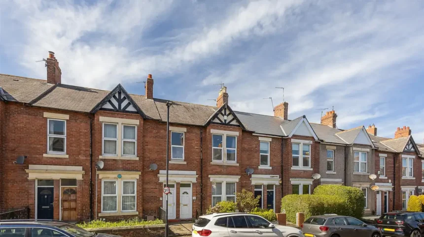
The housing stock reflected different social groups. Two-storey brick and stone terraces provided relatively dense accommodation, while larger detached houses appeared along important routes such as Kenton Road. Later development introduced more substantial semi-detached housing and planned estates.
Jesmond experienced an especially strong Victorian residential transformation. The South Jesmond Conservation Area records substantial development between approximately 1858 and 1898. Osborne Avenue, Osborne Road, Clayton Road, Fernwood Road, Akenside Terrace, Granville Road and sections of Jesmond Road became important residential streets.
The development reflected Newcastle’s industrial wealth. Shipbuilders, shipowners, commercial figures and other members of the city’s prosperous professional and business classes established homes in Jesmond. The conservation record identifies figures including T.H. Bainbridge and G.B. Hunter among people associated with the area.
Pears Archbold played a major role in constructing residential property between 1863 and 1875. His development included Portland Terrace, Hutton Terrace, Percy Terrace, Akenside Terrace and villas along Clayton Road.
This difference remains visible today. South Gosforth contains a mixture of Victorian terraces, later suburban houses and twentieth-century development. Jesmond retains concentrations of Victorian villas, terraces and large period properties.
What historic architecture can still be seen in South Gosforth?
South Gosforth retains Victorian and Edwardian houses, St Nicholas Church, historic terraces and locally significant buildings that record its transition from rural settlement and mining district to an established Newcastle suburb. The Gosforth Conservation Area protects important architectural and historic character.
The Gosforth Conservation Area was designated in April 2002. Newcastle City Council identifies High Victorian, Queen Anne Revival and Edwardian architecture as important components of its character. The area also contains the traditional Gosforth High Street and historic residential streets.
St Nicholas Church is one of the most important surviving historic structures in South Gosforth. The church has medieval origins, although much of the surviving building belongs to later periods. A new chapel was built in 1799, with additions designed by John Dobson in 1820. Further additions were made in 1912–13 and 1950. The building is Grade II listed.
The churchyard provides another important historical record. The first recorded burial there dates to 1170. The five-acre churchyard contains historic gravestones, tombs and mature trees, including the tomb of the Brandling family, owners of Gosforth Park.
Mining also shaped South Gosforth’s historical identity. Gosforth Colliery included the Mary and Fanny Pits, West Pit and Brandling Pit. The first shaft at the Mary and Fanny complex was sunk in 1825, while coal was reached in 1829 after the shaft had to descend to 181 fathoms because geological conditions affected access to the seam. The workings were out of use by 1895.
Industrial history is therefore embedded within the residential landscape. Streets that now contain family houses and local businesses developed in an area previously influenced by coal extraction, agriculture, churches and transport routes.
The conservation designation provides a modern mechanism for protecting historic character. Newcastle currently has 12 conservation areas, including Gosforth, South Jesmond and Jesmond Dene.
What historic architecture defines Jesmond today?
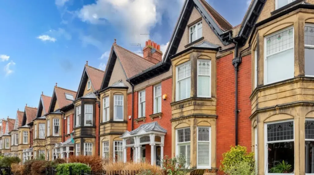
Jesmond is defined by medieval remnants, Victorian terraces, sandstone and brick villas, landscaped streets, Jesmond Dene and surviving heritage structures associated with Newcastle’s nineteenth-century industrial and commercial elite. South Jesmond Conservation Area provides formal protection for much of this architectural character.
South Jesmond Conservation Area was designated on 22 December 1987. Its historic environment is dominated by late Victorian residential development set within mature landscapes. The conservation area includes Jesmond Cemetery, Jesmond Old Cemetery and the County Cricket Ground.
The architectural range is substantial. Large detached and semi-detached Victorian villas sit alongside terraces. Buildings use sandstone, buff brick and red brick, with Italianate, restrained classical and Queen Anne influences. Some nineteenth-century houses have since been converted to commercial uses.
The conservation area includes a Grade II* listed entrance archway and chapel lodges at Jesmond Cemetery, together with 13 Grade II listed buildings and eight locally listed sites. Jesmond Old Cemetery is also a Grade II Registered Historic Park and Garden.
Jesmond Dene provides a different type of heritage. The dene is an ancient wooded valley along the Ouseburn. During the nineteenth century, industrialist Sir William Armstrong transformed much of it into a landscaped private estate.
By 1862 Armstrong had purchased most of Jesmond Dene and developed Jesmond Dene House and landscaped grounds containing waterfalls, a grotto and exotic planting. He transferred the garden to Newcastle in 1883, and the park opened to the public in 1884.
The Banqueting Hall survives as an important Grade II listed building. Designed by John Dobson in 1860–62, it provided Armstrong with a venue for entertaining clients and guests. Its original design included an art gallery and a water-powered pipe organ.
These surviving structures explain why Jesmond has a particularly strong architectural identity.
How do South Gosforth and Jesmond house prices compare?
Recent sold-price data places the overall South Gosforth average at £351,553 and the Jesmond average at £363,389, but property type creates substantial differences because both neighbourhoods contain flats, terraces, semi-detached homes and larger period properties.
House prices require careful interpretation because average figures combine different types of housing.
Rightmove records an overall South Gosforth average of £351,553 for the latest year covered by its sold-price data. Terraced properties averaged £399,671, while semi-detached properties averaged £387,444.
The same dataset records South Gosforth prices as 12% higher than the previous year and 17% above the reported 2022 peak of £301,193. These figures describe recorded transactions rather than an appraisal of every property currently available.
Jesmond recorded an overall average of £363,389 over the same broad period. Flats averaged £217,643, terraced properties averaged £480,609, and semi-detached properties averaged £695,321.
The difference between the neighbourhood averages therefore does not represent a simple premium on every Jesmond property. Jesmond contains a large flat market alongside expensive Victorian houses, while South Gosforth has a different distribution of property types.
Recent transactions illustrate this variation. In South Gosforth, a four-bedroom semi-detached house at Ridgewood Crescent sold for £370,000 in April 2026. Several transactions on Windsor Terrace during 2025 and 2026 exceeded £500,000.
Jesmond also has a wide range. Recent recorded transactions include flats around £275,000–£450,000 and terraced houses above £500,000. A four-bedroom terraced property on Princess Mary Court sold for £625,000 in June 2026.
The historical housing stock helps explain these differences. Jesmond’s Victorian villas and substantial terraces provide large properties in highly established streets, while South Gosforth combines period housing with later suburban forms.
For property research, sold prices should therefore be examined by street, property type, tenure, size and condition rather than by suburb-wide average alone.
Which area has more nightlife, South Gosforth or Jesmond?
Jesmond has a stronger concentrated nightlife identity because Osborne Road developed into a major student-oriented food, drink and evening destination, while South Gosforth has a more traditional local hospitality pattern centred on Gosforth High Street and established neighbourhood pubs.
Jesmond’s nightlife is closely connected with the expansion of Newcastle’s universities and student accommodation. Newcastle University records that Osborne Road has housed student accommodation since the 1950s and describes it as a major student-oriented evening destination.
Osborne Road also contains supermarkets, cafés, restaurants, bakeries and bars. Newcastle University identifies the street as a lively part of Jesmond’s food and drink environment.
This commercial concentration gives Jesmond a different evening profile from South Gosforth. The district combines residential streets with a substantial hospitality economy and a large student population.
South Gosforth’s historic hospitality pattern is older in character. Gosforth High Street contains public houses that form part of the area’s architectural heritage. Newcastle City Council’s conservation statement identifies the County, Brandling Arms, Earl Grey, Queen Victoria and Gosforth Hotel among historic public houses associated with the former Bulman Village.
The Gosforth Hotel provides a particularly clear example. The building dates from 1878, with a buffet bar added in 1891 and a distinctive tiled façade added in 1913. It served as a stopping point on the Great North Road.
The distinction is therefore historical as well as contemporary. Jesmond’s nightlife developed alongside twentieth-century student housing and its proximity to Newcastle University. Gosforth’s hospitality environment has deeper roots in the historic high street and road-based suburban economy.
For visitors interested in both heritage and present-day activity, the contrast is useful. To experience this historic landscape in person today, consult our comprehensive [Insert Anchor Text for Things to Do Article Here] for itineraries and visiting parameters.
Which area offers more family-oriented green space?
Both neighbourhoods provide substantial green space, but their landscapes differ: South Gosforth benefits from Gosforth Central Park and nearby open spaces, while Jesmond is closely associated with Jesmond Dene, Armstrong Park, mature Victorian streets and connected recreational routes.
Gosforth Central Park is one of South Gosforth’s important modern recreational assets. Newcastle City Council records more than 200 trees, formal flowerbeds, a wildflower meadow, wildlife pond, play facilities, tennis courts, basketball facilities, bowling and open grassland.
The park is particularly relevant to families because its facilities include a play area for children under 14, sports courts and open spaces for informal recreation. The nearest Metro station is South Gosforth.
Jesmond’s principal green-space asset is Jesmond Dene. Newcastle City Council describes the dene as ancient woodland with geological and ecological importance. The Ouseburn runs through the valley, while paths connect the area with neighbouring parks.
The dene also contains Pets Corner, which opened in the 1960s, a visitor centre, café, classroom and play area. These facilities provide a family-oriented use for a landscape whose origins include nineteenth-century private estate design and earlier industrial activity.
Armstrong Park provides another major open space connected with the Jesmond landscape. Lord Armstrong gifted the park to Newcastle in 1878. It contains mature woodland, grassland, steep valleys, sports facilities and a restored post-medieval watermill.
The historical importance of these landscapes extends beyond recreation. Jesmond Dene demonstrates how nineteenth-century industrial wealth created a designed landscape that later became a public asset. South Gosforth’s parks demonstrate how established suburbs incorporated public recreation into twentieth-century urban life.
How does transport history explain the difference between the two suburbs?
Transport helped convert both rural settlements into suburbs, with roads, tramways, railways and later Metro connections increasing access to Newcastle. South Gosforth retained strong connections with the Great North Road, while Jesmond benefited from routes toward the city and university districts.
The Great North Road is fundamental to Gosforth’s history. Newcastle’s Historic Environment Record describes it as an ancient northward route, possibly Roman in origin and certainly an important medieval highway. The modern Gosforth High Street follows this historic corridor.
Transport supported commercial development along the high street. Public houses, shops and services emerged alongside the route, creating the mixed residential and commercial environment that remains visible today.
Gosforth also developed railway and tram infrastructure. The Historic Environment Record identifies Gosforth Station and the Gosforth Park Light Railway among the area’s historic transport assets. The light railway extended tram services towards Gosforth Park, where the racecourse had been established in 1882.
Jesmond’s transport geography developed around routes such as Jesmond Road and Sandyford Road. These routes helped connect the expanding residential district with Newcastle’s central areas. The South Jesmond Conservation Area records them as important historical routes through the district.
Modern transport continues this suburban relationship. Newcastle City Council identifies South Gosforth Metro as the nearest station for Gosforth Central Park, while Jesmond Dene is served by nearby Jesmond and West Jesmond Metro stations.
The transport story explains why both areas remain attractive to people who need access to central Newcastle. Their modern accessibility is built upon infrastructure established through successive phases of urban development.
What does the historical evidence reveal about living in South Gosforth versus Jesmond today?
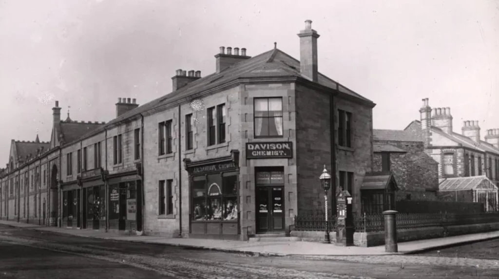
South Gosforth reflects a layered history of medieval settlement, coal mining, Victorian expansion and family-oriented suburban development, while Jesmond combines medieval origins, Victorian affluence, university influence and major landscaped heritage sites within a highly established residential district.
The distinction between the two neighbourhoods is not simply a matter of modern lifestyle branding. Their current physical environments reflect different historical processes.
South Gosforth’s identity developed from a small medieval settlement into an industrial and suburban district. St Nicholas Church and its churchyard preserve evidence of the medieval community. Gosforth Colliery records the area’s industrial period. Victorian terraces and later housing demonstrate the suburban transformation.
Jesmond followed a different trajectory. Its medieval settlement and pilgrimage landscape were followed by estate development and Victorian urbanisation. Industrial wealth financed substantial houses, while Lord Armstrong’s transformation of Jesmond Dene created one of Newcastle’s most important historic landscapes.
The housing market reflects these histories. South Gosforth has a strong family-house component, with terraces and semi-detached properties forming a major part of its recorded transactions. Jesmond combines large Victorian houses with a substantial flat market and student accommodation.
The nightlife difference also follows historical development. Jesmond’s Osborne Road became closely linked with university life and student accommodation, creating a concentrated food and drink economy. Gosforth retains a high-street model with historic pubs and local services.
Green space provides another distinction. South Gosforth’s Gosforth Central Park offers formal recreational facilities within the suburban environment. Jesmond’s green identity is more strongly connected with the historic valley landscape of Jesmond Dene and the connected parks around the Ouseburn.
For historians, both districts demonstrate how Newcastle’s suburbs developed through successive economic and social changes. For educators and students, they provide accessible examples of medieval settlement, industrialisation, Victorian architecture, transport development, conservation and twentieth-century urban change.
For heritage preservationists, the conservation areas demonstrate the importance of managing historic streetscapes while accommodating contemporary housing and commercial needs. Newcastle City Council’s conservation framework specifically identifies areas of special architectural or historic interest for careful management.
For genealogical researchers, historic churches, cemeteries, property records and changing street patterns provide valuable evidence. St Nicholas churchyard, Jesmond Old Cemetery and surviving Victorian terraces connect present-day neighbourhoods with earlier residents, landowners, industrialists and workers.
South Gosforth and Jesmond therefore represent two closely connected but historically distinct chapters in Newcastle’s suburban development. Their present housing prices, nightlife patterns, green spaces and family environments are products of that longer history rather than isolated modern characteristics.