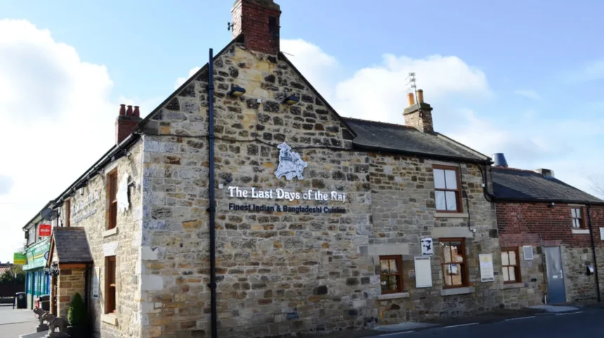
Dinnington is a village in the northern part of Newcastle upon Tyne, Tyne and Wear, England. Located near Newcastle International Airport and surrounded by Northumberland countryside, the village combines a historic rural settlement, traditional buildings, local community facilities and convenient connections to the wider Tyneside area. Its character reflects centuries of agricultural activity, changing transport networks and the gradual expansion of Newcastle beyond its historic urban boundaries.
- Where Is Dinnington Village and How Did Its Location Shape Its History?
- How Far Back Does Dinnington Village’s History Go?
- How Did Medieval Landownership Shape Dinnington?
- What Did Dinnington Village Look Like in the Eighteenth Century?
- How Did Agriculture and Prestwick Carr Influence Dinnington’s Development?
- Which Historic Buildings Preserve Dinnington’s Architectural Heritage?
- What Archaeological Evidence Exists Around Dinnington Village?
- How Did Dinnington Change During the Victorian Period?
- How Did Newcastle International Airport Affect Dinnington’s Modern Development?
- What Is Dinnington Village Like for Residents Today?
- How Is Dinnington’s Historic Character Protected for Future Generations?
- What Can Visitors Learn from Dinnington’s History Today?
- Why Does Dinnington Matter to the History of Newcastle?
Dinnington offers an important example of how villages on the edge of a major English city retain their separate identities while adapting to modern economic and residential pressures. Its historical development connects rural Northumberland traditions with the growth of Newcastle, the development of regional transport and the changing relationship between countryside and city.
For history enthusiasts, Dinnington provides a useful starting point for examining settlement patterns, agricultural life, parish history and the transformation of northern Newcastle. For prospective residents and visitors, its location near the airport and surrounding rural landscape explains its continuing appeal as a village outside the central urban area.
This guide examines Dinnington’s origins, historical development, architecture, transport connections, community life and heritage. It also explains how the village’s rural character relates to the wider history of Newcastle and the modern North East of England.
Where Is Dinnington Village and How Did Its Location Shape Its History?
Dinnington is a historic village in the northern part of Newcastle upon Tyne, close to Newcastle International Airport and the rural landscape around Prestwick Carr. Its position between Newcastle and Northumberland shaped its agricultural economy, settlement pattern and modern residential character.
Dinnington lies within the metropolitan district of Newcastle upon Tyne in Tyne and Wear. The settlement retains a village identity despite being part of the wider Newcastle administrative area. Its surroundings include agricultural land, established residential streets and the wetland landscape associated with Prestwick Carr.
The village’s location is central to understanding its development. Historic routes connected rural settlements with markets, neighbouring townships and larger centres of trade. Dinnington’s position also placed it within a landscape shaped by water, grazing land and the practical requirements of farming.
Newcastle International Airport provides a modern geographical reference point. The airport serves domestic and international passengers and connects the northern outskirts of Newcastle with a wider transport network. Its proximity has strengthened Dinnington’s relationship with employment, travel and urban development, although the village retains a distinct settlement pattern.
Dinnington’s rural setting does not mean it developed in isolation. Agricultural communities historically depended on nearby markets, landowners, religious institutions and regional transport routes. These connections linked village households to broader economic and political changes.
The village therefore occupies an important position in the history of Newcastle’s northern fringe. Its development illustrates the relationship between rural settlement, changing land use and the outward growth of an English city.
How Far Back Does Dinnington Village’s History Go?
Dinnington’s documented history reaches at least the medieval period, with Newcastle’s Historic Environment Record identifying the settlement in records from the thirteenth century. Medieval tenancy evidence from 1303 describes houses, enclosed yards and cultivated land, establishing its agricultural foundations.
The Newcastle Historic Environment Record classifies Dinnington as a medieval settlement. Its records provide specific evidence of landholding, population and the organisation of domestic life before the early modern period.
In 1242, Dinnington was held with Brenkley by the heirs of Henry de Ferlington. Brenkley is a neighbouring historic settlement whose landholding history helps place Dinnington within the medieval territorial structure of the region. The estate formed part of the barony of Mitford, a feudal landholding associated with Northumberland.
Tax records offer further evidence of the village’s development. Six taxpayers were recorded in 1296, rising to ten in 1312. These figures demonstrate the existence of a taxable population, but they do not represent a complete headcount. Medieval assessments did not necessarily include every inhabitant, particularly people outside the relevant tax categories.
A rental survey from 1303 provides a more detailed picture of everyday life. Eleven men each held a house with a curtilage, meaning an enclosed area associated with a dwelling, and 1.5 acres of arable land. Two additional tenants were also recorded.
These details reveal a settlement organised around households and agricultural holdings. Houses, yards and cultivated plots formed the practical basis of village life. The surviving documentary evidence does not establish the precise date when the first settlement appeared, so the medieval records represent a firm historical reference point rather than the village’s absolute beginning.
The village’s earlier development also connects with the wider history of northern England. Anglo-Saxon settlement influenced place names throughout the surrounding area, while later medieval institutions shaped landownership and taxation. Dinnington’s recorded history belongs to this wider landscape of rural communities and estates.
How Did Medieval Landownership Shape Dinnington?
Medieval Dinnington developed within a landholding system that linked local households to estate owners and the barony of Mitford. Its documented tenants occupied houses and cultivated small plots, while later changes in ownership transferred control of the manor between established landowning families.
Landownership influenced agricultural production, rents and the organisation of village settlement. Medieval tenants relied on access to land for food production and household income. Their obligations depended on the terms of their holdings and the wider rights exercised by estate owners.
The 1303 rental is particularly useful because it records a relationship between residential property and cultivated acreage. The reference to 1.5 acres of arable land for each of eleven men demonstrates that individual holdings formed part of the settlement’s economic structure. It does not, however, establish that every household relied exclusively on its own plot.
In the mid-fifteenth century, the manor was sold to the Heselrigg family. The family retained ownership until the estate was sold to Matthew Bell in 1763. This sequence connects Dinnington’s medieval origins with the changing landholding arrangements of the early modern period.
The transfer to Matthew Bell occurred during a period when landownership, agricultural management and estate improvement played important roles in the British countryside. Large landowners influenced the use of fields, the maintenance of buildings and the organisation of rural property.
Estate ownership also helps explain why documentary sources are so important to local history. Rentals, estate plans and property records preserve details that ordinary domestic buildings do not always reveal. For researchers tracing family histories, these documents can identify tenants, landowners and changes in property occupation.
Dinnington’s ownership history should therefore be understood as part of the wider development of rural society. Its medieval households, fifteenth-century transfer to the Heselriggs and eighteenth-century sale to Matthew Bell provide a documented framework for studying how authority over village land changed over time.
What Did Dinnington Village Look Like in the Eighteenth Century?
An eighteenth-century account describes Dinnington as two rows of buildings set apart on either side of a village green. Buildings partly enclosed the green’s eastern end, creating a settlement form that reflected rural movement, shared space and the organisation of domestic property.
The historic layout offers important evidence of how Dinnington functioned before modern suburban development. Rather than forming a dense urban street network, the village developed around a central open space bordered by buildings.
A village green traditionally served as a shared landscape feature. Depending on local custom and ownership, such spaces supported movement, informal gatherings and activities connected with village life. The available Dinnington record establishes the green’s physical position but does not document every activity that took place there.
The two rows of buildings created a recognisable settlement arrangement. Their separation from one another left the central green as a defining feature. At the eastern end, a block of buildings partly closed the open space, giving the settlement a more enclosed appearance.
This layout is valuable for understanding the relationship between buildings and land. Rural settlements developed in response to practical needs, including access to fields, routes between neighbouring communities and the location of domestic property. Dinnington’s arrangement reflects these concerns without requiring assumptions about the precise intentions of its original builders.
Historic maps provide another way to investigate the village’s physical development. The Newcastle Historic Environment Record identifies an estate plan dating to approximately 1780 and a township plan dating to around 1820. These documents provide evidence for examining land boundaries, property arrangements and the relationship between the village and its surrounding countryside.
Comparing historic plans with the present-day street pattern helps researchers identify continuity and change. Some boundaries survive long after the original buildings disappear, while later roads and property divisions can obscure older settlement features.
For visitors interested in rural history, Dinnington’s historic layout provides a starting point for understanding how a village green, domestic buildings and agricultural land once formed a connected settlement.
How Did Agriculture and Prestwick Carr Influence Dinnington’s Development?
Agriculture and Prestwick Carr shaped the historic landscape around Dinnington. The wetland supplied peat and supported activities such as fishing and game shooting, while cultivated land sustained rural households. Drainage works during the 1850s transformed the surrounding landscape and altered its water management.
Prestwick Carr is a historically important wetland near Dinnington. The term carr comes from Old Norse and refers to waterlogged or boggy ground. Before extensive drainage, the wetland formed part of a much larger shallow lake landscape extending towards Ponteland.
The area supplied resources that mattered to neighbouring settlements and religious houses. Peat provided fuel for domestic and other purposes, while local rights to extract it were known as turbary rights. Fishing and shooting also contributed to the use of the wetland landscape.
The relationship between Dinnington and Prestwick Carr demonstrates that rural economies depended on more than cultivated fields. Wetlands, common resources and surrounding moorland supplied materials and food, while access rights influenced how local people used the land.
Water also affected movement and religious customs. The Dinnington neighbourhood plan records a historical account describing the use of flooding to transport coffins. This unusual practice illustrates the practical influence of local water conditions, although it should be understood as a reported historical detail rather than a universal custom
During the 1850s, drainage works began transforming the wetland. Drainage altered the relationship between water and land, creating conditions for different patterns of agricultural use and management. It also formed part of a wider historical process in which wet ground was modified to meet economic and land-management objectives.
The consequences extend beyond the nineteenth century. Prestwick Carr is now recognised for its wetland and wildlife importance. Parts of the area have been identified as a Site of Special Scientific Interest, a designation used to protect land with important wildlife or geological features, and as a Site of Local Conservation Interest. Part of the landscape also serves as an operational Ministry of Defence training site.
Prestwick Carr therefore connects several historical themes: natural resources, rural livelihoods, nineteenth-century landscape engineering and contemporary conservation. Understanding these connections explains why the surrounding countryside remains central to Dinnington’s local identity.
Which Historic Buildings Preserve Dinnington’s Architectural Heritage?
Dinnington’s historic buildings preserve evidence of nineteenth-century education and rural domestic life. The former school on Cochrane Terrace, dated 1874, is a Grade II listed sandstone building. Historic cottages and associated outbuildings also document traditional construction and changing rural property use.
The former school on Cochrane Terrace is one of the village’s documented historic buildings. Historic England identifies it as a Grade II listed structure, with its construction dated to 1874. The school was built at the expense of Matthew Bell, connecting the building with the landowning history of Dinnington.
Its architectural details include rock-faced sandstone, ashlar stone dressings, a Welsh slate roof and stone window surrounds. Ashlar refers to carefully cut masonry with smooth faces and regular joints. The building has an L-shaped plan, a single-storey main section and distinctive stone detailing around its windows and entrance. It is now used as a club rather than a school.
The building documents a period when organised schooling was becoming an established feature of community life. Its date places it in Victorian England, when education legislation and expanding local provision reshaped access to schooling. The school itself demonstrates local investment in an educational building, although its construction alone does not establish the attendance arrangements or curriculum followed by every child in Dinnington.
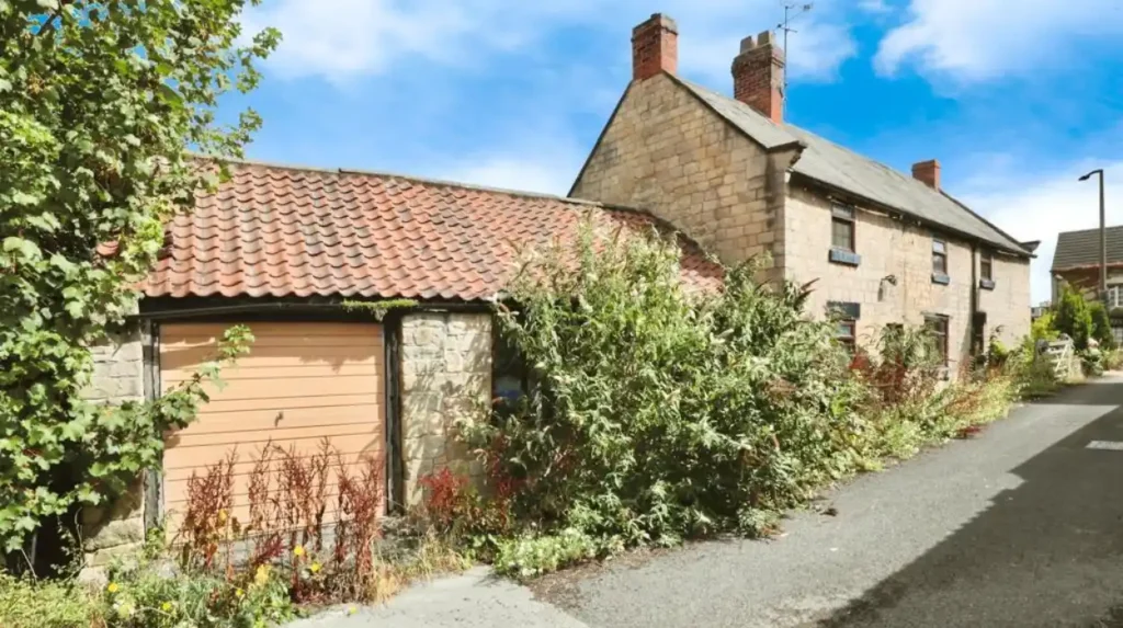
Historic domestic buildings offer another source of evidence. South Shotton Edge Cottage and its adjacent outbuildings are recorded by Historic England as Grade II listed and date to the early nineteenth century. The property uses roughly tooled squared stone, cut dressings and a Welsh slate roof. Its original arrangement included accommodation above stables associated with the Red Lion Inn.
This example reveals how rural buildings often combined domestic and commercial functions. Accommodation above service buildings supported activities connected with travel, livestock and hospitality. The relationship between a former inn, stables and living quarters provides evidence of the practical organisation of rural property.
Listed status recognises a building’s special architectural or historic interest and provides statutory protection against unauthorised alterations or demolition. Newcastle City Council explains that listed buildings fall into Grade I, Grade II* and Grade II categories. Owners must obtain listed building consent for works that require it.
For Dinnington, preserving historic masonry, rooflines, window openings and the relationships between buildings helps maintain the legibility of the village’s past. These features allow visitors and researchers to connect surviving structures with the economic and social conditions in which they were built.
What Archaeological Evidence Exists Around Dinnington Village?
Dinnington’s recorded archaeological evidence includes medieval settlement remains and a reported burial-related discovery from 1820. The Newcastle Historic Environment Record documents foundations and bones found in a field known as the Back Yards, although the identification of the structure as a chapel remains historical interpretation.
The archaeological record adds a different dimension to Dinnington’s history. Written records identify landowners and tenants, while archaeological discoveries help researchers investigate earlier land use and the physical remains of settlement.
In 1820, part of a field called the Back Yards, on the north-western edge of Dinnington, was excavated. The historical account reported building foundations and a number of bones thought to be human. Skulls with teeth still present in their jawbones were also described. The structure was believed to be a chapel, but the available record does not establish that identification conclusively.
The discovery is important because it raises questions about the village’s religious and funerary landscape. Medieval communities relied on churches, chapels and burial grounds for religious observance and commemoration. Small religious structures did not always leave extensive remains above ground, making documentary references and archaeological evidence particularly valuable.
The reported bones require careful interpretation. The original account dates from the nineteenth century, before modern archaeological excavation and scientific methods for identifying human remains. Without further verified evidence, it is not appropriate to assign a precise date to the remains or state that the supposed chapel has been definitively identified.
The wider Historic Environment Record also identifies archaeological assessment work around Dinnington, including an evaluation at North Hill in 2012. Such assessments help establish the archaeological potential of a site before construction or other ground disturbance takes place.
Archaeological records matter to local planning because buried evidence can survive beneath modern buildings, roads and gardens. Development proposals involving historically sensitive land require appropriate consideration of known sites and potential remains.
For genealogists and local historians, archaeological evidence complements parish records, estate papers and historic maps. Together, these sources support a more complete reconstruction of Dinnington’s development while preserving a clear distinction between documented findings and interpretations that remain unconfirmed.
How Did Dinnington Change During the Victorian Period?
The Victorian period brought documented changes to Dinnington’s built environment and surrounding landscape. The former school opened in 1874 as a lasting example of local educational investment, while drainage works during the 1850s altered Prestwick Carr and its relationship with neighbouring agricultural land.
The nineteenth century provides a clear point of transition in Dinnington’s history. The village’s medieval records describe tenants and agricultural holdings, while later sources reveal changes to education, buildings, land management and the wider rural environment.
The drainage of Prestwick Carr during the 1850s changed how the wetland was managed. Wetland drainage formed part of a wider pattern of landscape improvement in Britain, where landowners and local authorities sought to modify waterlogged land for agricultural and other uses. The documented local works connect Dinnington to that broader process.
The former school, dated 1874, provides a tangible example of investment in community infrastructure. Its construction demonstrates the presence of a dedicated educational building within the village by the later Victorian period. Its later conversion to a club also illustrates how historic buildings acquire new uses as local needs change.
The nineteenth century also produced valuable records for reconstructing rural life. The Newcastle Historic Environment Record identifies Dinnington’s 1841 tithe awards and enclosure awards from 1860 among its historical sources. Tithe awards recorded land parcels, occupiers and ownership arrangements for the purpose of administering tithe payments. Enclosure awards documented changes to land boundaries and rights as land was reorganised.
These records help researchers understand the relationship between households and the countryside. They can identify fields, landholders and changes in the organisation of property, providing a more precise picture than general descriptions of village life.
The Victorian evidence also shows why historical change should not be reduced to urban expansion alone. In Dinnington, alterations to wetland management, investment in education and changes in land administration were equally important to the village’s development.
Together, these developments connect Dinnington’s older agricultural foundations with the institutions and landscape management practices that shaped the modern settlement.
How Did Newcastle International Airport Affect Dinnington’s Modern Development?
Newcastle International Airport has strengthened Dinnington’s connection with regional transport, employment and travel. Its proximity places the village within Newcastle’s wider economic area, while the historic settlement and surrounding countryside retain a distinct rural character within the metropolitan district.
The development of modern transport changed how villages around Newcastle related to the city. Improved road connections, motorised travel and aviation expanded the movement of people and goods beyond traditional rural routes.
Newcastle International Airport serves the North East of England and provides connections to destinations in the United Kingdom and overseas. For Dinnington, the airport’s proximity is a defining feature of its present-day location. Residents can access regional and international travel facilities without living in Newcastle’s central urban area.
The airport also forms part of the region’s employment geography. Aviation supports work in airport operations, passenger services, transport, maintenance and related commercial activities. Other businesses benefit from access to regional transport infrastructure.
However, the presence of an airport does not determine every aspect of village life. Dinnington’s development also depends on housing, planning decisions, local facilities, road access and the management of surrounding land.
The contrast between the airport and the village illustrates a wider change in northern Newcastle. Agricultural settlements that once depended primarily on local land and nearby markets now operate within an interconnected metropolitan economy.
This change also creates planning challenges. Residential development, transport infrastructure, countryside protection and airport-related activity require coordination. Noise, traffic and the availability of developable land are relevant considerations in assessing future proposals, although their effects vary by location and project.
Dinnington’s modern identity therefore reflects both continuity and change. The village remains associated with its historic settlement and rural surroundings, while its location connects residents with the transport infrastructure of a major regional city.

What Is Dinnington Village Like for Residents Today?
Dinnington retains a village identity within Newcastle upon Tyne, combining residential streets with nearby countryside and access to wider urban services. Its modern character reflects historic settlement patterns, local planning decisions and the practical advantages of living near Newcastle International Airport.
Contemporary Dinnington is best understood as a rural settlement within a metropolitan district rather than an isolated countryside community. Residents benefit from access to Newcastle and other parts of Tyne and Wear, while the village’s surroundings provide a connection to agricultural land and the wider rural landscape.
The local environment remains central to its identity. Prestwick Carr provides a historical and ecological connection to the area’s former wetlands. Traditional buildings, including the former school on Cochrane Terrace, preserve physical evidence of earlier community life.
Daily life also depends on transport and access to services. Residents travelling into Newcastle rely on the available road network and public transport connections. Journey times vary according to the destination, traffic conditions and transport mode, so prospective residents should check current services rather than rely on fixed estimates.
Housing in and around Dinnington reflects its village setting. Traditional properties and newer residential development contribute to the area’s built environment. The age, size and condition of individual homes vary, and property prices depend on market conditions and the characteristics of each property.
For people considering a move, the main practical questions concern commuting, access to schools and shops, local amenities, housing costs and the balance between countryside and urban convenience. These factors are separate from the village’s historical significance, but they help explain how Dinnington functions today.
The village’s future is also shaped by planning policy. Newcastle City Council provides a formal framework for considering development, infrastructure and environmental protection across its administrative area. Dinnington’s local planning arrangements give the community a means of addressing these issues through a neighbourhood plan.
How Is Dinnington’s Historic Character Protected for Future Generations?
Dinnington’s heritage is documented through Newcastle’s Historic Environment Record, Historic England’s listed-building register and local planning records. These sources help identify significant buildings, archaeological evidence and historic landscapes when development proposals and conservation priorities are assessed.
Heritage protection involves more than retaining attractive old buildings. It also requires the identification of archaeological remains, historic land boundaries, traditional building materials and landscapes that explain how communities developed.
The former school on Cochrane Terrace illustrates the value of statutory listing. Its Grade II status recognises its architectural and historic interest and subjects relevant works to the legal controls governing listed buildings. This protection helps prevent inappropriate changes from erasing important architectural evidence.
Newcastle’s Historic Environment Record provides another layer of protection and research. It brings together information about recorded sites, archaeological discoveries, settlement history and other heritage assets. Such records support planning decisions and guide further investigation where construction affects historically sensitive locations.
The Dinnington Neighbourhood Plan provides a particularly important example of community involvement in planning. Newcastle City Council records that the plan was submitted for independent examination and proceeded to a referendum held on 22 May 2025. Following the successful referendum, the council formally made the plan on 2 June 2025. It consequently forms part of the statutory development plan used in planning decisions.
Neighbourhood planning allows a qualifying local community to establish planning policies for its designated area within the framework of national and local planning requirements. These policies help guide decisions about the location and form of development, environmental considerations and the future of the settlement.
For Dinnington, long-term heritage management involves balancing residential needs with the protection of historic structures, countryside and archaeological evidence. It also involves maintaining reliable historical records so that future generations can distinguish verified evidence from local tradition.
Researchers and residents can consult Newcastle City Council’s planning and heritage resources to examine listed buildings, local planning documents and the Historic Environment Record. Historic England’s official entries provide additional architectural descriptions and information about protected structures.
What Can Visitors Learn from Dinnington’s History Today?
Visitors can explore Dinnington’s history through its surviving historic buildings, documented medieval settlement, rural setting and nearby Prestwick Carr landscape. These features connect local heritage with wider themes of agriculture, landownership, education, environmental change and Newcastle’s modern expansion.
Dinnington is relevant to visitors interested in the history of settlements beyond a major city centre. Its recorded history demonstrates how a village developed through landholding, farming, community institutions and changes to the surrounding landscape.
The former school on Cochrane Terrace provides a specific architectural reference point. Its Victorian stonework and recorded construction date help explain the development of local educational provision during the nineteenth century. Historic domestic buildings provide further evidence of traditional materials and the relationship between homes and rural economic activity.
Prestwick Carr offers a different historical perspective. Its wetland resources, nineteenth-century drainage and modern conservation status connect environmental history with everyday life. The landscape demonstrates how the use of natural resources changed over time and how areas once modified for economic purposes later acquired renewed ecological importance.
Visitors should distinguish between exploring a historic landscape and entering private property. Historic buildings and archaeological sites do not automatically provide public access. Before visiting a particular property or conservation site, check access arrangements, any restrictions and current guidance from the relevant landowner or authority.
To explore the wider area and plan a visit around its heritage and countryside, consult our comprehensive for local attractions, outdoor activities and visitor information.
For educators, Dinnington offers a useful local case study. Medieval rental records can introduce students to historical taxation and landholding. Victorian buildings provide evidence for studying architecture and education. Prestwick Carr supports discussion of environmental change, resource use and habitat conservation.
Genealogical researchers can also use the village’s historical sources to investigate family connections. Parish registers, census returns, wills, land records and estate documents provide different kinds of evidence. The relevant surviving records and date ranges must be checked before drawing conclusions about an individual family.
The village’s importance ultimately rests on the relationship between documentary evidence and the landscape itself. Historic maps, buildings, land boundaries and archaeological records reveal different aspects of settlement development. Used together, they provide a detailed account of how Dinnington evolved from a medieval agricultural community into a village connected with modern Newcastle.
Why Does Dinnington Matter to the History of Newcastle?
Dinnington matters because its surviving records and historic buildings preserve evidence of rural life on Newcastle’s northern edge. Medieval landholding, Victorian education, wetland management and modern transport connections demonstrate how a village adapts while retaining traces of its earlier development.
The history of Dinnington offers a useful perspective on Newcastle beyond its urban centre. The village’s medieval records establish a settlement with identifiable tenants and agricultural holdings. Its later landownership history documents the transfer of the manor to the Heselrigg family and then to Matthew Bell in 1763.
The eighteenth-century village green, nineteenth-century school and traditional rural buildings provide evidence of changing settlement patterns and community institutions. Meanwhile, Prestwick Carr reveals how natural resources influenced local livelihoods and how drainage altered the surrounding landscape.
The village’s present-day position near Newcastle International Airport adds a modern dimension to this history. Transport infrastructure connects Dinnington with regional and international networks, while planning policy addresses the relationship between development, rural character and historic assets.
These themes are relevant to historians, students, residents and visitors because they show how local history can be reconstructed from several independent sources. Historic Environment Record entries, listed-building descriptions, estate plans and neighbourhood planning documents each contribute evidence about a different aspect of the settlement.
Dinnington’s story also demonstrates why heritage protection requires continuing attention. Historic buildings need appropriate maintenance, archaeological records require careful interpretation, and future development decisions benefit from accurate information about the past.
For Newcastle Times readers, Dinnington provides a documented example of the historical relationship between countryside and city. Its medieval origins, agricultural foundations, Victorian architecture and modern connections make it a valuable part of the wider history of northern Newcastle and the North East of England.