
Lemington is a western Newcastle upon Tyne neighbourhood with established road and bus connections into the city centre. The main commuting corridor follows the A6085 through Lemington Road and Scotswood Road, while buses provide direct connections towards Eldon Square and other central destinations.
- How do you travel from Lemington to Newcastle City Centre?
- What is Lemington and why does its location matter for commuting?
- Which road connects Lemington with Newcastle City Centre?
- Which buses run from Lemington to Newcastle City Centre?
- How long does the Lemington to Newcastle bus journey take?
- Is driving from Lemington to Newcastle City Centre straightforward?
- Can you walk or cycle from Lemington to Newcastle City Centre?
- How is Newcastle improving bus travel from western neighbourhoods?
- What road maintenance affects Lemington commuters?
- What should commuters know about Newcastle City Centre road restrictions?
- What is the historical connection between Lemington and Newcastle transport?
- What is the most practical commuting option from Lemington?
The journey reflects Lemington’s historic relationship with Newcastle. The area developed around coal transport, glassmaking, ironworking and riverside industry before becoming predominantly residential. Today, the same west-east geography supports daily journeys for workers, students, shoppers and residents travelling into central Newcastle.
Transport conditions continue to change. Newcastle City Council is investing in highway maintenance, bus priority, pedestrian crossings and measures designed to reduce delays on important public transport corridors. These changes affect how people travel between western neighbourhoods and the city centre.
How do you travel from Lemington to Newcastle City Centre?
Commuting from Lemington to Newcastle City Centre is a short west-to-east journey using buses, the A6085 corridor, walking and cycling routes. The main public transport option is the direct bus connection from Lemington Road Ends to central Newcastle daily now.
For most commuters, the key starting point is the Lemington Road Ends area. From there, services travel east through Denton Burn and the western part of Newcastle before reaching central destinations.
The transport network is primarily road-based. Unlike neighbourhoods with a direct Metro station, Lemington’s central connection depends heavily on buses and the road network. Newcastle Central Station provides national rail connections once commuters reach the city centre. National Rail identifies Newcastle station as a major interchange with bus, Metro, tram and taxi connections.
The main travel choices are therefore bus, car, cycling and walking. Each uses a different part of the same west-east transport structure.
For commuters travelling beyond the city centre, Newcastle station is particularly important. The station is on Neville Street and provides onward connections by rail and local public transport. It has step-free access to all platforms to varying degrees, lifts, accessible toilets, passenger assistance and bicycle storage.
The most useful central destinations include Eldon Square, Newcastle Central Station, Grainger Street, Westgate Road and the wider city-centre area.
What is Lemington and why does its location matter for commuting?
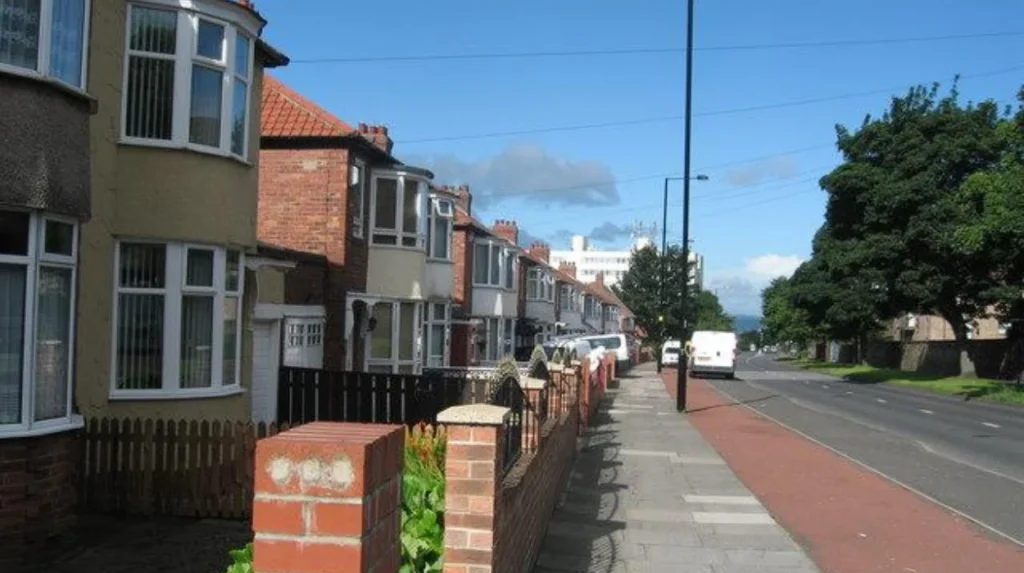
Lemington is a residential and historic riverside area in west Newcastle upon Tyne, beside the River Tyne and close to Newburn, Scotswood and Denton Burn. Its industrial past shaped today’s roads, housing pattern and east-west commuting connections for residents today.
Lemington’s transport geography is closely connected to its industrial history. Newcastle City Council’s heritage records state that a small settlement known as Lamendon or Lamenton existed at the riverside staiths before 1620. The settlement expanded substantially during the eighteenth and nineteenth centuries as industry developed.
The area became an important industrial location because of its position beside the River Tyne. Coal staiths supported the movement of coal, while the eighteenth century brought major industrial facilities.
The Lemington Glass Works opened in 1787 under the Northumberland Glass Company. The surviving Lemington Cone dates from this period and is now a Grade II* listed building. The Tyne Iron Works was established in 1797 and operated until 1876.
These industries created demand for housing and transport infrastructure. By the mid-nineteenth century, Lemington had developed into a substantial industrial village. Newcastle’s heritage records describe further expansion of worker housing during the nineteenth century.
The area’s modern transport pattern reflects this history. Newcastle City Council’s character assessment identifies the A6085 Scotswood Road and Lemington Road as the main east-west access routes through the western riverside area.
This makes Lemington a naturally road-oriented commuting area. The principal journey into Newcastle follows the same broad east-west direction that historically connected the riverside industrial settlements with the city.
Which road connects Lemington with Newcastle City Centre?
The principal road corridor is the A6085, which includes Lemington Road and Scotswood Road. It connects Lemington with Newcastle’s western urban area and continues towards central Newcastle through the Scotswood and Westgate corridors for regular commuter traffic throughout the day.
The A6085 is the most important road reference for drivers travelling between Lemington and Newcastle. Newcastle City Council’s road classification information identifies Lemington Road as A6085 and also identifies other sections of the wider route, including Newburn Road, Northumberland Road and Ponteland Road.
For commuters, the western section functions as an arterial route. An arterial road is a major road designed to carry traffic between districts rather than primarily serve individual properties.
The route connects residential communities, employment areas, commercial premises and industrial locations. It also provides access towards the wider A1 and regional road network.
The council’s highways documentation lists resurfacing work on both A6085 Scotswood Road and A6085 Lemington Road. This demonstrates the route’s continuing importance within Newcastle’s highway network.
Scotswood Road is another important part of the corridor. It runs eastward from the Lemington and western riverside area towards the built-up western districts of Newcastle.
The wider road network then connects with streets approaching the city centre. Westgate Road and Neville Street provide important central approaches, with Newcastle Central Station located on Neville Street.
Drivers should distinguish the A6085 corridor from the A69. The A69 is a trunk road maintained by National Highways, while Newcastle City Council manages its adopted local highway network. The council specifically identifies the A69, A1 and A696 as roads maintained by National Highways.
Which buses run from Lemington to Newcastle City Centre?
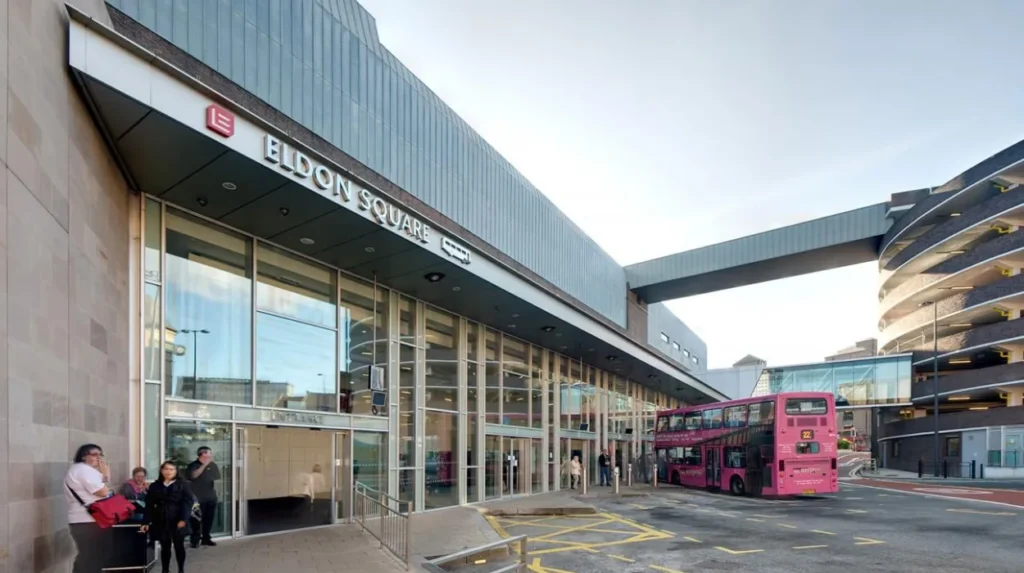
Bus services provide the most direct public transport connection from Lemington Road Ends to Newcastle city centre. Current services include Go North East routes 684 and 685, with scheduled journeys reaching Eldon Square and serving central Newcastle throughout the day.
Go North East’s current timetable for service 684 shows Lemington Road Ends followed by Denton Burn Library, Westgate Road and Newcastle Eldon Square. The timetable therefore provides a direct public transport connection without requiring a change of bus.
The 684 is part of the Tynedale Links network. Its Newcastle-bound service operates through Lemington Road Ends and continues towards Eldon Square.
Service 685 also connects Lemington Road Ends with Newcastle Eldon Square. Stagecoach’s current route information lists Lemington Road Ends between Newcastle and Hexham, confirming another direct service serving the area.
These services are particularly useful because they connect Lemington with the city centre through the existing road corridor. Commuters do not need to travel to a separate Metro station before beginning the central journey.
Timetables differ between weekdays, Saturdays and Sundays. They also change because of planned service revisions, road closures and other operating conditions. Travellers should check the current operator timetable before making a time-sensitive journey.
The Lemington Road Ends stop is therefore an important transport point for residents living across the surrounding neighbourhood. It provides access to central Newcastle as well as destinations farther west, including communities towards Hexham.
How long does the Lemington to Newcastle bus journey take?
A typical scheduled bus journey from Lemington Road Ends to Eldon Square takes about 14 to 16 minutes on current 684 and 685 timetables. Actual door-to-door commuting time also includes walking to stops, waiting and final walking time each way.
Current published timetables provide useful reference points.
On Go North East service 684, a scheduled journey shown from Lemington Road Ends at 06:34 reaches Newcastle Eldon Square at 06:50, giving a 16-minute scheduled journey. Other timetable journeys show the same general order of travel through Denton Burn and Westgate Road.
The Stagecoach 685 timetable gives another reference. One listed journey reaches Lemington Road Ends at 16:19 and Newcastle Eldon Square at 16:33, producing a 14-minute scheduled journey.
These figures apply specifically to journeys between the listed stop and Eldon Square. They are not complete door-to-door commuting times.
A commuter living several streets away from Lemington Road Ends needs additional walking time. Waiting time also depends on the departure chosen. The journey from Eldon Square to a workplace or college adds another walking or public transport stage.
Traffic also affects road-based journeys. A timetable represents planned operating times rather than a guarantee that every journey takes exactly the same time.
For regular commuters, the most useful measurement is therefore the complete journey. This includes the walk from home, waiting at the bus stop, bus travel, walking from the central stop and any additional connection.
Is driving from Lemington to Newcastle City Centre straightforward?
Driving gives commuters a direct road journey along the A6085 and connecting city streets. The route is affected by traffic, roadworks, parking controls and central Newcastle restrictions, so the fastest route changes with network conditions throughout the day and peaks.
The A6085 provides the principal road connection from Lemington towards Newcastle. The route is important for private cars, buses, commercial vehicles and other road users.
Traffic conditions become increasingly important as vehicles approach the more densely developed parts of Newcastle. City-centre streets have limited road space and compete with buses, pedestrians, cyclists, deliveries and taxis.
Newcastle City Council is introducing transport measures designed to improve traffic movement and public transport reliability. The council’s wider transport programme focuses on reducing city-centre traffic, improving bus priority and upgrading junctions.
Parking restrictions also affect central journeys. In August 2026, Newcastle City Council announced plans for trial red routes on Blackett Street and along a corridor including Newgate Street, Grainger Street, the bottom of Westgate Road and Neville Street. The measures are designed to prevent stopping that blocks buses and traffic.
The trial is planned to operate for 18 months, with consultation during its first six months. Vehicles that contravene the restrictions can receive penalty charge notices.
These restrictions are particularly relevant to commuters entering the central area because Westgate Road and Neville Street form part of the wider western approach to Newcastle.
Drivers should also allow for planned highway works. Newcastle City Council has been undertaking resurfacing and maintenance across key roads, including sections of Scotswood Road and Lemington Road.
Can you walk or cycle from Lemington to Newcastle City Centre?
Walking and cycling provide active travel options between Lemington and central Newcastle, although the road network includes busy arterial sections and junctions. Newcastle’s transport strategy prioritises safer walking, cycling, public transport reliability and reduced city-centre traffic for commuters overall directly.
Active travel means travelling by walking, cycling or another human-powered mode rather than using a private motor vehicle.
Lemington’s position beside the River Tyne creates a mixture of local streets, arterial roads and riverside routes. The most direct road corridors are not uniformly designed as quiet residential streets, so route selection is important for people cycling or walking.
Newcastle City Council’s transport strategy identifies walking and cycling as important parts of the city’s future transport system. The council’s transport programme includes safer pedestrian infrastructure, cycle facilities and improvements designed to reduce traffic impacts.
The council also uses highway improvement programmes to upgrade pavements, crossings and road surfaces. In February 2026, it reported resurfacing and repair work on Tyne View in Lemington as part of additional highways investment.
Cyclists travelling towards the city centre need to consider road classification and traffic volume. The A6085 is an important arterial road rather than a low-traffic residential route.
Walking journeys are similarly dependent on crossings and pavement conditions. Major junctions create the main points where pedestrians need dedicated crossing facilities.
For commuters, active travel also combines effectively with public transport. A resident can walk from home to a bus stop, use a direct service into Newcastle and complete the final part of the journey on foot.
This type of combined journey reduces dependence on car parking in the city centre and fits Newcastle’s wider transport objectives.
How is Newcastle improving bus travel from western neighbourhoods?
Newcastle’s transport programme is changing the conditions around bus corridors, roads and the city centre. Current priorities include bus priority, safer crossings, highway maintenance and restrictions on obstructive stopping, which affect future journeys from western neighbourhoods such as Lemington.
Newcastle’s Bus Service Improvement Plan forms part of the regional North East Bus Service Improvement Plan. Newcastle City Council states that the programme is supported by £163.5 million of government funding across the regional plan.
The council has identified four major bus improvement corridors into the city centre. These are West Road and Westgate Road, Central Motorway East and Stamfordham Road, Great North Road and Shields Road and Byker Bridge.
The West Road and Westgate Road programme is especially relevant to journeys approaching Newcastle from the west. Planned measures include bus priority, upgraded crossings, improved bus boarding platforms and restrictions on stopping or parking along designated sections.
The West Road scheme includes a proposed city-bound bus lane between Denhill Park and Condercum Road. It also includes improvements at several pedestrian crossings and cycle facilities on Beaconsfield Street and Gloucester Road.
These projects matter because bus reliability depends on more than the timetable. A bus travelling through congested streets can lose time when general traffic blocks junctions, stops or lanes.
Keeping bus routes moving is therefore a central part of Newcastle’s transport policy. The city’s approach combines infrastructure changes with traffic management.
The 2026 central-city red-route trial follows the same principle. Newcastle City Council stated that the restrictions are intended to prevent vehicles from blocking key bus routes and delaying services.
For Lemington commuters, the relevance is indirect but important. The bus journey begins in the western part of Newcastle and finishes inside the city-centre road network. Improvements at either end influence overall journey reliability.
What road maintenance affects Lemington commuters?
Road maintenance affects Lemington commuters through resurfacing, pavement repairs, drainage work, road markings and traffic management. Newcastle City Council maintains adopted local highways, while National Highways maintains major trunk routes including the A69, A1 and A696.
Newcastle City Council is responsible for maintaining adopted local highways. An adopted highway is a road, footpath or footway maintained by the council after it meets the relevant requirements. Private roads and some other routes have different maintenance responsibilities.
The council’s highway maintenance programme covers road surfaces, pavements, drainage, signs, markings and pothole repairs.
The A6085 is directly relevant to Lemington commuters. The council’s highway maintenance documents list resurfacing works for A6085 Scotswood Road and A6085 Lemington Road.
In February 2026, Newcastle City Council reported that additional funding had allowed urgent repairs to proceed. The programme included work on Tyne View in Lemington as well as major routes elsewhere in the city.
Road maintenance has two effects on commuting. The first is short-term disruption caused by temporary traffic management, lane restrictions or diversions. The second is improved road condition after work is completed.
Weather also influences the road network. Newcastle City Council operates winter maintenance and gritting arrangements, with major roads receiving priority. The council states that residential streets can be harder to treat because parked vehicles and narrow carriageways restrict gritting vehicles.
The distinction between local and national roads is important for commuters travelling beyond Newcastle. The A69, for example, is maintained by National Highways rather than Newcastle City Council.
What should commuters know about Newcastle City Centre road restrictions?
Newcastle City Centre uses traffic-management measures to protect bus reliability, pedestrian safety and road capacity. Current measures include red-route trials, parking controls, loading arrangements and restrictions on stopping along important central streets.
The central part of the journey is different from the residential section in Lemington. Road space becomes more constrained as commuters enter Newcastle’s commercial core.
Blackett Street, Newgate Street, Grainger Street, Westgate Road and Neville Street are important central routes. In 2026, Newcastle City Council announced red-route trials covering several of these streets.
A red route uses red lines and signs to restrict stopping. The 2026 Newcastle trial permits specific exceptions, including licensed Hackney taxis collecting or dropping passengers and vehicles displaying a Blue Badge when picking up or dropping off a disabled person.
The measures also preserve designated loading arrangements for deliveries. This separates loading activity from general roadside stopping.
The purpose is not simply to restrict drivers. The council states that vehicles stopping in key locations can prevent buses from moving freely and create safety problems for pedestrians.
This matters to Lemington commuters using buses because a journey can begin with a clear road in the western suburbs but experience delays inside the city centre.
Drivers heading towards Newcastle Central Station should also follow current access arrangements. Newcastle City Council states that the station’s short-stay car park is approached from Bewick Street, while the long-stay car park is accessed from Neville Street.
For public transport users, Eldon Square is an important central destination. For rail passengers, Newcastle Central Station provides connections to national rail and local public transport.
What is the historical connection between Lemington and Newcastle transport?
Lemington’s transport network developed from its role in coal, glass and iron industries. Riverside staiths, wagonways and later railways connected the area with wider Tyneside markets, creating the east-west movement pattern that still influences modern commuting into Newcastle.
Transport has been central to Lemington’s development for centuries.
The settlement’s coal staiths were established before the seventeenth century and supported the movement of coal along the River Tyne. Newcastle City Council’s heritage records identify Lemington as an important location within the regional coal transport network.
Wagonways later expanded connections between the coalfields and riverside transport points. The Newburn-Wylam wagonway was built around 1748 and remained in use until 1968. Other wagonways connected surrounding mining communities with the Tyne.
The industrial expansion of Lemington brought further transport demand. The glassworks opened in 1787, while the Tyne Iron Works followed in 1797. The industrial workforce required housing, roads and transport connections.
Railway development followed this wider industrial pattern. The Scotswood, Newburn and Wylam Railway was promoted in the nineteenth century to improve transport for industrial businesses and support development in the Tyne Valley west of Newcastle.
This history explains why modern commuting from Lemington remains strongly east-west. The area’s physical relationship with Newcastle developed around moving workers, materials and goods along the Tyne corridor.
The industrial landscape later declined. Newcastle’s heritage records describe the decline of major industries during the twentieth century, while residential development continued.
Today’s commuters therefore use a modern transport system built across an older industrial geography.
What is the most practical commuting option from Lemington?
For most commuters, the direct bus from Lemington Road Ends offers the simplest public transport journey, while the A6085 provides the principal driving corridor. Walking, cycling and combined journeys remain alternatives for shorter or flexible daily trips.
The direct bus has a major practical advantage: it removes the need to find city-centre parking and provides a continuous connection from Lemington Road Ends to central Newcastle.
Current 684 and 685 timetables demonstrate direct journeys to Eldon Square. Published examples show scheduled journey times of approximately 14 to 16 minutes between Lemington Road Ends and Eldon Square.
Driving remains important for commuters whose workplaces or destinations are outside the central area or poorly served by public transport. The A6085 provides the main road connection.
Walking and cycling suit commuters whose homes and destinations are positioned conveniently along suitable routes. They also form useful first and final sections of public transport journeys.
The choice also depends on the final destination. Eldon Square is convenient for the main shopping and commercial centre. Newcastle Central Station is more suitable for rail connections. Westgate Road and surrounding districts provide additional employment and institutional destinations.
For time-sensitive journeys, current bus timetables and road conditions should always be checked before departure. Transport services, roadworks, traffic restrictions and city-centre management measures change over time.
The long-term direction of Newcastle’s transport policy is clear: improved public transport reliability, safer walking and cycling, better-maintained highways and more controlled city-centre traffic. These priorities will continue to shape commuting between Lemington and Newcastle City Centre.