Chapel House is a post-war suburban estate in the western part of Newcastle upon Tyne. Its housing, schools, road layout and community facilities reflect the city’s expansion after the Second World War. The NE5 postcode also sits within a landscape containing important Roman archaeological remains.
- What is Chapel House in Newcastle?
- When was Chapel House developed as a residential estate?
- How did post-war planning shape Chapel House?
- What Roman history is connected with Chapel House?
- Where is Milecastle 9 and why is it historically important?
- What types of homes are found in Chapel House?
- What are Chapel House house prices in 2026?
- How do Chapel House prices compare within NE5?
- Does Chapel House have schools for families?
- How has education changed in Chapel House since the estate was built?
- What community facilities support life in Chapel House?
- How does Chapel House connect with Newcastle’s wider history?
- How should buyers interpret Chapel House house-price data?
- Is NE5 a family-oriented area?
- What makes Chapel House historically significant today?
- How should Chapel House be understood as part of Newcastle’s future history?
What is Chapel House in Newcastle?
Chapel House is a suburban residential area in west Newcastle upon Tyne, centred on housing developed mainly from the 1960s into the early 1970s. It forms part of the NE5 postcode and sits close to West Denton, Westerhope, Chapel Park and Blucher.
Chapel House is an estate rather than an ancient village with a continuous medieval settlement history. Its modern identity emerged from Newcastle’s large-scale post-war housing expansion.
The estate was designed by architect John T. Bell and developed from 1964 into the early 1970s. The development created a planned residential environment approximately five miles from Newcastle city centre, with housing, schools, roads and local services arranged around the needs of a growing suburban population.
The distinction between the modern Chapel House estate and older places carrying the same name is important. Historic England records several buildings called Chapel House elsewhere in England, including a Grade II listed building at Westoe Village in South Tyneside. That building dates from about 1808 and replaced an earlier mid-18th-century house. It is not the Newcastle estate.
The Newcastle area has a much older archaeological history, however. Chapel House lies close to Milecastle 9 on Hadrian’s Wall, providing a direct connection between the modern suburb and Roman frontier archaeology.
This combination gives Chapel House two distinct historical layers. The residential estate represents 20th-century urban planning, while the surrounding archaeological landscape records Roman military organisation from almost 2,000 years earlier.
When was Chapel House developed as a residential estate?
Chapel House was developed as a planned suburban estate from 1964 through the early 1970s, during Newcastle’s post-war expansion. John T. Bell designed the estate, which introduced predominantly private residential properties within a planned outer-west Newcastle neighbourhood.
The timing reflects a major period of change in British housing.
After 1945, Newcastle and other industrial cities faced strong demand for modern housing. Older urban districts contained dense terraces and housing affected by age, overcrowding and wartime pressures. Local authorities and private developers therefore expanded residential areas beyond established city neighbourhoods.
Chapel House formed part of this outward growth.
The estate’s planned layout separated residential streets from larger traffic routes. This approach was characteristic of post-war suburban planning, when designers sought to provide families with larger homes, gardens and access to schools and local facilities.
The development also demonstrates how Newcastle’s urban boundary changed during the second half of the 20th century. Areas that had previously been agricultural or semi-rural became incorporated into a continuous suburban landscape.
The housing stock remains one of the strongest indicators of this period. Semi-detached houses, terraced properties and other low-rise homes dominate the local built environment.
This historical background is important when assessing Chapel House house prices today. A buyer is purchasing within a housing market shaped by a specific development period rather than an old town-centre property market.
How did post-war planning shape Chapel House?
Post-war planning shaped Chapel House through planned residential streets, family-sized housing, schools and local facilities. The estate reflects the period’s emphasis on suburban expansion, lower-density housing and neighbourhood services outside Newcastle’s historic central districts.
The planning philosophy was closely connected to the changing structure of British cities.
Industrial employment had created dense urban neighbourhoods around Newcastle during the 19th and early 20th centuries. By the middle of the 20th century, transport improvements and planning policies enabled residential development farther from the traditional urban core.
Chapel House illustrates this transition.
The estate was not designed as an isolated collection of houses. It formed part of a broader suburban system involving nearby West Denton, Westerhope, Chapel Park and Blucher.
Its position also demonstrates the importance of road infrastructure. Residents could live in a suburban environment while remaining connected to Newcastle’s employment, education and commercial centres.
The estate’s schools were particularly important to its original design. Education formed a central component of post-war neighbourhood planning because new housing developments required corresponding public services.
The resulting environment remains recognisable today. Streets of mid-20th-century houses continue to provide the physical framework of the neighbourhood.
For historians, Chapel House therefore provides a useful case study in how Newcastle expanded during the decades after the Second World War.
What Roman history is connected with Chapel House?
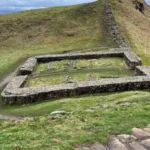
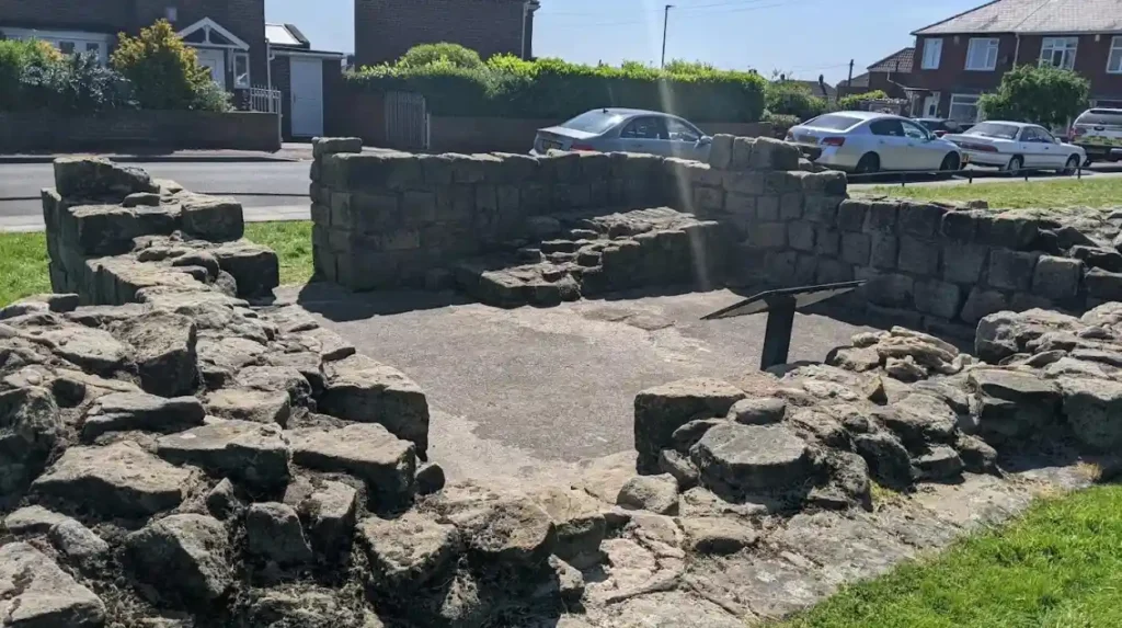
Chapel House has a major Roman archaeological connection through Milecastle 9 on Hadrian’s Wall. Archaeological investigation identified a Roman military installation with substantial stone foundations, internal buildings, defensive features and evidence of occupation across several centuries.
Hadrian’s Wall was constructed during the reign of Emperor Hadrian, beginning around AD 122. The frontier extended across northern Britain and formed a major defensive and administrative boundary within the Roman Empire.
Milecastles were small fortified installations positioned along the Wall. They controlled movement through gateways and supported the wider frontier system.
Milecastle 9, associated with Chapel House, is one of the easternmost reliably located milecastles along the Wall.
Newcastle City Council’s Historic Environment Record states that the existence of the milecastle was noted by antiquarian John Horsley before its location was confirmed archaeologically in 1928. The North of England Excavation Committee investigated the site, followed by excavation by Eric Birley in 1929.
The excavation revealed a milecastle measuring approximately 60 feet north-south and 48 feet 10 inches east-west internally. Archaeologists identified substantial wall foundations and internal structures.
Three broad occupation phases were proposed, corresponding to the second, third and fourth centuries.
A coin of the emperor Valentinian, who ruled between AD 364 and 375, provided evidence associated with continued occupation during the later Roman period.
The site was evaluated again during archaeological work in 1999 and 2000. Historic England’s report confirmed surviving parts of the outer wall, an internal building and external surfaces. The investigation also found evidence that the milecastle had been constructed over earlier archaeological deposits.
The archaeological evidence establishes that the landscape around modern Chapel House was militarily important long before the suburban estate existed.
Where is Milecastle 9 and why is it historically important?
Milecastle 9 is part of the Hadrian’s Wall archaeological landscape associated with Chapel House and West Denton. Its remains provide evidence of Roman frontier construction, military occupation and later archaeological preservation within Newcastle’s modern urban environment.
The surviving archaeological evidence demonstrates the difficulty of preserving ancient structures beneath modern infrastructure.
Historic England’s research records the milecastle around the eastern edge of the Chapel House and West Denton area. Parts of the Wall and milecastle have been affected by later roads and land use.
The 2000 archaeological evaluation was designed partly to understand the condition and vulnerability of the remains. Researchers examined the shape, construction, internal layout and survival of the monument.
The archaeological site is significant because it connects Newcastle directly to Hadrian’s Wall, a UNESCO World Heritage Site.
Historic England also identifies the wider Hadrian’s Wall and vallum landscape in the Newcastle area as a protected heritage environment. One designated section between Blucher and Dene House is recorded as a Scheduled Monument and part of the World Heritage Site.
This heritage context gives Chapel House unusual historical depth. The houses themselves largely belong to the 20th century, but the land contains evidence of Roman military organisation dating from the 2nd century.
For visitors studying Newcastle’s history, this relationship between modern suburb and ancient frontier is particularly important.
To experience the wider historic landscape in person today, consult our comprehensive [Insert Anchor Text for Things to Do Article Here] for itineraries and visiting parameters.
What types of homes are found in Chapel House?
Chapel House contains a substantial stock of post-war suburban properties, including semi-detached, terraced and detached houses. The housing pattern reflects its planned development from the 1960s into the early 1970s and continues to shape local property values today.
The housing stock is central to understanding Chapel House property prices.
Semi-detached houses form an important part of the market. These properties typically provide more internal space than many central Newcastle terraces while retaining relatively conventional suburban layouts.
Terraced houses are also represented, particularly within the wider NE5 housing market.
Detached homes occupy a smaller part of the market and command different prices because of their additional space and land.
The age of the housing stock also affects maintenance requirements. Properties built during the 1960s and early 1970s can have construction details and building services associated with that period.
Buyers therefore examine more than location when comparing properties. Roof condition, windows, insulation, heating systems, electrical installations, extensions and leasehold or freehold status all influence the practical cost of ownership.
The historical character of the estate also means that individual streets can contain similar house types but different levels of modernisation.
This creates variation within the overall Chapel House property market.
What are Chapel House house prices in 2026?
Recent sold-price data places the average Chapel House sale price at about £209,480 over the latest recorded year, with semi-detached homes averaging £214,520, terraced homes £215,000 and detached properties £247,500.
These figures provide a current snapshot rather than a permanent valuation.
Rightmove’s Chapel House sold-price data, based on HM Land Registry records, reports an overall average of £209,480 over the latest year. Semi-detached properties averaged £214,520, while terraced properties averaged £215,000 and detached homes averaged £247,500.
The same dataset reports that Chapel House prices were broadly similar to the preceding year and approximately 1% above the 2022 peak of £207,339.
Individual transactions demonstrate why an average should not be treated as the expected price of every property.
For example, 64 Chapel House Road, a three-bedroom semi-detached property, sold for £235,000 on 10 July 2026. The same property previously sold for £150,000 in January 2007.
Another example is 105 Chapel House Drive, a three-bedroom semi-detached property, which sold for £245,000 on 29 June 2026. It had previously sold for £198,000 in March 2023.
These transactions show the effect of property-specific factors and long-term market movement.
They also demonstrate why buyers researching NE5 should examine completed sales rather than relying only on asking prices.
How do Chapel House prices compare within NE5?
NE5 contains several neighbourhoods and property types, so Chapel House prices represent one part of a broader postcode market. Recent sales show substantial variation between streets, property sizes, tenure types and neighbouring communities within NE5.
NE5 covers a broad part of west and north-west Newcastle.
The postcode includes Chapel House alongside nearby areas such as West Denton, Westerhope, Blucher and other residential communities. Consequently, an NE5 average does not represent every Chapel House property.
Rightmove’s NE5 records include recent Chapel House transactions alongside sales elsewhere in the postcode. The database states that its underlying sold-price information is produced from publicly available HM Land Registry data covering transactions registered from 1 January 1995 to 31 July 2026.
Chapel House Drive provides another useful comparison. Rightmove reports an overall average of £221,606 for sales during the latest year. Semi-detached properties averaged £231,207, detached properties £220,000 and terraced properties £156,000.
These numbers illustrate how property type can produce a substantial difference even within a small geographic area.
A buyer assessing a Chapel House home should therefore compare the same property type, bedroom count and street where possible.
Historical transaction data is more useful than a postcode-wide figure when estimating the market position of an individual house.
Does Chapel House have schools for families?
Chapel House has established primary-school provision, including Knop Law Primary School and Milecastle Primary School. Both are located on Hillhead Parkway and provide education for children aged four to eleven, supporting the area’s established family housing role.
Education is one of the most important factors in evaluating a suburban housing market.
Newcastle City Council lists Knop Law Primary School at Hillhead Parkway, Chapel House, NE5 1DS. The academy has an admission number of 60 for its year of entry and serves children aged four to eleven.
Milecastle Primary School is also located on Hillhead Parkway at NE5 1LH. Newcastle City Council lists it as an academy for pupils aged four to eleven, with an admission number of 30 for the year of entry.
The schools form part of the wider education network serving west Newcastle.
Families also need to consider secondary-school arrangements, admissions policies and catchment boundaries separately. A home’s postcode does not by itself guarantee admission to a particular school.
The historical development of Chapel House explains why schools occupy such an important place within the estate. They were developed alongside housing as part of a planned suburban community rather than added to an already established urban neighbourhood.
This relationship between housing and education remains one of the clearest examples of post-war planning visible in Chapel House today.
How has education changed in Chapel House since the estate was built?
Chapel House’s education system has changed since the estate’s construction, reflecting wider changes in Newcastle’s school structure. The former middle-school system ended in 2005 when Newcastle’s outer-west education system moved to a two-tier structure.
The original educational arrangement differed from today’s system.
Chapel House Middle School previously served approximately 500 pupils from the local area and beyond. It closed in 2005 when the outer-west Newcastle education system changed from a three-tier structure to two-tier education.
Knop Law Primary School and Milecastle Primary School also operated historically within the former first-school structure.
The change illustrates how public services evolve after a residential estate has been built.
Housing can remain physically recognisable for decades while schools, transport arrangements and community services change around it.
For families researching Chapel House today, current admissions information is therefore more relevant than historical school catchment arrangements. For historians, however, the former education structure provides evidence of how the estate’s population and public institutions developed during the second half of the 20th century.
What community facilities support life in Chapel House?
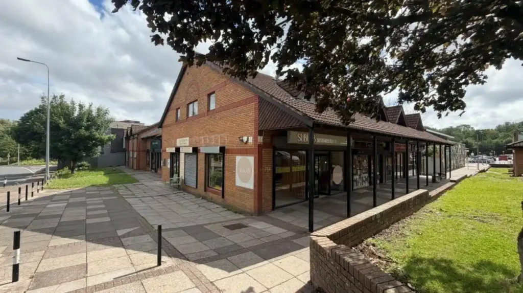
Chapel House has local services that support everyday residential life, including shops, healthcare provision, public transport connections and community facilities. Its planned suburban structure places many essential services within the wider residential area rather than the historic city centre.
The estate’s local infrastructure reflects the principles used during its development.
Newcastle City Council’s housing information for Allerdale House, an assisted-living development in Chapel House, identifies proximity to local bus routes, shops, GP surgeries, pharmacies and a church.
Allerdale House contains 32 one- and two-bedroom apartments for people aged over 55 who meet the eligibility requirements for the Housing Plus assisted-living service.
Although this facility serves a specific age group, its location provides useful evidence of the wider service environment.
The presence of healthcare, retail and transport facilities is particularly relevant to family households because residential convenience depends on more than the house itself.
Chapel House also benefits from its position within the wider western suburbs. Residents can access services in neighbouring areas, while Newcastle city centre remains the main regional centre for employment, culture, higher education and major civic institutions.
How does Chapel House connect with Newcastle’s wider history?
Chapel House connects Newcastle’s modern suburban history with the Roman frontier, post-war housing expansion and continuing urban development. The area therefore represents several clearly documented stages in Newcastle’s long transformation from Roman frontier territory to modern city.
The Roman connection is the earliest documented layer.
Hadrian’s Wall established a frontier across northern Britain during the 2nd century. Milecastle 9 provided a military installation within that system.
The medieval and early modern history of the immediate estate area is less visible because the modern residential development replaced much of the former agricultural landscape.
The major transformation came during the 20th century.
From 1964, Chapel House became a planned residential estate. Its houses, schools and roads represented the outward growth of Newcastle after the Second World War.
The estate’s architecture is therefore valuable as evidence of social and planning history.
Its housing records the demand for family accommodation, while its school provision demonstrates the public infrastructure required to support new suburban populations.
The survival of Roman archaeology alongside modern housing adds another layer. It shows how archaeological remains can persist beneath or beside successive phases of urban development.
How should buyers interpret Chapel House house-price data?
Chapel House sold-price data should be interpreted by property type, transaction date, street, tenure, size and condition. An area average provides context, while recent comparable sales provide a more precise indication of individual property values.
House prices are not fixed historical facts in the same way as building dates or archaeological measurements.
A recorded transaction is a fact about a completed sale at a particular date. It does not establish the value of every comparable property.
The latest Chapel House figures show an overall average of £209,480, but the variation between semi-detached, terraced and detached properties demonstrates why averages require context.
A buyer should also distinguish between freehold and leasehold properties. Rightmove’s recent transaction records include both tenure types within NE5.
Property improvements also affect prices.
A 1960s house with a modern kitchen, upgraded insulation, contemporary heating and an extended floor plan does not occupy the same market position as an unmodernised property of similar original design.
The most useful comparison therefore involves recently sold homes with similar characteristics.
HM Land Registry data provides the underlying transaction evidence used by property-price databases. Rightmove explicitly acknowledges HM Land Registry as the source of its sold-price information.
Is NE5 a family-oriented area?
NE5 contains established family housing, primary schools and suburban services, while Chapel House offers predominantly low-rise post-war homes. These characteristics provide the physical and institutional foundations associated with long-established family-oriented residential neighbourhoods.
The evidence for family suitability is primarily structural rather than subjective.
Chapel House contains a substantial stock of houses rather than being dominated by flats or high-density apartment blocks. Its schools include two primary academies directly within the neighbourhood.
The estate’s planned design also created residential streets and family-sized properties during a period when suburban home ownership expanded across Britain.
The presence of neighbouring communities increases access to additional schools, services and employment areas.
However, family suitability depends on individual circumstances. School admissions, commuting requirements, household income, property condition and transport needs differ between households.
For this reason, the historical evidence supports a description of Chapel House as an established suburban residential area with significant family housing. It does not establish a universal assessment for every household.
The house-price data adds another dimension. Recent Chapel House sales show that the area contains homes across several price points, although the exact figure varies according to property type and individual condition.
What makes Chapel House historically significant today?
Chapel House is historically significant because its modern housing estate occupies a landscape connected with Hadrian’s Wall and Milecastle 9. Its buildings also preserve evidence of Newcastle’s post-war suburban expansion and changing approach to residential planning.
The historical value of Chapel House is therefore not limited to surviving old buildings.
The Roman archaeological evidence provides national and international heritage context. Historic England identifies the Hadrian’s Wall remains in this part of Newcastle as protected archaeological heritage associated with a UNESCO World Heritage Site.
The archaeological investigations at Milecastle 9 demonstrate the continuing importance of research. Excavations in 1929 and later evaluation work in 1999–2000 provided evidence about construction, occupation and preservation.
The modern estate provides a different type of historical evidence.
Its houses document the physical expansion of Newcastle during the 1960s and early 1970s. Its schools record changing approaches to education. Its local services demonstrate how planned communities were adapted to changing population needs.
This makes Chapel House useful for studying both ancient archaeology and modern urban history.
How should Chapel House be understood as part of Newcastle’s future history?
Chapel House will remain historically relevant because its post-war housing stock, schools and archaeological setting document successive phases of Newcastle’s development. Future research will continue to connect Roman heritage, suburban planning, property change and community history.
The neighbourhood provides an example of how cities accumulate historical layers.
The Roman frontier established one of the earliest documented systems in the landscape. Agricultural land and later rural settlement followed. The 20th-century expansion of Newcastle transformed the area into a planned suburban estate.
The modern property market adds another historical layer.
Every completed house sale creates a record of changing residential values. Over time, these transactions form a measurable history of housing demand and property ownership.
The preservation of archaeological evidence remains equally important. Historic England’s assessment of the Hadrian’s Wall and vallum remains near Blucher identifies localised problems and high vulnerability in part of the protected landscape.
This demonstrates that heritage preservation remains an active responsibility rather than a completed historical process.
For researchers, Chapel House offers several complementary subjects: Roman archaeology, post-war architecture, suburban planning, education history, property ownership and Newcastle’s geographical expansion.
For families considering the area, its significance is more immediate. The housing market, schools and local services provide the practical context, while the archaeological landscape gives the neighbourhood a distinctive historical setting.
Chapel House is therefore best understood as a modern Newcastle suburb built within a much older landscape. Its current NE5 property market reflects the continued evolution of that landscape, while its schools, streets and archaeological remains preserve evidence of the changes that created the area seen today.