Chapel Park and Chapel House are residential suburbs in the western part of Newcastle upon Tyne. Their modern identity developed mainly from the late 1960s and 1970s, when suburban housing expanded across former agricultural and mining landscapes west of the historic city.
- What is the history of Chapel Park and Chapel House?
- How did the Roman history of Chapel House shape the area?
- How did coal mining influence Chapel Park before the housing estates?
- When were Chapel Park and Chapel House built as residential suburbs?
- What is the architecture and housing character of Chapel Park and Chapel House?
- Why are Chapel Park and Chapel House associated with family suburban living?
- What historic features remain around Chapel Park and Chapel House today?
- How have Chapel Park and Chapel House changed since the 1970s?
The two neighbourhoods form part of an urban landscape shaped by several distinct phases. Roman frontier infrastructure established an early strategic presence. Coal mining and wagonways later transformed the western outskirts. Twentieth-century planning then converted large areas of open land into residential estates.
Understanding this history explains why Chapel Park and Chapel House contain modern family housing alongside older landscape features, transport routes and archaeological remains.
What is the history of Chapel Park and Chapel House?
Chapel Park and Chapel House developed as planned suburban neighbourhoods during Newcastle’s twentieth-century expansion, with major residential development gaining planning permission in 1970 after centuries of agriculture, mining, wagonways and Roman frontier activity shaped the surrounding landscape.
Before the modern estates appeared, the area west of Newcastle was predominantly agricultural and industrial. Newcastle City Council’s character assessment records agricultural buildings, mining infrastructure and historic routes as important elements of the pre-war landscape.
The area also contained connections to the wider coalfield. Mining locations around Blakelaw and Slatyford were connected with the River Tyne by wagonways. The North Walbottle Wagonway formed part of this transport landscape and remains an important historical reference point for understanding later development.
Chapel Park contains remnants of former mining terraces. These features demonstrate that the present residential environment replaced an earlier industrial landscape rather than occupying land with no previous settlement history.
The transition accelerated during the twentieth century. Newcastle expanded beyond its older urban districts as demand for housing increased. New estates provided larger homes, gardens and planned streets outside the dense inner-city neighbourhoods.
Newcastle City Council records that the extensive Chapel Park and subsequent Chapel House residential developments received planning permission in 1970. The estates were part of a much wider suburban expansion that altered the western edge of Newcastle.
The development also affected nearby historic areas. Northumberland Gardens, an older residential landscape, became increasingly surrounded by twentieth-century suburban development. Chapel Park and Chapel House were among the developments that changed the relationship between older properties and the expanding city.
This history gives Chapel Park and Chapel House a distinctive chronological structure. Roman military archaeology represents the earliest major surviving evidence. Mining and agricultural landscapes represent the later pre-suburban period. The estates themselves represent post-war urban expansion.
How did the Roman history of Chapel House shape the area?
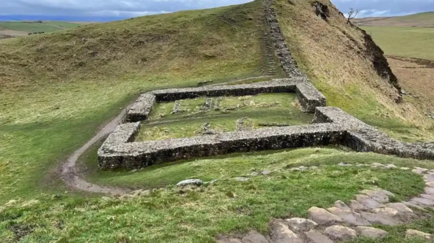
Chapel House has a documented Roman archaeological connection through Milecastle 9 on Hadrian’s Wall, excavated in 1929 after its location was identified by the North of England Excavation Committee, providing direct evidence of Roman frontier organisation near the modern suburb.
Hadrian’s Wall was constructed under the Roman emperor Hadrian from AD 122. The frontier extended across northern Britain from the Tyne to the Solway Firth and controlled movement along the northern edge of the Roman province.
Milecastles were small fortified installations positioned along the Wall. They provided controlled gateways and supported movement along the frontier.
Milecastle 9 was associated with the Chapel House area. Newcastle’s Historic Environment Record states that its position was definitely located in 1928 by the North of England Excavation Committee. Archaeological excavation followed in 1929.
E. Birley excavated the southern two-thirds of the milecastle in 1929. The remaining section lay beneath the road, while the north gate was recorded in 1951.
The excavated structure measured approximately 60 feet north to south and 48 feet 10 inches east to west internally. The evidence indicated a long-axis milecastle.
Archaeologists identified three broad periods of occupation, corresponding to the second, third and fourth centuries. A coin of Valentinian, who ruled between AD 364 and 375, provided evidence supporting continued occupation while Hadrian’s Wall remained operational.
Roman building stones were also recorded. Several stones recovered during the 1929 excavation carried Roman inscriptions or markings. The Tyne and Wear Historic Environment Record preserves details of these finds and their archaeological references.
The modern suburb therefore sits within a landscape containing evidence of a major Roman frontier system. Much of the visible military structure has disappeared, but the archaeological record remains significant for understanding the area’s earlier function.
The Roman connection also explains why Chapel House belongs within the broader historical geography of Hadrian’s Wall. The modern residential streets represent a twentieth-century layer placed over a landscape that had already been strategically important for almost two millennia.
How did coal mining influence Chapel Park before the housing estates?
Coal mining influenced the western Newcastle landscape through pits, transport routes and workers’ settlements, while wagonways connected mining districts with the Tyne; small remnants of mining terraces at Chapel Park survive as evidence of this industrial phase.
Coal became one of the defining economic forces in the wider Newcastle region. The western districts formed part of a landscape where coal extraction, agriculture and transport infrastructure existed alongside one another.
Mining required efficient movement of coal. Wagonways provided a practical method for transporting mineral output towards river and industrial facilities. The North Walbottle Wagonway forms part of the historical infrastructure associated with this system.
Newcastle City Council’s character assessment identifies ancient routes and industrial transport corridors as important influences on the western part of the city. It specifically records mining activity around Blakelaw and Slatyford and links these locations with wagonways leading towards the Tyne.
Chapel Park retains small pockets of former mining terraces. These terraces represent physical evidence of the industrial landscape that existed before large-scale residential construction.
The industrial geography also influenced later planning. New residential roads had to be inserted into a landscape already divided by historic routes, field boundaries, industrial remnants and established settlements.
This process produced an urban environment where modern streets coexist with older landscape patterns. The relationship is particularly important for local historians because many traces of former industrial activity survive indirectly rather than through large standing structures.
The transition from mining and agriculture to housing reflects a wider twentieth-century process across Newcastle. Industrial land uses declined in importance while residential demand increased.
The result was not an immediate replacement of one landscape by another. Instead, older routes, land boundaries and archaeological features became incorporated into the expanding suburban environment.
When were Chapel Park and Chapel House built as residential suburbs?
The main Chapel Park and Chapel House residential developments date from the late 1960s and 1970s, with planning permission recorded in 1970 and surviving property records showing many homes constructed around the early 1970s.
The year 1970 provides an important marker in the development history of the two suburbs. Newcastle City Council documentation records planning permission for the extensive Chapel Park and subsequent Chapel House residential developments in that year.
The estates reflected the housing priorities of post-war Britain. Families increasingly sought homes with more internal space, private gardens, garages and quieter residential streets than were available in many older inner-city districts.
Housing construction therefore expanded into areas previously occupied by agricultural and industrial uses.
The architecture of Chapel Park reflects this period. Surviving properties include semi-detached houses, linked homes, terraces, bungalows and detached houses. Garages, front gardens and rear gardens form recurring elements of the estate layout.
Property records for streets such as Greenway provide additional evidence of the development period. Available property data indicate construction dates extending from the late 1950s to the late 1970s, with the largest concentration around 1971.
Other property records identify leases beginning in 1970, providing another indication of the period in which substantial parts of the estate were developed.
The physical design reflects the planning principles of suburban expansion. Roads are arranged around residential streets and cul-de-sacs rather than following the dense grid found in historic central Newcastle.
Open areas and landscaped spaces form part of the residential environment. This layout created separation between through-traffic and many residential properties.
The estates were also connected to nearby communities rather than functioning as isolated developments. Chapel Park sits within the broader western Newcastle landscape alongside Westerhope, Newburn, Walbottle, Blakelaw and other expanding residential areas.
The development of Chapel House followed the earlier phase of Chapel Park. Together, they demonstrate how Newcastle’s western edge changed from a landscape dominated by farms, mines and wagonways into a predominantly residential environment.
What is the architecture and housing character of Chapel Park and Chapel House?
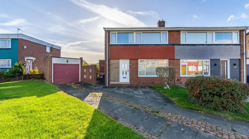
Chapel Park and Chapel House contain predominantly twentieth-century suburban housing, including semi-detached, linked, terraced, detached and bungalow properties, with garages, gardens, cul-de-sacs and landscaped spaces reflecting the design priorities of post-war family housing.
The housing architecture is functional rather than monumental. Most buildings belong to the late twentieth-century suburban tradition, when housebuilders produced standardised designs adapted to estate layouts.
Semi-detached houses are particularly important within this housing pattern. They provided separate family accommodation while using land more efficiently than detached houses.
Linked houses also appear across the estates. These properties connect individual dwellings through garages or other structural elements, creating a balance between density and private external space.
Bungalows form another part of the housing stock. Their single-storey layouts provide an alternative to conventional two-storey family houses and contribute to the age diversity of the neighbourhood.
Garages were a major feature of the original suburban design. Post-war estates were planned during an era when private car ownership was becoming increasingly important, so many houses incorporated garages or dedicated parking.
Gardens are equally significant. Front gardens establish a landscaped transition between public roads and private homes, while rear gardens provide private outdoor space.
The design of streets also matters. Cul-de-sacs and residential loops reduce the need for through-traffic on many internal roads. This approach was common in post-war housing estates and contrasts with older urban streets that were often designed around industrial movement, commercial activity or dense terraced housing.
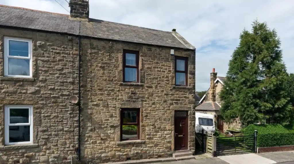
The architecture has changed over time through extensions, replacement windows, new doors, garage conversions and landscaping. These changes create differences between individual properties while preserving the underlying estate structure.
For architectural historians, Chapel Park and Chapel House are useful examples of ordinary post-war suburban design. Their significance comes from the relationship between housing type, road layout, open space and changing patterns of domestic life rather than from individual landmark buildings.
Why are Chapel Park and Chapel House associated with family suburban living?
Chapel Park and Chapel House developed around housing forms and neighbourhood layouts associated with family life, including gardens, schools, community facilities, local services, residential streets and access to Newcastle’s wider transport network.
The family-oriented character of the estates is closely connected with their original planning purpose. Larger suburban homes offered more domestic space than many older inner-city properties.
The physical environment also supports different household arrangements. Three-bedroom houses, four-bedroom properties, bungalows and smaller linked homes create a varied residential market.
Schools form an important part of the wider neighbourhood structure. Educational facilities were integrated into the expanding suburban geography as new housing increased demand for local services.
The surrounding community infrastructure also developed alongside housing. Shops, healthcare facilities, churches, community buildings and transport services became part of everyday life.
Newcastle City Council’s current housing directory identifies services in Chapel House, including local shops, bus routes, healthcare facilities and a church in the wider area.
The wider Chapel ward also demonstrates the continuing demographic importance of family services. Newcastle City Council’s childcare sufficiency assessment recorded children aged under five within the ward, showing continuing demand for early-years provision.
The neighbourhood’s position on the western side of Newcastle provides another defining feature. Residents have access to the city while living within a suburban landscape separated from the dense central districts.
The wider city has also expanded considerably. Census 2021 recorded approximately 300,100 residents in Newcastle upon Tyne, compared with approximately 280,200 in 2011. The local authority therefore experienced population growth of around 7.1 percent over the decade.
This growth provides context for the continued importance of suburban districts. Chapel Park and Chapel House are no longer peripheral settlements in the same sense as they were during their construction period. They form established parts of Newcastle’s residential structure.
Their suburban character therefore comes from both original design and accumulated community infrastructure. The estates have matured from new developments into established neighbourhoods with several generations of residents and property adaptations.
To explore the area’s wider heritage and surrounding attractions, consult our comprehensive for itineraries and visiting parameters.
What historic features remain around Chapel Park and Chapel House today?
Historic features around Chapel Park and Chapel House survive mainly through archaeological records, former mining landscapes, historic routes and nearby older buildings, while the modern estates preserve the physical evidence of Newcastle’s twentieth-century suburban expansion.
The most important archaeological feature is the former Milecastle 9 site associated with Hadrian’s Wall. Although the Roman structure itself is no longer an intact visible monument, archaeological excavation established its location and dimensions.
The site demonstrates that the landscape had strategic importance long before suburbanisation.
Former mining terraces provide a second layer of physical evidence. Newcastle City Council identifies small pockets of former mining terraces at Chapel Park, preserving traces of the area’s industrial past.
Historic transport routes provide another connection with the past. The North Walbottle Wagonway forms part of the landscape history around the estates and illustrates how coal movement influenced the geography of western Newcastle.
Nearby historic buildings add further chronological depth. Westerhope existed as a village during the early nineteenth century, before rapid twentieth-century suburban development transformed the wider area.
St John’s Church in Westerhope also provides evidence of the transition from rural to suburban settlement. Church historical material records that the building originally stood within a farming community before nearby Chapel Park and later residential estates altered the surrounding environment.
The modern estate itself has historical value. Buildings constructed during the late 1960s and 1970s now represent an identifiable period in Newcastle’s housing history.
This creates an important distinction between architectural preservation and historical preservation. A neighbourhood does not require large numbers of listed buildings to have historical significance. Its value can also come from its archaeological setting, development pattern, infrastructure and social history.
Chapel Park and Chapel House therefore function as historical records of urban expansion. Their streets show how Newcastle incorporated former agricultural and industrial land into the twentieth-century city.
For genealogists and local historians, property records, electoral records, maps and planning documents provide opportunities to trace the development of individual streets and households.
Historic maps are particularly useful because they reveal the landscape before construction. Comparing earlier maps with modern street plans shows the disappearance of fields, farms, mining features and wagonways beneath the expanding residential city.
How have Chapel Park and Chapel House changed since the 1970s?
Since the 1970s, Chapel Park and Chapel House have changed from new suburban estates into established Newcastle neighbourhoods, while property adaptations, new development, community infrastructure and population growth have continued to reshape the western urban landscape.
The first generation of residents moved into homes designed as new-build suburban properties. Over subsequent decades, those houses became established parts of Newcastle’s housing stock.
Property alterations are now visible throughout the estates. Extensions, conservatories, renovated kitchens, replacement windows, converted garages and updated gardens reflect changing household requirements.
The housing stock has also developed through changes in tenure. Original ownership patterns have been followed by resale, renting, inheritance and adaptation to different household needs.
Planning records demonstrate that development did not stop after the original estates were completed. Later applications include additional houses, alterations to existing properties, landscaping changes and infrastructure work.
The wider western part of Newcastle has also continued to expand. New residential development around Westerhope, Callerton and surrounding districts has strengthened connections between previously separate settlements and estates.
This continuing growth places Chapel Park and Chapel House within a larger process of metropolitan expansion. Roads, schools, retail facilities and community infrastructure increasingly connect the neighbourhoods with surrounding districts.
The historical significance of this process is clear. The estates represent one stage in a much longer sequence of land use.
Roman military organisation established an early strategic landscape. Medieval and later agriculture shaped fields and settlements. Coal mining introduced industrial infrastructure. Twentieth-century housing replaced much of the industrial and agricultural land. Modern planning continues to modify the suburban environment.
Each layer remains relevant to understanding the next.
The future historical importance of Chapel Park and Chapel House will therefore extend beyond individual houses. Researchers will be able to study the estates as evidence of post-war housing policy, suburban design, changing family structures, transport patterns and the transformation of Newcastle’s western edge.
For today’s residents, the neighbourhoods provide an established suburban environment. For historians, they provide evidence of how a landscape can change repeatedly while retaining traces of earlier periods.
Chapel Park and Chapel House are therefore best understood as historical suburbs rather than simply modern residential districts. Their identity combines Roman archaeology, industrial heritage, post-war planning and contemporary urban life.
The estates’ development from former agricultural and mining land into established residential communities forms part of the wider history of Newcastle upon Tyne. Their streets, houses and surviving landscape features record the physical expansion of the city and the changing requirements of its population.
That combination of archaeology, industrial history and twentieth-century housing makes Chapel Park and Chapel House useful case studies for understanding how Newcastle evolved beyond its historic core.