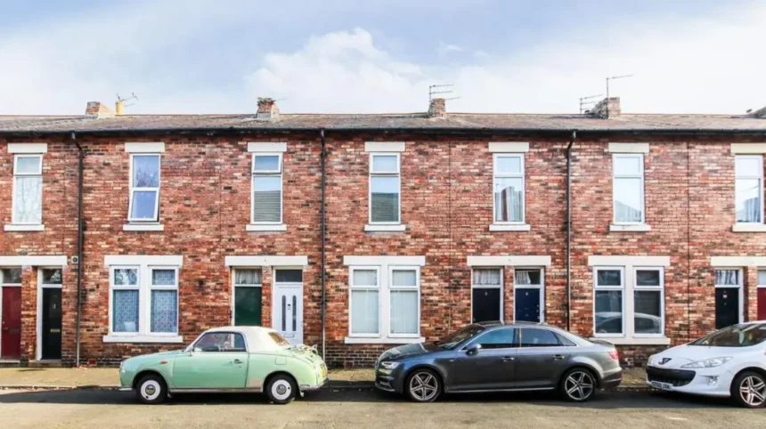
Hazlerigg and Brunswick Village are two settlements north of Newcastle upon Tyne with identities shaped by agriculture, coal mining, planned workers’ housing, transport routes, archaeological remains and post-industrial landscape change. Their present-day residential character reflects a long transition from rural settlements to mining communities and, later, suburban neighbourhoods.
- How did Hazlerigg develop before the coal-mining era?
- When did coal mining transform Hazlerigg and Brunswick Village?
- Why were miners’ houses important to the character of these villages?
- What historical buildings and memorials survive in Brunswick Village?
- How did mining change the landscape around Hazlerigg and Brunswick?
- What archaeological evidence connects Hazlerigg with Roman and Iron Age Newcastle?
- How did the decline of coal mining reshape Hazlerigg and Brunswick?
- How have Hazlerigg and Brunswick changed from mining villages into Newcastle suburbs?
- Why are Hazlerigg and Brunswick important for understanding Newcastle’s wider history?
Both villages occupy a distinctive position within the wider Newcastle urban area. Hazlerigg lies close to the A1 and Newcastle Great Park, while Brunswick Village sits near Dinnington, Wideopen and the northern edge of Newcastle. Administrative boundaries cross this landscape, with parts of both communities associated with Newcastle upon Tyne and North Tyneside.
The area also contains archaeological evidence that predates the industrial period by many centuries. Historic England records scheduled archaeological remains at Hazlerigg associated with late Iron Age or Romano-British settlement. Newcastle’s Historic Environment Record also records prehistoric, Roman, medieval and post-medieval evidence across the surrounding landscape.
Understanding Hazlerigg and Brunswick Village therefore requires more than a description of modern housing. Their streets, open spaces, former industrial land and surviving buildings reflect successive phases of North East England’s economic and social development.
How did Hazlerigg develop before the coal-mining era?
Hazlerigg began as a rural settlement within an agricultural landscape, with evidence of Iron Age and Romano-British occupation showing that people lived and worked in the area long before nineteenth-century industrialisation transformed the district.
The wider Hazlerigg landscape formed part of the agricultural hinterland north of Newcastle. Fields, farms, tracks and small settlements dominated the area before large-scale coal extraction created a new industrial economy.
Archaeological investigation has established a much older human presence. Newcastle’s Historic Environment Record records an Iron Age roundhouse and associated ditches at Hazlerigg. Excavation in 2013 identified an early ditch with radiocarbon dating of charcoal to approximately 790–539 BC.
The same excavation identified a roundhouse approximately 8 metres in diameter. Charcoal from its associated gully produced a radiocarbon date of approximately 753–410 BC. A later feature produced a date within the middle Iron Age, while other evidence indicated activity during the later Iron Age and Roman period.
These discoveries establish that Hazlerigg was not created by the Industrial Revolution. Its later mining settlement occupied land with a much longer history of agricultural and domestic use.
Historic England also protects two rectilinear enclosed settlements south of Castle Street as a Scheduled Monument. The protected archaeological complex contains two enclosed settlements interpreted as late Iron Age or Romano-British in date.
The northern enclosure measures approximately 75 metres by 75 metres. The southern enclosure has a trapezoidal plan, with sides measuring approximately 60 metres except for one side measuring about 50 metres. Archaeological evidence includes hut circles ranging from approximately 7 to 20 metres in diameter.
These remains provide evidence for communities that used enclosed settlements, roundhouses and agricultural land before Roman Britain developed across northern England.
When did coal mining transform Hazlerigg and Brunswick Village?
Coal mining transformed both settlements during the nineteenth and twentieth centuries by creating employment, housing and industrial infrastructure, with Hazlerigg Colliery opening in 1892 and Dinnington Colliery beginning production at Brunswick in 1867.
Coal extraction changed the physical and social geography of northern Newcastle. Deep mining required workers, transport infrastructure, workshops, housing and supporting services. Villages consequently expanded around collieries rather than developing solely from agricultural settlement.
At Hazlerigg, the Burradon and Coxlodge Coal Company began sinking the colliery in 1892. Mine records show rapid expansion during the following years. Employment reached 208 people by 1896 and approximately 874 by 1900.
Hazlerigg Colliery reached an employment peak of 1,156 people in 1910, including approximately 960 workers below ground. The principal products included household and steam coal, while fireclay and shale were also extracted during parts of the mine’s operating history.
The colliery continued operating until 1964. The National Coal Board became responsible for the mine after the nationalisation of Britain’s coal industry in 1947.
Brunswick Village developed around Dinnington Colliery. Newcastle’s Historic Environment Record identifies 1867 as the opening date of the deep mine, which was established by John Bowes & Partners Ltd. The Seaton Burn Coal Company acquired the colliery in 1899.
Dinnington Colliery closed on 26 February 1960. At its peak, it employed more than 1,000 people.
The original settlement was known as Dinnington Colliery before becoming Brunswick Village. The name change reflected the settlement’s development beyond its direct industrial identity.
Mining therefore produced two connected but distinct village histories. Hazlerigg developed around its own colliery, while Brunswick emerged from the Dinnington mining complex.
Why were miners’ houses important to the character of these villages?
Miners’ housing provided the permanent residential framework for Hazlerigg and Brunswick, linking employment, family life and community services through planned terraces, streets and institutions built close to the collieries.
Coal companies needed stable workforces close to underground operations. Housing construction became an important part of industrial development across the Northumberland coalfield.
At Hazlerigg, the colliery company constructed housing for miners and their families. The village that exists today developed substantially from this mining expansion.
The relationship between employment and housing was especially important because coal mining required large numbers of workers to begin shifts at fixed times. Proximity reduced travelling distances and helped companies maintain a concentrated workforce.
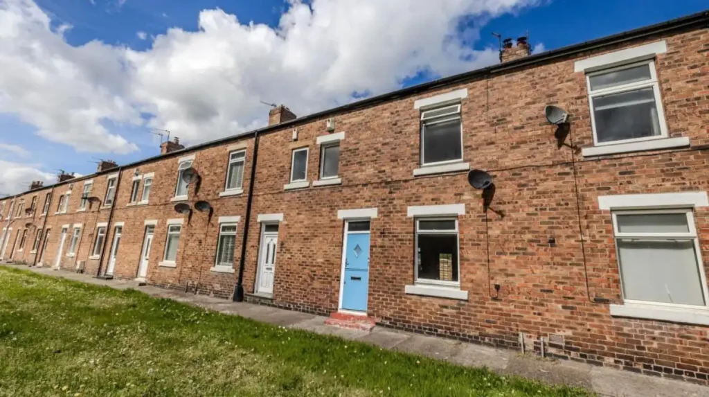
Brunswick provides particularly clear evidence of this planned approach. Newcastle’s Historic Environment Record describes the Dinnington colliery settlement as being designed according to model-village standards.
The surviving terraces are significant because they retain part of the physical structure of the nineteenth-century mining community. The original housing was accompanied by industrial infrastructure, transport routes and community facilities.
The Historic Environment Record also records a brickworks within Dinnington Colliery. It operated near the Augusta shaft from 1908. By 1922, the works contained a 26-chamber Belgian kiln, with each chamber holding approximately 6,500 bricks.
In 1939, Hartley Main Collieries took over the brickworks. In 1950, the Belgian kiln was converted to a top-fired Hoffman-type kiln, increasing individual chamber capacity to approximately 8,500 bricks.
The brickworks closed shortly after the colliery in 1960. This industrial sequence demonstrates how mining generated secondary industries, including brick production for construction.
Some original terraces remain visible in Brunswick. They form an important architectural connection between the modern village and its nineteenth-century industrial origins.
What historical buildings and memorials survive in Brunswick Village?
Brunswick retains several physical reminders of its mining-community past, including surviving workers’ terraces, St Cuthbert’s Church and the Grade II-listed war memorial on Darrell Street.
St Cuthbert’s Church provides an important religious landmark. The church was built in 1905, when Brunswick Village was still known as Dinnington Colliery.
The building originally functioned as a chapel associated with St Matthew’s Church in Dinnington. It served the families of local miners and reflected the growth of the settlement around the colliery.
In 1988, St Cuthbert’s became a church in its own right within the newly formed parish of Christ the King. Its continuing use provides a direct institutional link between the mining village and the modern community.
The Brunswick Village War Memorial provides another major historical reference point. Historic England lists the memorial at Grade II.
The memorial dates from 1921, with later additions commemorating the Second World War. It stands on Darrell Street and takes the form of a Celtic cross.
The memorial was unveiled on 12 March 1921 by R. S. Barrett of the Seaton Burn Coal Company. Reverend J. E. Harland dedicated it.
Its historical importance extends beyond the structure itself. The memorial records the impact of national conflicts on a relatively small mining settlement and provides evidence of how communities commemorated local service and loss after the First World War.
The combination of church, terraces and memorial creates a concentrated record of Brunswick’s twentieth-century community history.
These buildings also demonstrate that industrial villages were not defined solely by coal production. Religious institutions, schools, family housing and memorial spaces formed an interconnected social landscape.
How did mining change the landscape around Hazlerigg and Brunswick?
Mining reshaped the landscape through shafts, spoil heaps, wagonways, subsidence ponds, industrial buildings and workers’ housing, while later reclamation converted several former industrial areas into woodland, nature reserves and modern employment sites.
Coal extraction produced visible physical changes above ground and less visible changes below it. Shafts provided access to underground workings, while spoil from excavation accumulated around the mines.
At Hazlerigg, the former colliery site has been transformed into woodland. Newcastle’s character assessment identifies former colliery spoil at Three Hills and the wider Havannah area as important landscape features.
The former Havannah Drift Mine opened in 1950 to the west of Hazlerigg. It closed in 1977. Parts of the former industrial complex were subsequently reused, while surrounding land became associated with the Havannah and Three Hills Nature Reserve.
The character assessment for North Gosforth and Newcastle Great Park describes the landscape as gently undulating, with heavy glacial clay over sandstone. The former mining areas form part of this broader landscape structure.
Transport was also central to the mining economy. Historic Environment Record evidence identifies former wagonways and industrial routes connecting mining communities with wider transport networks.
One raised trackway ran north-south between Hazlerigg and Middle Brunton Farm. Archaeological investigation found that it consisted of compacted ash, clinker and building debris. The route measured approximately 4.5 metres in width and extended for around 480 metres.
The evidence indicates that this particular track was more likely a pedestrian or horse-and-cart route than a formal wagonway.
At Brunswick, mining subsidence produced another distinctive landscape feature. Big Waters Nature Reserve centres on a large pond formed in the 1920s as a result of mining subsidence.
Newcastle City Council identifies Big Waters as reclaimed mining land containing mature woodland, paths and a large pond. The reserve now supports birds, insects, waterfowl and otters.
The transformation from industrial ground to wildlife habitat illustrates a major phase in the post-mining history of the district.
What archaeological evidence connects Hazlerigg with Roman and Iron Age Newcastle?
Hazlerigg contains nationally protected archaeological evidence demonstrating that settlement in the area extends from the Iron Age into the Romano-British period, long before the later agricultural and coal-mining communities emerged.
The archaeological record makes Hazlerigg particularly important within the northern Newcastle landscape.
Historic England’s Scheduled Monument at Hazlerigg includes two enclosed settlements. Their form and archaeological characteristics correspond with late Iron Age or Romano-British settlement patterns identified elsewhere in Northumberland and northern Britain.
The northern enclosure contains two concentric ditches. The outer ditch encloses approximately 75 metres by 75 metres, while an inner ditch sits around 10 metres inside it.
Two nearby hut circles have also been identified. One measures approximately 16 metres in diameter and another approximately 14 metres.
The southern enclosure has a more complex archaeological sequence. Geophysical investigation identified several intercutting hut circles and associated ditches. Seven hut circles form part of one concentration, with additional features located outside the principal enclosure.
The archaeological evidence demonstrates repeated use of the landscape rather than a single isolated occupation event.
The earlier 2013 excavation provides additional evidence. It identified an early Iron Age ditch, an approximately 8-metre roundhouse and later features associated with Iron Age and Roman activity.
Three pieces of Roman pottery were recovered from one feature. Environmental analysis also identified spelt wheat, barley, hazelnut remains, charred hay and oak.
These discoveries provide evidence about food production, fuel, vegetation and agricultural activity. Spelt wheat and barley indicate cereal cultivation, while hazelnut remains provide evidence of gathered plant resources.
The presence of oak and other environmental remains also contributes to understanding the landscape available to ancient communities.
For historians and genealogical researchers, the archaeological record establishes a long chronology of settlement before written records provide detailed information about the modern villages.
How did the decline of coal mining reshape Hazlerigg and Brunswick?
The closure of Hazlerigg and Dinnington collieries ended the economic system that had created the villages, leading to industrial-land reclamation, employment diversification, environmental restoration and a stronger connection with Newcastle’s wider suburban economy.
The closure dates provide clear markers in the area’s twentieth-century transformation.
Dinnington Colliery closed in February 1960. Hazlerigg Colliery continued longer and closed in 1964. Havannah Drift Mine remained in operation until 1977.
These closures removed large-scale underground employment from the local economy. Industrial sites subsequently entered different phases of demolition, reuse, reclamation and redevelopment.
Brunswick’s former Dinnington Colliery site is now associated with Brunswick Industrial Estate. This represents a change from a single dominant industrial employer to a broader employment landscape.
Hazlerigg experienced a different transformation. Former colliery land became woodland, while nearby former mining areas became part of the wider nature-reserve landscape.
Big Waters demonstrates the environmental consequences of subsidence and the later reuse of disturbed land. A pond that formed because of mining activity became the centre of a managed wildlife reserve.
The post-mining landscape therefore retains industrial evidence even where machinery, shafts and buildings have disappeared.
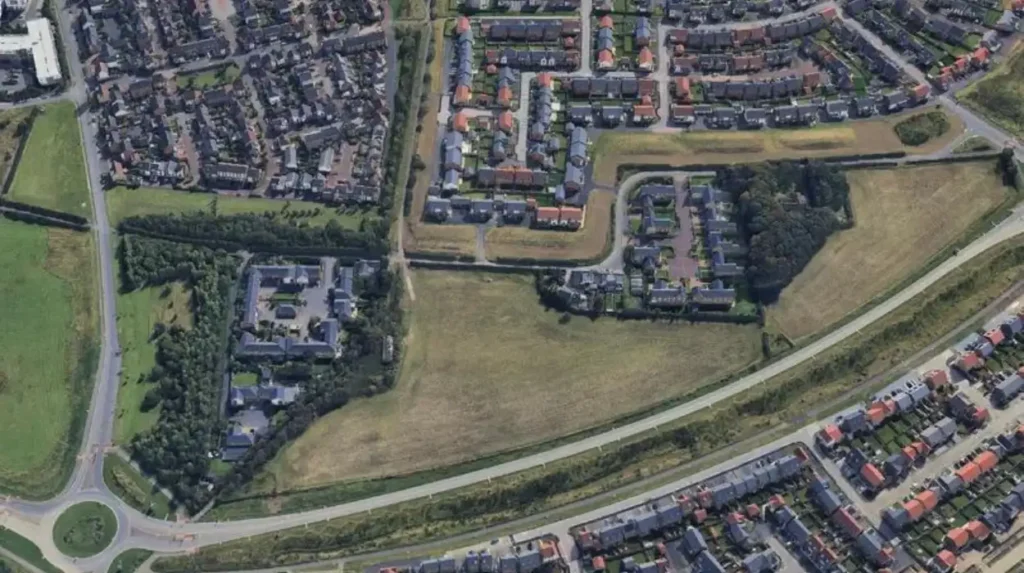
Modern Hazlerigg also sits alongside the major Newcastle Great Park development. Newcastle City Council’s character assessment identifies the former rural and Green Belt landscape as an area undergoing substantial urban change.
The expansion of housing creates a new relationship between historic village boundaries, former agricultural land and modern Newcastle.
This transition is important when studying the meaning of “quiet suburbs”. The quiet residential appearance of the villages is the result of industrial decline, landscape recovery and controlled suburban expansion rather than an absence of historical activity.
How have Hazlerigg and Brunswick changed from mining villages into Newcastle suburbs?
Hazlerigg and Brunswick now function primarily as residential communities while retaining mining-era street patterns, community buildings, archaeological sites and reclaimed landscapes that connect modern suburban life with the region’s industrial and agricultural history.
The present-day identity of the two villages reflects several historical layers.
Hazlerigg retains the compact character associated with its colliery origins while sitting immediately beside the expanding Newcastle Great Park area. Its administrative geography is also distinctive because the settlement is divided between Newcastle upon Tyne and North Tyneside.
Brunswick similarly crosses modern administrative boundaries and borders Hazlerigg, Dinnington and Wideopen.
This boundary arrangement reflects the complex historical geography of northern Newcastle. Modern local-government divisions do not correspond neatly with older industrial communities.
The transport relationship with Newcastle also remains important. Brunswick is served by bus connections linking the village with Wideopen, Gosforth and Newcastle. Hazlerigg’s location near the A1 places it close to major regional transport infrastructure.
The surrounding landscape continues to contain evidence of its industrial past. Former spoil heaps have become woodland, mining subsidence created Big Waters, and former industrial land has been reused for employment.
The modern landscape therefore does not erase the mining period. Instead, it incorporates elements of it into residential, recreational and ecological spaces.
For visitors interested in the area’s present-day landscape, local history can be combined with exploration of its open spaces. To experience the area’s historic and natural landmarks in person today, consult our comprehensive for itineraries and visiting parameters.
The archaeological heritage also gives Hazlerigg a wider historical significance. Its Iron Age and Romano-British remains demonstrate that the land was occupied long before the coal industry.
Brunswick’s surviving war memorial and St Cuthbert’s Church provide different forms of evidence. They document the social institutions and collective memory of a community created by nineteenth-century mining.
Why are Hazlerigg and Brunswick important for understanding Newcastle’s wider history?
Hazlerigg and Brunswick show how Newcastle’s northern fringe developed through successive agricultural, archaeological, industrial and suburban phases, making the villages useful case studies for understanding regional settlement, coal mining, community formation and landscape regeneration.
The history of these villages reflects wider changes across North East England.
The earliest archaeological evidence demonstrates prehistoric and Romano-British occupation. Later agricultural development established farms, fields and routes across the landscape. The nineteenth century introduced deep coal mining, industrial employment and planned workers’ housing.
The twentieth century brought nationalisation, continued coal production, two world wars, industrial decline and colliery closures. The late twentieth and early twenty-first centuries introduced land reclamation, environmental restoration and suburban development.
Each phase left physical evidence.
The archaeological enclosures at Hazlerigg preserve evidence of ancient settlement. Mining terraces preserve the architecture of industrial communities. St Cuthbert’s Church records the religious life of miners’ families. The Brunswick War Memorial records the effect of international conflict on local residents.
Former colliery land records another phase. Woodland, nature reserves, industrial estates and new housing occupy spaces previously dominated by extraction.
This layered landscape makes Hazlerigg and Brunswick important for heritage research. Archaeologists can investigate prehistoric settlement and industrial archaeology. Historians can examine coal ownership, labour and housing. Genealogists can use parish, census, electoral and mining records to trace families connected with the communities.
The villages also demonstrate how industrial heritage survives without complete industrial structures. A former mine site does not need its original shaft buildings to remain historically meaningful. Street layouts, terraces, memorials, landscape features and archival records can preserve the evidence of former communities.
For Newcastle, Hazlerigg and Brunswick represent the continuing relationship between the city and its northern fringe.
Their history extends from prehistoric settlement to modern suburban development. Their landscapes show the consequences of coal extraction and subsequent reclamation. Their buildings document the formation of mining communities. Their archaeological sites establish a chronology that predates Newcastle’s industrial expansion by many centuries.
The result is a distinctive historical landscape in which quiet residential streets exist alongside evidence of Iron Age settlement, Roman-period activity, nineteenth-century coal mining, twentieth-century industrial decline and twenty-first-century urban growth.
Hazlerigg and Brunswick are therefore not simply residential suburbs north of Newcastle. They are places where several periods of regional history remain visible within a relatively compact landscape.