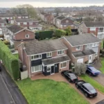
Chapel Park is a residential area in western Newcastle upon Tyne, positioned between Westerhope, Chapel House and North Walbottle. Today, commuting into Newcastle city centre is shaped by direct buses, road connections and the district’s post-war suburban development, while nearby Roman remains provide a much older historical context.
- How far is Chapel Park from Newcastle city centre?
- How long does the bus take from Chapel Park to Newcastle city centre?
- Which buses run from Chapel Park towards Newcastle city centre?
- What is the role of the 71 bus?
- What is the role of routes 62 and 63?
- Does route 74 serve Chapel Park?
- How long does it take to drive from Chapel Park to Newcastle city centre?
- Why did Chapel Park develop as a modern suburb rather than an historic town centre?
- What Roman history is connected with the Chapel Park and Chapel House area?
- What archaeological evidence has been found around Chapel Park?
- How did transport change the western Newcastle landscape?
- What historical places can commuters reach from Chapel Park?
- How has Chapel Park’s residential landscape changed over time?
- How should commuters choose between bus and driving?
- What makes Chapel Park historically important for Newcastle today?
- What should commuters know before travelling from Chapel Park?
How far is Chapel Park from Newcastle city centre?
Chapel Park is roughly 5 to 6 miles west of Newcastle city centre by road, with the exact distance depending on the starting street and destination. The area connects with central Newcastle through routes across Westerhope, Fenham, West Road and the western city corridor.
Chapel Park lies in the western part of Newcastle upon Tyne, close to the boundary between established residential neighbourhoods and the former rural landscape west of the city. The district includes streets around Greenway, North Walbottle Road and Chapel Park North.
The distance to Newcastle city centre is short enough for regular commuting but long enough for journey times to vary considerably according to the route, traffic conditions and final destination.
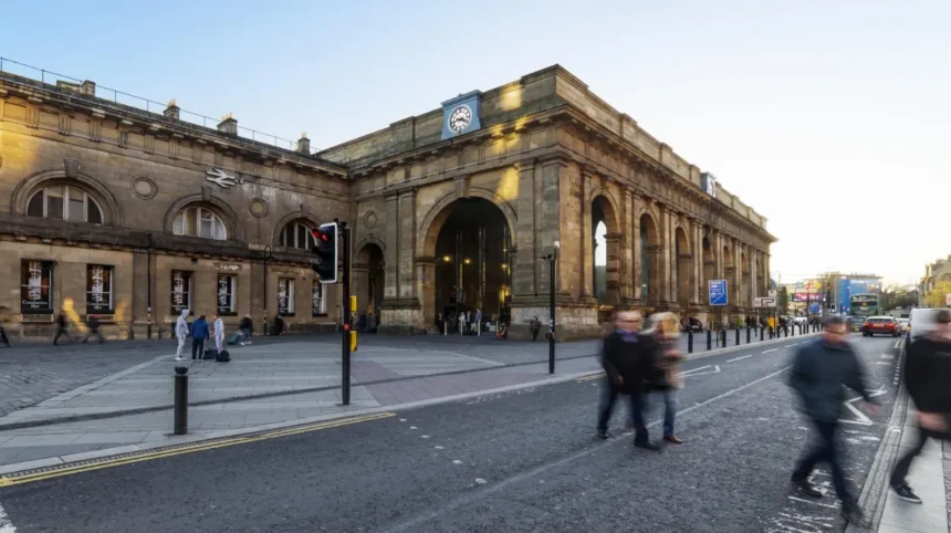
For practical purposes, commuters travelling towards Eldon Square, Monument, Northumberland Street, Newcastle Central Station or John Dobson Street should treat Chapel Park as a western suburban starting point rather than as a city-centre neighbourhood.
The road journey is generally longer than the straight-line distance because the local road network follows established residential streets and major arterial routes.
The location also explains the importance of bus services. Chapel Park does not have a Metro station within the neighbourhood itself, so buses provide the principal direct public transport connection with central Newcastle.
Current transport information shows several services operating through Chapel Park, including routes 62, 63, 71 and 74, while other services connect the district with surrounding neighbourhoods.
The commuting geography is therefore closely linked to the historical expansion of Newcastle westwards.
How long does the bus take from Chapel Park to Newcastle city centre?
A direct bus from Chapel Park to central Newcastle generally takes around 25 to 40 minutes, depending on the service, boarding point and destination. Route 71 provides a direct connection towards central Newcastle, while other routes serve different parts of the city.
The most important direct service for a city-centre commute is service 71, operated by Stagecoach North East.
Current timetable information shows route 71 running between Newcastle John Dobson Street and North Walbottle, passing through Chapel Park. At Chapel Park Greenway, scheduled eastbound departures include approximately 06:09, 07:06, 08:09, 09:17 and 10:17, with later services continuing through the day.
The service provides a particularly useful connection because John Dobson Street is located in central Newcastle, close to the city-centre shopping, business and cultural districts.
Journey time varies because buses stop at intermediate locations. A passenger travelling from Chapel Park Greenway therefore experiences a different journey from someone boarding farther west or travelling to a destination beyond John Dobson Street.
Other services also serve Chapel Park. Current transport listings identify routes 62 and 63 alongside route 71, with route 74 also connecting Chapel Park with Newcastle Eldon Square on its longer Hexham–Newcastle route.
The practical distinction is important.
A commuter should check the exact stop and destination rather than assuming that every bus serving Chapel Park has the same journey time. A route terminating at a different part of Newcastle can have a different stopping pattern and travel time.
The transport network also changes over time. Nexus maintains timetable information for registered services, while operators publish route and timetable updates.
For an evergreen guide, the most reliable approach is therefore to use approximate journey ranges while checking the operator’s current timetable before travelling.
Which buses run from Chapel Park towards Newcastle city centre?
Several bus services operate through Chapel Park, including routes 62, 63, 71 and 74. Route 71 provides a direct central Newcastle connection, while route 74 links the area with Eldon Square and continues towards Hexham.
The current bus network illustrates how Chapel Park functions as part of western Newcastle rather than as an isolated residential estate.
What is the role of the 71 bus?
Route 71 is the clearest direct city-centre connection from Chapel Park.
The service operates between Newcastle John Dobson Street and North Walbottle, with Chapel Park stops including North Walbottle Road-Marquis Avenue and several stops along Greenway. Current timetable data places the Chapel Park Greenway stop only a few minutes after North Walbottle Road on eastbound journeys.
The route provides regular access to central Newcastle throughout much of the day.
The frequency is not identical to a high-frequency Metro service. Current published timetable data shows scheduled departures from Chapel Park Greenway at roughly hourly intervals on route 71 during the daytime, with additional services at other points on the wider network.
What is the role of routes 62 and 63?
Routes 62 and 63 provide additional connections through Chapel Park, although their destinations differ from route 71.
Current information shows route 62 operating between Killingworth and Throckley, while route 63 operates between Killingworth Bus Station and Thistle Way. Both services serve Chapel Park Greenway.
These routes are important because they connect Chapel Park with other western and northern parts of Newcastle’s transport network.
They are not simply duplicate city-centre buses. Their route structures serve different travel purposes, including connections between suburban districts.
Does route 74 serve Chapel Park?
Route 74 also serves Chapel Park and provides a direct route towards Newcastle Eldon Square.
The service operates between Hexham Bus Station and Newcastle Eldon Square, passing through places including Chapel Park. Current operator-derived timetable information records Chapel Park among the towns and areas served by the route.
This makes route 74 particularly relevant for passengers whose final destination is around Eldon Square.
However, route 74 operates as a longer regional service. Its timetable and operating hours therefore differ from a local suburban route.
How long does it take to drive from Chapel Park to Newcastle city centre?
Driving from Chapel Park to Newcastle city centre normally takes around 20 to 30 minutes in lighter traffic, while weekday peak periods can take longer. The exact time depends on the destination, road conditions, congestion and chosen western approach.
The driving route is influenced by the structure of Newcastle’s western suburbs.
Chapel Park connects with major roads through Westerhope, North Walbottle and the western Newcastle corridor. Commuters then continue towards central Newcastle through routes serving areas such as Fenham, West Road and Benwell.
The road network has developed through several stages of urban expansion.
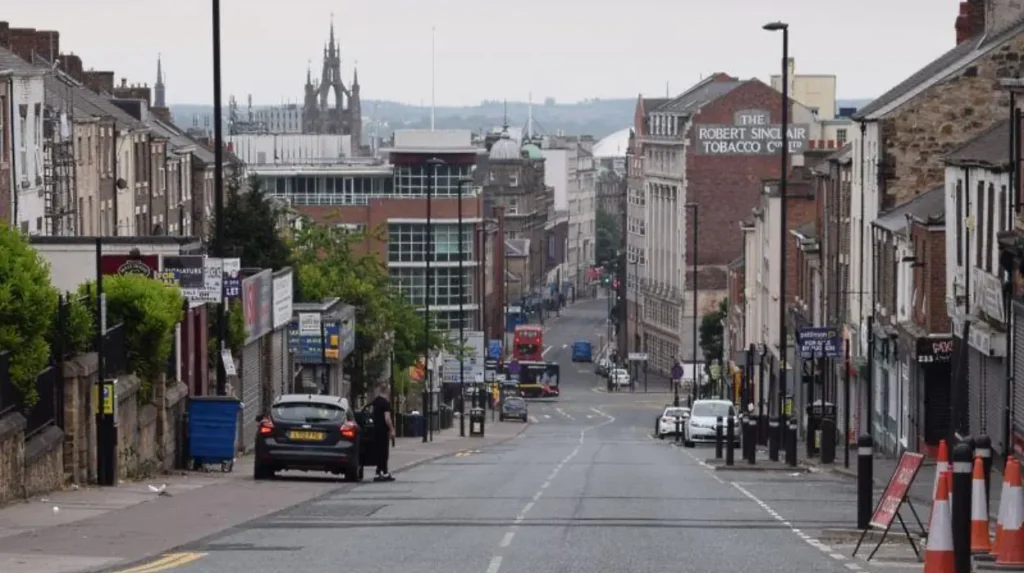
Newcastle’s historic core developed around the River Tyne and its medieval town, while industrial expansion pushed settlement into surrounding areas. During the twentieth century, large-scale residential development created suburban districts farther from the historic centre.
Chapel Park belongs largely to this later suburban landscape.
For motorists, the most important variable is congestion rather than distance. A five- or six-mile journey can produce substantially different travel times depending on when it is undertaken.
Morning commuter traffic concentrates around major approaches to central Newcastle. The same road can therefore produce a much longer journey at weekday peak times than during quieter periods.
Parking also affects the effective commuting time.
A driver travelling to an office near Newcastle Central Station must account for parking, walking and possible delays after leaving the main road. A passenger travelling to Eldon Square has a different final-mile requirement.
The drive should therefore be understood as a complete door-to-door journey rather than simply the time spent moving between Chapel Park and the city centre.
Why did Chapel Park develop as a modern suburb rather than an historic town centre?
Chapel Park developed as part of Newcastle’s twentieth-century suburban expansion rather than as an independent historic town. Its present residential character reflects planned housing growth, road infrastructure and the outward expansion of Newcastle into formerly agricultural landscapes.
The distinction between Chapel Park and older Newcastle districts is important for understanding the area’s character.
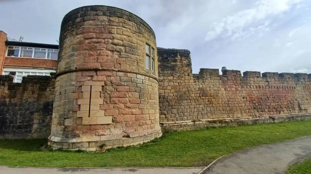
The historic city developed around Newcastle Castle, the medieval town walls, the River Tyne and major commercial streets. Western suburban districts expanded later as Newcastle’s population, industries and housing requirements increased.
Twentieth-century planning introduced new residential areas designed around family housing, roads, schools, shops and open spaces.
Chapel Park forms part of this suburban pattern.
The area should therefore not be interpreted through the same architectural chronology as medieval central Newcastle. Its history is primarily connected with modern urban planning and the transformation of land around older villages and rural settlements.
This process also altered commuting patterns.
Earlier settlements depended more heavily on walking, horse transport and local employment. Modern suburban residents could live several miles from the city centre because buses, roads and private cars provided practical connections.
Public transport consequently became part of the physical structure of suburban life.
The modern Chapel Park bus network is a continuation of that development process.
What Roman history is connected with the Chapel Park and Chapel House area?
The wider Chapel House and Chapel Park landscape contains important Roman evidence associated with Hadrian’s Wall. Milecastle 9 was located at Chapel House, excavated in 1929, and occupied during several Roman periods between the second and fourth centuries.
The area’s historical depth extends far beyond twentieth-century housing.
The most important archaeological feature is Milecastle 9, associated with Hadrian’s Wall at Chapel House.
Hadrian’s Wall was a Roman frontier system constructed during the reign of Emperor Hadrian in the second century AD. It crossed northern Britain from the Tyne to the Solway coast and controlled movement along the frontier.
Newcastle City Council’s Historic Environment Record identifies Milecastle 9 at Chapel House as a Roman frontier-defence site.
The milecastle was definitively located in 1928 by the North of England Excavation Committee.
Excavation followed in 1929, when archaeologist Eric Birley investigated the southern two-thirds of the structure. The remainder lay beneath the road, while the north gate was recorded in 1951.
The structure measured approximately 60 feet north-south by 48 feet 10 inches east-west internally.
Archaeological interpretation identified three broad occupation phases, associated with the second, third and fourth centuries.
A coin of Emperor Valentinian, who ruled from 364 to 375 AD, provides evidence supporting continued occupation while Hadrian’s Wall remained in use.
This Roman history is important for commuters because it demonstrates that today’s suburban landscape sits directly within a much older transport and military corridor.
The Roman road system connected forts, milecastles and settlements along the frontier.
Modern roads do not reproduce the Roman system exactly, but the survival of archaeological features demonstrates the long-term strategic importance of movement through the Newcastle area.
What archaeological evidence has been found around Chapel Park?
Archaeological records demonstrate that the Chapel Park landscape contains evidence from several historical periods, including prehistoric material and Roman frontier remains. A Bronze Age tanged and barbed arrowhead is recorded from Chapel Park alongside the Roman evidence at Chapel House.
The Tyne and Wear Historic Environment Record contains a specific entry for a tanged and barbed arrowhead from Chapel Park.
The artefact is classified as Bronze Age, placing it broadly within a prehistoric period that predates Roman occupation by many centuries.
This archaeological evidence changes the interpretation of the area.
Chapel Park is not historically significant only because of its modern housing. The landscape has produced evidence of human activity extending from prehistoric times through the Roman period and into later agricultural settlement.
The archaeological sequence includes different types of evidence.
The Bronze Age arrowhead represents portable material culture.
Milecastle 9 represents military architecture.
Later buildings and field patterns represent post-medieval and modern land use.
These discoveries demonstrate how the same geographical area can serve different purposes across time.
For educators and students, this provides a useful local example of archaeological stratification: material evidence from different periods can survive within one modern urban landscape.
How did transport change the western Newcastle landscape?
Transport changed western Newcastle by allowing residential development to spread beyond the historic centre. Roads and bus services connected new housing districts with employment, education and commerce, making longer-distance daily commuting practical during twentieth-century suburban expansion.
Transport infrastructure was fundamental to modern suburbanisation.
Before widespread motor transport, residential areas needed strong connections with nearby workplaces. Industrial Newcastle provided employment, but workers’ homes remained closely tied to established communities.
The growth of buses and road transport altered that relationship.
A resident could increasingly live farther from the city centre while maintaining access to employment and services.
The development of western residential districts therefore involved more than house construction. It required roads, bus routes, schools, shopping facilities and public services.
Chapel Park reflects this integrated planning model.
The modern bus network continues the same basic function.
Route 71 connects Chapel Park directly with central Newcastle, while routes 62 and 63 connect the neighbourhood with wider suburban destinations. Route 74 provides a longer-distance connection towards Eldon Square and Hexham.
This network illustrates the continuing importance of public transport in a district without a local Metro station.
The commuting pattern also explains why route changes matter to residents.
Changes in housing, employment, road layouts and population distribution influence where buses operate and how frequently services run.
What historical places can commuters reach from Chapel Park?
Commuters from Chapel Park can reach Newcastle’s historic core and cultural landmarks after travelling into the city centre. Important destinations include Newcastle Castle, the medieval streets around the Quayside, Central Station and surviving historic buildings across the city centre.
The journey from Chapel Park provides access to a concentration of historic sites.
Newcastle Castle represents the medieval defensive history of the city. The surviving castle complex occupies the site of Newcastle’s medieval stronghold and forms part of the city’s historic core.
The Quayside provides evidence of Newcastle’s commercial relationship with the River Tyne.
Newcastle Central Station represents nineteenth-century railway development and the transformation of long-distance transport during the Industrial Revolution.
The city centre also contains surviving streets, churches, bridges and civic buildings that reflect later phases of Newcastle’s development.
The relationship between Chapel Park and these places is therefore more than a simple commuting connection.
The bus journey moves from a modern western suburb into a historic urban core shaped by Roman, medieval, industrial and modern transport systems.
To experience this historic landscape in person today, consult our comprehensive for itineraries and visiting parameters.
How has Chapel Park’s residential landscape changed over time?
Chapel Park’s residential landscape reflects modern Newcastle’s continued housing expansion, with planning applications demonstrating ongoing changes to homes, schools, access arrangements and infrastructure. The neighbourhood therefore remains part of an evolving urban landscape rather than a fixed historic estate.
Modern planning records demonstrate continuing development around Chapel Park.
Newcastle City Council planning documentation records residential and infrastructure proposals associated with Chapel Park, including housing, access, parking, landscaping and school-related works.
The records show that suburban development continues through individual housing schemes and institutional changes rather than through one single construction period.
This distinction is useful when interpreting the neighbourhood.
The original development established a broad residential framework. Later planning decisions adjust individual plots, community facilities, school accommodation and infrastructure.
The result is a layered twentieth- and twenty-first-century suburb.
Modern additions do not erase the area’s earlier history. Instead, they occupy a landscape that already contains archaeological evidence from the Bronze Age and Roman periods.
This creates a direct relationship between heritage management and modern planning.
Archaeological records identify known historic assets, while planning processes assess the effects of proposed development.
That system helps preserve information about historic sites even where visible structures no longer survive.
How should commuters choose between bus and driving?
Bus travel provides a direct alternative to driving for Chapel Park residents travelling into central Newcastle, while driving provides greater flexibility for destinations beyond the main bus corridors. Journey time, service frequency, parking and final destination determine which method suits each journey.
Bus travel is particularly useful for passengers whose destinations lie close to central stops.
Route 71 connects Chapel Park with John Dobson Street, while route 74 provides access to Eldon Square.
The principal advantage of the bus is that passengers do not need to find city-centre parking.
Driving offers greater flexibility for journeys involving several destinations, equipment, irregular working hours or locations away from major bus corridors.
However, the effective driving time includes parking and walking.
The bus journey includes walking to the stop and waiting time.
For this reason, comparing a bus timetable with a nominal driving distance does not provide a complete comparison.
A commuter should calculate:
walking time from home to the bus stop, waiting time, scheduled journey time, walking time from the final stop to work and the return journey.
For drivers, the equivalent calculation includes road travel, congestion, parking and walking from the parking location.
These factors are especially relevant during weekday peak periods.
What makes Chapel Park historically important for Newcastle today?
Chapel Park demonstrates how modern suburban Newcastle overlaps with a much older archaeological landscape. Its transport links connect residents with the historic city centre, while nearby prehistoric and Roman evidence records human activity across more than two thousand years.
The area’s historical significance comes from this combination of layers.
The modern suburb represents twentieth-century urban expansion.
The bus network represents contemporary mobility.
The surrounding archaeological record preserves evidence from prehistoric and Roman periods.
Milecastle 9 provides the strongest documented Roman connection. Its excavation history, dimensions and occupation evidence are recorded by Newcastle’s Historic Environment Record.
The Bronze Age arrowhead adds an earlier archaeological dimension.
The modern transport network adds another historical layer.
Route 71 currently connects Chapel Park with John Dobson Street, while other services provide connections across the western and northern parts of Newcastle.
This means that a routine commute crosses a landscape shaped by successive systems of movement.
Roman soldiers travelled along frontier roads.
Later agricultural communities used local lanes and tracks.
Industrial Newcastle depended on expanding transport infrastructure.
Twentieth-century residents depended increasingly on buses and roads.
Today’s commuters continue that pattern through a modern suburban transport network.
Chapel Park is therefore best understood as part of Newcastle’s wider historical geography rather than as a neighbourhood isolated from the city’s past.
What should commuters know before travelling from Chapel Park?
Chapel Park commuters should check the current operator timetable, exact stop and destination before travelling because bus routes and schedules change. Route 71 offers a direct central connection, while routes 62, 63 and 74 provide additional network options.
Transport information is time-sensitive.
Current records show route 71 serving Chapel Park and travelling towards Newcastle John Dobson Street, while current route listings identify routes 62, 63 and 74 among services serving the wider Chapel Park area.
A commuter should therefore confirm the following before departure:
The exact Chapel Park stop is important because different stops have different departure times.
The direction of travel is essential because eastbound and westbound services follow different destinations.
The final city-centre destination matters because John Dobson Street and Eldon Square are not the same location.
The date also matters because operators periodically revise timetables.
For driving, road congestion and parking conditions create similar variability.
The most useful evergreen conclusion is therefore not one fixed journey time. It is an understanding of the transport geography.
Chapel Park sits approximately 5 to 6 miles west of central Newcastle by road. Direct buses generally provide a roughly 25-to-40-minute connection depending on the service and destination, while driving commonly takes around 20 to 30 minutes outside heavier congestion.
Those figures provide a practical planning range rather than a guaranteed timetable.
The deeper history adds another dimension. Chapel Park belongs to a modern residential landscape built around contemporary transport needs, but its surrounding archaeological record reaches back to the Bronze Age and Roman frontier. Milecastle 9 at Chapel House, excavated in 1929 and associated with occupation during the second, third and fourth centuries, provides the clearest surviving evidence of that ancient landscape.
For Newcastle Times readers, the journey from Chapel Park to the city centre therefore connects two distinct urban landscapes: a twentieth-century western suburb and a historic city whose development spans Roman frontier infrastructure, medieval Newcastle, industrial expansion and modern urban transport.