Blakelaw is a residential area in the north-west of Newcastle upon Tyne, with roots in farming, coal extraction and Second World War defence infrastructure. Its modern identity developed around planned housing, schools, community facilities, green space and connections to neighbouring districts. The area is also part of the wider NE5 property market, where recent sold-price data provides a useful guide to housing costs.
- What is Blakelaw and where is it in Newcastle?
- How did Blakelaw develop before modern housing?
- When did Blakelaw become an important twentieth-century settlement?
- What historic structures and archaeological remains survive in Blakelaw?
- What are house prices like in Blakelaw?
- How has Blakelaw’s housing stock changed over time?
- What is crime like in Blakelaw?
- What amenities are available in Blakelaw?
- Which schools serve Blakelaw?
- How well connected is Blakelaw to Newcastle and nearby areas?
- How does Blakelaw’s history affect life in the area today?
- What should people know before researching or moving to Blakelaw?
What is Blakelaw and where is it in Newcastle?
Blakelaw is a residential district and electoral area in Newcastle upon Tyne, positioned in the north-west of the city around Ponteland Road, Silver Lonnen and neighbouring Kenton, Fawdon and Cowgate. Its identity combines twentieth-century housing with older agricultural, mining and wartime remains.
Blakelaw forms part of Newcastle upon Tyne, the metropolitan district administered by Newcastle City Council. The area uses NE5 postcodes and sits within the western and north-western urban part of Newcastle.
The administrative geography has changed over time. Newcastle City Council’s current ward structure includes Blakelaw among the city’s electoral wards, while the Office for National Statistics separately identifies Blakelaw as a statistical area.
The area should not be confused with the broader NE5 postcode district. NE5 includes several communities, so property statistics for the whole postcode do not represent every Blakelaw street.
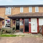
Blakelaw’s modern housing landscape includes terraced houses, semi-detached houses, flats and newer residential development. This mix reflects several stages of urban growth rather than a single planned construction period.
The area also sits close to major roads serving Newcastle’s western and northern suburbs. Ponteland Road provides an important transport corridor, while neighbouring districts include Kenton, Fawdon, Cowgate, Westerhope and Fenham.
This location gives Blakelaw a distinctly suburban character while keeping it connected to Newcastle’s wider urban economy.
How did Blakelaw develop before modern housing?
Before becoming a residential suburb, Blakelaw was a rural and industrial landscape containing a farm, coal workings, a smithy, cottages and a quarry. Historic mapping and archaeological records show that these earlier activities existed before the twentieth-century housing landscape transformed the area.
Newcastle’s Tyne and Wear Historic Environment Record provides direct evidence for the earlier landscape.
The site known as Blakelaw is recorded as a post-medieval farm. It appears on the first edition Ordnance Survey map, with the historic farm location later becoming a school field. The record identifies documentary evidence dating from the Victorian period.
The industrial history is equally important.
The Historic Environment Record identifies Blakelaw Pit as a former colliery and separately records a Blakelaw coal shaft. Another recorded shaft was described as an old working on the nineteenth-century Ordnance Survey mapping, indicating that it had probably ceased operation before the later nineteenth-century survey period.
Blakelaw also contained a smithy and cottages. A smithy was a workshop where a blacksmith produced and repaired metal goods, including agricultural and transport equipment. Its presence reflects the area’s connection with rural settlement and local industry.
A quarry also formed part of the historic landscape. These features demonstrate that modern Blakelaw was built over a landscape that previously supported agriculture, mineral extraction and small-scale trades.
For genealogical research, this distinction matters. A family described as living at Blakelaw in a nineteenth-century source was not necessarily living within the modern residential district. Historical boundaries, addresses and land uses changed substantially during the twentieth century.
When did Blakelaw become an important twentieth-century settlement?
Blakelaw’s twentieth-century significance developed through residential expansion and wartime defence infrastructure. Housing transformed the former rural and industrial landscape, while the Second World War brought military command facilities associated with RAF Blakelaw and No. 13 Group Fighter Command.
The Second World War created one of the area’s most important historical layers.
Historic England records a military headquarters complex at Kenton Bar associated with RAF Newcastle and RAF Blakelaw. Construction began in 1939, with the complex serving as the wartime headquarters of No. 13 Group Royal Air Force Fighter Command from 1940.
No. 13 Group was responsible for air defence over northern England and Scotland during the early wartime period. The command system formed part of the wider Fighter Command network used to coordinate aircraft, radar information and operations.
The associated filter room at Blakelaw Quarry performed an important information-processing function. Information from radar and other observation systems was assessed before being passed to operational command centres and fighter stations.
This infrastructure demonstrates that Blakelaw’s wartime importance extended beyond ordinary residential geography.
After the war, the former RAF facilities acquired a civilian role. The former filter room was converted into Newcastle County Borough’s main Civil Defence Control Centre in 1952. It remained associated with civil defence until 1968.
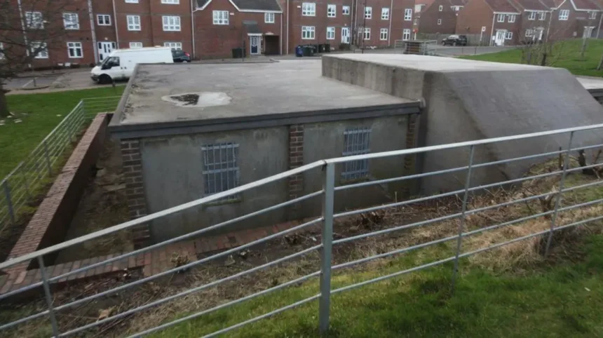
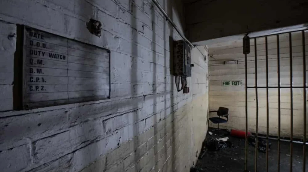
The surviving bunker at Kenton Bar is now a listed historic structure. Historic England identifies it as a Grade II underground operations room built in 1939 from reinforced concrete and brick.
This wartime infrastructure gives Blakelaw a direct connection to the military history of Newcastle and the wider North-East.
What historic structures and archaeological remains survive in Blakelaw?
Blakelaw’s surviving heritage includes recorded coal workings, historic agricultural sites and Second World War military infrastructure. The strongest documented physical heritage connection is the former RAF command system, including the Grade II-listed Kenton bunker and the former Blakelaw filter-room site.
The Historic Environment Record is particularly useful for identifying features that are no longer visually obvious.
The Blakelaw farm site illustrates how modern construction can conceal earlier land use. The historic farm was recorded cartographically, and the location is now associated with a school field.
Coal mining left another layer beneath the modern neighbourhood. The records identify Blakelaw Pit, a coal shaft and other industrial features. Such records are important because former mining landscapes often disappear physically after redevelopment while remaining documented in archaeological databases.
The Second World War bunker provides a more substantial surviving structure.
Historic England’s record describes the Kenton bunker as an underground operations room with surviving original features including ventilation equipment, air-pressure gauges, electrical fittings and anti-gas filtration equipment.
The bunker therefore has value not only as a military building but also as evidence of twentieth-century command technology.
Blakelaw’s heritage should consequently be understood as layered rather than concentrated in one historic street or building. Agriculture, coal mining, wartime defence and post-war housing each contributed to the area’s physical development.
What are house prices like in Blakelaw?
Recent sold-price data places Blakelaw’s overall average house price at about £149,455 for the latest year reported by Rightmove, with terraced homes averaging £145,096, semi-detached homes £169,723 and flats £92,500.
Property prices vary considerably according to street, property type, condition, tenure and exact postcode.
Rightmove’s Blakelaw sold-price page, based on HM Land Registry transaction data, reports an overall average of £149,455 over the last year. Terraced properties accounted for most recorded sales, averaging £145,096. Semi-detached properties averaged £169,723, while flats averaged £92,500.
The same dataset states that the overall historical sold-price level was similar to the preceding year and 3% below the 2022 peak of £154,169.
Individual transactions show the range within the area. Recent recorded examples include a terraced property on Craigmillar Avenue selling for £150,000 in May 2026, a semi-detached property on Lilac Crescent selling for £202,450 in April 2026, and a flat on Foxglove Walk selling for £105,000 in May 2026.
These figures are sold prices rather than asking prices. That distinction is important when researching the Blakelaw housing market.
Postcode-level data also shows variation. The NE5 3 sector had a median sold price of £146,800 in 2026 from 30 registered sales, according to a market report built from HM Land Registry records.
The broader NE5 district had a higher 2026 median of £179,200 across 256 registered sales, demonstrating why postcode-wide figures should not automatically be treated as Blakelaw-specific figures.
How has Blakelaw’s housing stock changed over time?
Blakelaw’s housing stock has evolved from established twentieth-century residential streets into a mixed market containing older terraces, semi-detached houses, flats and newer homes. New construction has added accessible housing while retaining established neighbourhood infrastructure.
The age and design of homes reflect different phases of Newcastle’s suburban expansion.
Older properties form much of the established residential landscape. Their layouts, gardens, road patterns and construction materials reflect the planning standards of the period in which the neighbourhood expanded.
Later development added different forms of housing. Newcastle City Council reported the completion of 14 accessible homes at Wansfell Avenue in 2021, consisting of 10 two-bedroom bungalows and four two-bedroom Tyneside flats.
The project was designed for older residents who did not require sheltered accommodation but wanted housing with additional management and support arrangements. The homes were managed by Your Homes Newcastle as part of the Housing Plus – Community service.
Planning records also document residential expansion around Blakelaw Road and the Springfield Centre. A Newcastle housing-land report identified a 7.9-hectare site with an estimated capacity of 308 homes, with 280 homes recorded as complete and 28 outstanding in the report’s development schedule.
These developments show how Blakelaw continues to evolve rather than remaining a fixed post-war estate.
What is crime like in Blakelaw?
Crime statistics for Blakelaw are published within the combined Blakelaw, Kenton and Fawdon policing area. In July 2026, the most commonly reported categories were violence and sexual offences, anti-social behaviour, criminal damage and arson, and public order offences.
Crime figures require careful geographic interpretation.
Northumbria Police currently groups Blakelaw with Kenton and Fawdon for its local policing profile. The published figures therefore do not represent Blakelaw alone.
For July 2026, the policing profile recorded 75 violence and sexual offences, 50 anti-social behaviour offences, 29 criminal damage and arson offences, and 25 public order offences in the combined area.
The same police profile records monthly totals for the preceding year. August 2025 recorded 312 offences, September 317, October 294, November 230 and December 271. January 2026 recorded 88, followed by 177 in February, 204 in March, 249 in April, 262 in May, 234 in June and 244 in July.
Those figures should not be converted into a simple Blakelaw crime rate because the police boundary includes neighbouring communities.
Anti-social behaviour is also a distinct category from serious violence. It includes incidents such as nuisance behaviour, harassment, disorder and other conduct affecting community life.
Newcastle City Council also lists Blakelaw within its No Cold Calling Zone locations. Such zones are designed to discourage unsolicited doorstep sales and related approaches.
For anyone assessing crime, the most useful approach is to examine current Northumbria Police data for the precise policing area and consider the type, frequency and location of reported incidents rather than relying on a single headline number.
What amenities are available in Blakelaw?
Blakelaw has community, sports, library, education and green-space facilities, with Blakelaw Centre and Blakelaw Park providing important neighbourhood services. Nearby districts add further schools, libraries, retail facilities, healthcare services and transport connections.
Community infrastructure is central to the area’s modern identity.
Newcastle City Council lists Blakelaw Centre on Binswood Avenue, NE5 3PN, among the city’s community buildings. The council states that community centres provide activities and services ranging from children’s programmes to exercise sessions.
Blakelaw Library operates from Leisure United Blakelaw on Cragstone Avenue. The current service is a pop-up library with a small selection of books, family activities, Universal Credit support and heritage-related resources.
The library currently provides term-time Under 5 Storytime sessions and other activities. Newcastle City Council also describes the library as autism-friendly.
Sports provision expanded significantly through investment in Blakelaw Park.
Newcastle City Council reported a project involving two new small-sided 3G football pitches, a multi-use games area, replacement of an existing full-size 3G pitch, a two-storey pavilion, changing rooms, a community café, education room, fitness suite, additional parking and a children’s play area.
The improved facility also provides a training base for Blakelaw Juniors and Montagu & Fenham Juniors.
These facilities give the neighbourhood a combination of formal services and recreational infrastructure.
For visitors researching the area’s wider attractions and surrounding Newcastle districts, consult our comprehensive [Insert Anchor Text for Things to Do Article Here] for itineraries and visiting parameters.
Which schools serve Blakelaw?
Blakelaw has established primary education provision, including Thomas Walling Primary Academy, while other schools in neighbouring districts provide additional primary and secondary options. School boundaries and admissions arrangements should be checked directly with the relevant school and Newcastle City Council.
Thomas Walling Primary Academy is located on Lindfield Avenue, Blakelaw, Newcastle upon Tyne, NE5 3PL. The Department for Education identifies it as an academy converter serving children from age two to 11.
The school’s predecessor establishment was Thomas Walling Primary School, with the successor academy relationship recorded by the Department for Education.
Blakelaw also has an educational history that reaches beyond current schools.
Blakelaw School was formerly a mixed community secondary school on Firfield Road. The Department for Education records that it served pupils aged 11 to 18 and closed on 1 September 1998.
The closure forms part of the wider restructuring of secondary education in Newcastle during the late twentieth century.
For families researching current education, school performance data and admissions criteria need to be checked using current official records. Historical school status does not describe present-day provision.
How well connected is Blakelaw to Newcastle and nearby areas?
Blakelaw is connected to Newcastle and surrounding suburbs through local bus services and major road corridors. The nearest Metro station listed by Newcastle City Council for Blakelaw Library is Kingston Park, while Blaydon is identified as the nearest National Rail station.
The area’s transport geography reflects its suburban position.
Newcastle City Council states that a bus stop is within 150 metres of Blakelaw Library at Leisure United Blakelaw. The council identifies Kingston Park as the nearest Metro station and Blaydon as the nearest National Rail station for that venue.
This means Blakelaw does not have its own Metro station within the neighbourhood.
Road connections remain important because residential streets feed into larger routes linking the district with Newcastle’s western and northern suburbs.
The transport pattern also explains the area’s relationship with neighbouring communities. Residents use services and employment centres beyond Blakelaw itself, while surrounding districts provide additional retail, education, leisure and transport facilities.
For historical research, this connectivity also helps explain why the twentieth-century expansion of Blakelaw formed part of a wider process of suburban growth across Newcastle.
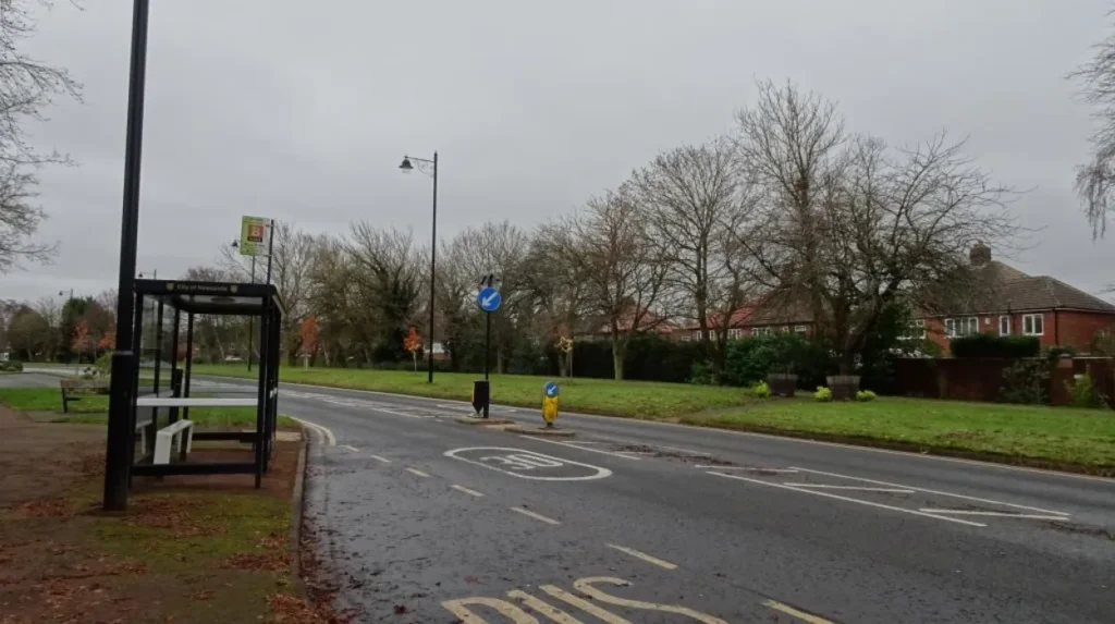
How does Blakelaw’s history affect life in the area today?
Blakelaw’s present character reflects successive layers of agricultural land use, coal extraction, wartime defence, planned housing, community infrastructure and modern redevelopment. Historic records remain important because several earlier land uses survive only through maps, archaeological records and protected structures.
The most visible influence is the housing landscape.
Residential streets occupy land that once supported farming and mining. The historic Blakelaw farm, coal workings, smithy and quarry demonstrate that the neighbourhood existed as a working landscape before modern suburban development.
The Second World War added another layer.
The RAF command facilities demonstrate how Newcastle’s strategic position influenced the physical geography of Blakelaw and Kenton. The surviving Grade II-listed bunker provides a tangible connection with Britain’s wartime air-defence system.
The post-war period then shifted the area’s primary function toward residential life.
Schools, community centres, sports facilities and housing created the infrastructure required for a permanent suburban population. More recent housing programmes have added accessible homes and modern facilities rather than simply extending the historical housing stock.
For historians and genealogists, the area demonstrates why local history requires more than a modern map. A present-day street can occupy land that previously carried a farm, mine, quarry or military facility.
What should people know before researching or moving to Blakelaw?
Anyone researching or considering Blakelaw should separate current housing, crime and amenities data from historical records. Property prices vary by postcode and property type, crime figures cover a wider police area, and local facilities continue to change through housing and community investment.
Property research should begin with completed transactions rather than asking prices. Recent HM Land Registry-derived figures show meaningful differences between terraces, semi-detached homes and flats.
Crime research requires equal care. The current Northumbria Police profile combines Blakelaw, Kenton and Fawdon, so its figures cannot be treated as a Blakelaw-only crime rate.
Amenities should also be considered geographically. Blakelaw has its own community centre, library and sports facilities, while nearby districts provide additional services.
Historical research benefits from the Tyne and Wear Historic Environment Record. Its entries preserve evidence for the former farm, coal workings, smithy and other archaeological features.
The wartime record provides another research route. Historic England’s documentation of the Kenton bunker establishes the significance of the former RAF Blakelaw defence complex and its surviving fabric.
Blakelaw therefore has two complementary identities: a modern residential community and a landscape containing documented evidence of earlier agricultural, industrial and military activity.
Its housing market provides current evidence of how the neighbourhood functions as part of Newcastle’s suburban property system. Its schools, sports facilities, library and community centre demonstrate the infrastructure supporting everyday life. Its archaeological and military records preserve the historical layers beneath that modern landscape.
For Newcastle historians, students and genealogical researchers, these overlapping records provide a framework for understanding how Blakelaw changed from a rural and industrial setting into an established urban neighbourhood.