Cowgate is a residential locality in north-west Newcastle upon Tyne with roots in the city’s twentieth-century housing expansion. Its present character is closely connected to council-house development, road infrastructure, community facilities and its position between established west Newcastle neighbourhoods and the wider north-west urban area.
- What exactly is Cowgate in Newcastle upon Tyne?
- How did Cowgate develop from farmland into a residential area?
- When was the Cowgate estate built?
- What historical changes shaped Cowgate during the twentieth century?
- How does Cowgate’s history affect its architecture today?
- Is Cowgate well connected to the rest of Newcastle?
- What is Cowgate like for housing today?
- What is everyday life like in Cowgate?
- How close is Cowgate to Newcastle city centre?
- What historical sites are close to Cowgate?
- What role does Cowgate play in Newcastle’s housing history?
- How has Cowgate changed since the inter-war period?
- Is Cowgate important for local and family history research?
- What does Cowgate tell us about Newcastle’s wider urban history?
- What should someone consider before choosing Cowgate as a place to live?
- What is the long-term historical significance of Cowgate?
For residents, Cowgate is primarily a practical residential district rather than a historic visitor destination. Its importance to Newcastle’s history comes from the transformation of former agricultural land into planned housing during the inter-war period and from the wider development of Newcastle’s west and north-west suburbs.
The name also has a much older Newcastle connection. Newcastle’s Historic Environment Record identifies a medieval Cowgate street first recorded in 1272–73, but that historic street was in the medieval town centre and should not be confused with the modern Cowgate locality in north-west Newcastle. The distinction is important when researching local history, genealogy and historical maps.
Today, Cowgate forms part of the Blakelaw and Cowgate area of Newcastle City Council. The locality is strongly associated with residential streets, public transport connections, schools, everyday retail services and major road infrastructure. Its history explains much of the built environment visible today.
What exactly is Cowgate in Newcastle upon Tyne?
Cowgate is a north-west Newcastle residential locality shaped mainly by twentieth-century housing development, especially council housing. It sits outside the historic medieval core and has a different history from Newcastle’s medieval Cowgate street recorded from 1272–73.
Modern Cowgate lies approximately 3 miles north-west of Newcastle city centre. It forms part of the built-up western and north-western side of the city and sits within a landscape transformed substantially during the twentieth century.
The locality developed as Newcastle expanded beyond its older urban core. Industrialisation increased demand for housing, while twentieth-century public-health reforms and housing policies encouraged local authorities to provide planned residential neighbourhoods.
The modern area is therefore best understood through the history of urban expansion. Its streets are predominantly associated with twentieth-century residential development rather than medieval buildings or Victorian commercial streets.
This distinction is particularly important for researchers. Newcastle has more than one historical reference to Cowgate. The medieval Cowgate described in the Tyne and Wear Historic Environment Record ran from Pilgrim Street towards Pandon Dene. It was first documented in 1272–73 and was later associated with the names Austin Chare and Manor Chare.
The present Cowgate locality is a separate geographical entity. Its identity developed much later as Newcastle’s population expanded into areas that had previously contained farmland, estates and open land.
The locality therefore represents an important stage in the city’s transition from a compact industrial town into a much larger twentieth-century urban area.
How did Cowgate develop from farmland into a residential area?
Cowgate changed substantially during the twentieth century as Newcastle expanded housing beyond its older urban districts. Inter-war council-house construction transformed previously less-developed land into a planned residential environment connected to the wider west and north-west Newcastle suburbs.
Newcastle’s north-western outskirts experienced major physical change during the first half of the twentieth century. Newcastle City Council’s character assessment records the transformation of the wider north-west zone from a predominantly rural landscape containing farms, villages and former industrial sites into a built-up urban area.
Housing policy was an important part of this transformation.
The Housing Act 1919, commonly known as the Addison Act, made housing a national responsibility and encouraged local authorities to construct large numbers of new homes. Newcastle was among the cities that expanded council housing during this period.
The first phase of Newcastle’s post-1919 council housing included the Pendower Estate in the west of the city. The council purchased the 60-acre Pendower estate in 1919 for £37,500. Around 45 acres were intended for housing, while other land was allocated for education and community purposes.
Pendower illustrates the planning principles used across Newcastle during this period. Houses were arranged at lower densities than many older urban districts, with gardens and wider streets forming part of the design.
Cowgate subsequently became part of this broader north-west housing expansion.
The development of council estates was not simply a response to population growth. It was also connected to concerns about overcrowding, sanitation, housing quality and public health.
Older industrial neighbourhoods often contained tightly packed housing with limited gardens and poor sanitation. Inter-war housing schemes introduced different standards, including greater separation between buildings, access to open space and improved domestic facilities.
Cowgate’s present residential character reflects this wider planning history.
When was the Cowgate estate built?
The modern Cowgate estate was principally developed during the 1920s as part of Newcastle’s expansion of planned housing. Its development belongs to the wider inter-war period when Newcastle built council estates across areas that had previously remained comparatively rural.
The 1920s were a major period of council-house construction in Newcastle.
National housing legislation created financial support for local authorities, while local demand for better-quality housing remained high after the First World War. Newcastle expanded its housing programme through planned estates rather than relying entirely on the dense urban form of older districts.
The Cowgate estate belongs to this wider phase of development.
The physical appearance of inter-war housing is significant. Many houses from this period were designed as low-rise family homes with front gardens, rear gardens, roads and pedestrian spaces. This approach differed from the dense terraces found in older parts of Newcastle.
The wider city also experienced substantial post-war housing development. Areas including Kenton, Fenham, Blakelaw and other north-west districts expanded as Newcastle’s population and housing requirements changed.
This produced a large continuous urban area where earlier boundaries between farms, estates and villages became less visible.
The history of Cowgate therefore cannot be separated from the development of north-west Newcastle as a whole.
What historical changes shaped Cowgate during the twentieth century?
Cowgate was shaped by inter-war council housing, post-war urban expansion, changing housing policy, transport investment and redevelopment. These processes converted a formerly less-developed landscape into a permanent residential district within Newcastle’s expanding urban area.
The first major change was housing construction during the inter-war period.
The second was continued urban growth after the Second World War. Newcastle required additional homes as wartime damage, population growth and housing shortages created pressure on existing neighbourhoods.
The third was changing housing policy. Council housing remained an important part of Newcastle’s housing system, but policies introduced from the 1980s altered the balance between council-owned, privately owned and privately rented homes.
The Right to Buy policy introduced under the Housing Act 1980 allowed qualifying council tenants to purchase their homes. This changed the ownership structure of many established council estates across Britain.
Newcastle also created Your Homes Newcastle in 2004 as an organisation responsible for managing council housing on behalf of the city council.
These changes mean that an area originally planned largely around council housing is not necessarily composed entirely of council-owned homes today.
The fourth major factor was transport.
Cowgate became increasingly connected to major routes serving the north-west of Newcastle. Road infrastructure now plays a major role in defining the area’s relationship with other parts of the city.
This combination of housing and transport explains why Cowgate has retained a strongly residential identity while remaining closely connected to the wider Newcastle urban area.
How does Cowgate’s history affect its architecture today?
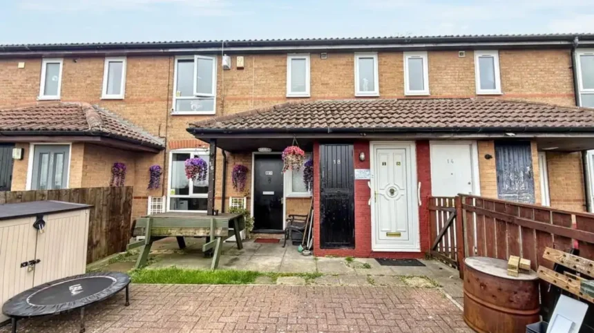
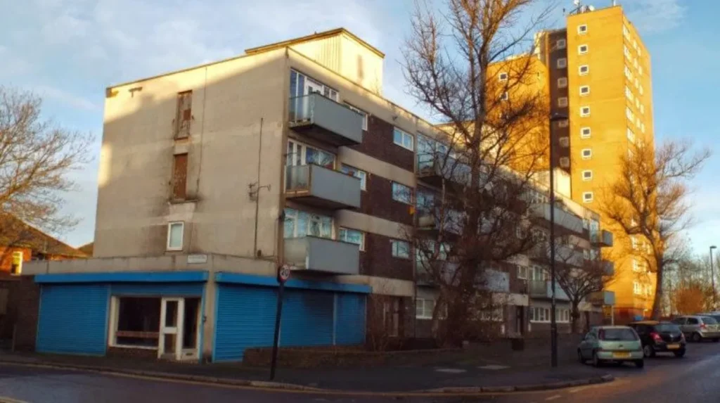
Cowgate’s built environment reflects twentieth-century planned housing rather than Newcastle’s medieval or Victorian architectural traditions. Low-rise residential streets, repeated house types, gardens and later modifications provide the strongest visible evidence of its development.
Visitors expecting Newcastle’s medieval streets, Victorian terraces or industrial warehouses will find a different architectural environment in Cowgate.
The dominant historical influence is planned residential development.
Inter-war estates were designed around principles that differed from the dense urban form of nineteenth-century Newcastle. Streets were generally wider, houses were separated by gardens and residential layouts incorporated more open space.
This design was influenced by the garden-suburb movement, which promoted healthier residential environments with lower densities and greater access to greenery.
The approach can be seen elsewhere in Newcastle’s inter-war housing estates.
Pendower Estate provides an important local example. The estate was designed according to Tudor Walters standards and followed garden-suburb principles. Approximately 150 houses formed the earliest phase, with the first tenants moving in towards the end of 1922. By 1931, around 589 council houses had been constructed across the estate.
Cowgate developed within this wider planning culture.
The architecture also demonstrates how housing priorities changed. Older Newcastle neighbourhoods often prioritised compact construction close to employment and commercial activity. Inter-war estates instead placed greater emphasis on family accommodation, gardens, road access and separation from heavy industry.
Later alterations, extensions, replacement windows, doors, landscaping and changes in tenure have modified individual properties, but the underlying planned layout remains an important part of the area’s historical character.
Is Cowgate well connected to the rest of Newcastle?
Cowgate has strong road and bus connections because it sits beside major routes serving north-west Newcastle. The Cowgate junction is a significant transport interchange, carrying about 60,000 vehicles and almost 70 buses per hour during daytime periods.
Transport is one of the defining practical features of Cowgate today.
Newcastle City Council describes Cowgate junction as a major route for public transport and reports approximately 60,000 motorists using the junction daily. Almost 70 buses pass through the junction each hour during daytime periods.
The council invested more than £5 million in improvements to the junction. The project replaced the former roundabout arrangement with a signalised junction incorporating bus and cycle lanes and street-level pedestrian crossings.
The changes were designed to address congestion and improve movement through the junction.
For residents, the transport role has two consequences.
First, Cowgate provides direct road connections towards Newcastle’s central and northern districts. Second, the volume of traffic means that major roads form an important part of the locality’s physical character.
Public transport is particularly important for households without private cars, students and residents travelling to employment centres.
The area therefore has a different transport profile from quieter suburban districts where local streets carry relatively little through traffic.
Cowgate’s position also reflects its historical development. Planned housing estates became more valuable as transport networks expanded around them, allowing residents to reach employment, education and commercial centres beyond their immediate neighbourhood.
What is Cowgate like for housing today?
Cowgate remains primarily residential, with its housing stock shaped by twentieth-century estate development and later changes in ownership and tenure. The area contains established family housing alongside privately rented homes and properties affected by subsequent modifications.
Housing remains central to Cowgate’s identity.
The original estate was developed during a period when Newcastle City Council and other local authorities were expected to address housing shortages through direct construction.
That historical role continues to influence perceptions of the locality because the street pattern and housing forms retain evidence of their planned origins.
Modern ownership is more varied than the original council-estate model.
Newcastle has experienced significant changes in housing tenure since the 1980s. Right to Buy transferred ownership of many council properties to former tenants, while later housing policies created a mixture of social housing, owner-occupied housing and private renting.
Newcastle City Council continues to operate housing and property-licensing policies across the city. From April 2025, Cowgate was included in a new selective licensing area covering private rented properties.
Selective licensing is a local authority system requiring qualifying private rented properties within a designated area to hold a licence. The purpose is to ensure that covered properties meet specified management and housing standards.
This is relevant to anyone considering renting in Cowgate because property licensing forms part of the area’s current housing-management framework.
Anyone researching a particular property should distinguish between the age of the building, ownership status, licensing requirements and current condition. These are separate factors.
What is everyday life like in Cowgate?
Everyday life in Cowgate is centred on residential streets, local services, schools, public transport and access to wider Newcastle. Its character is practical and community-based, while major roads provide rapid connections beyond the immediate neighbourhood.
Cowgate is not primarily a tourism district.
Its daily function is residential. Local residents use nearby shops, schools, community facilities, bus services and road networks rather than relying on visitor attractions within the locality itself.
This makes the area different from Newcastle’s city centre, Quayside or historic core.
For families, the estate-style housing pattern provides a clear residential structure. For commuters, transport connections are a major consideration. For researchers, the locality provides an example of how twentieth-century municipal housing reshaped Newcastle.
The area’s relationship with neighbouring communities is also important.
Cowgate forms part of a wider north-west Newcastle urban landscape that includes neighbourhoods such as Blakelaw, Kenton, Fenham and other established residential districts. Boundaries between these areas are defined by roads, estates, planning boundaries and local administrative arrangements.
The result is a connected urban environment rather than an isolated settlement.
For someone assessing Cowgate as a place to live, the practical questions are therefore less about historic attractions and more about housing type, transport, property condition, local services, schooling and the exact street.
Conditions can differ between individual streets and properties. A neighbourhood-level description should not be treated as a substitute for checking a specific address.
How close is Cowgate to Newcastle city centre?
Cowgate is approximately three miles north-west of Newcastle city centre, placing it within the city’s established urban area rather than the outer rural fringe. Road and bus links connect residents with central Newcastle and neighbouring districts.
The distance to the city centre is one reason Cowgate functions as a suburban residential locality rather than a separate settlement.
Newcastle’s historic centre developed around the River Tyne, the medieval town and later industrial and commercial expansion. During the nineteenth and twentieth centuries, urban development spread steadily beyond the old town boundaries.
Cowgate forms part of that later expansion.
The relationship between distance and accessibility is important. A locality can be geographically close to a city centre while experiencing a very different physical environment.
Cowgate demonstrates this clearly.
The area is dominated by residential development rather than major commercial buildings. Yet the Cowgate junction provides a major transport route towards other parts of Newcastle.
For residents, this creates a combination of suburban housing and metropolitan accessibility.
For historians, the relationship shows how Newcastle expanded beyond its medieval walls and industrial core. The city did not simply grow by adding isolated villages. It also created planned estates and new neighbourhoods through municipal housing programmes and twentieth-century transport infrastructure.
What historical sites are close to Cowgate?
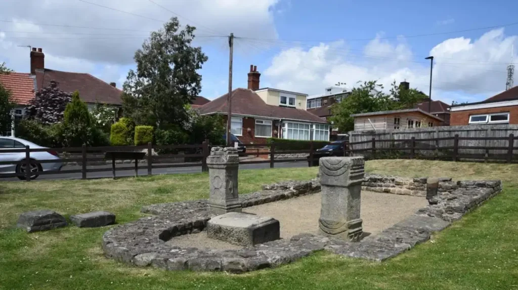
Cowgate itself is primarily a twentieth-century residential area, but it sits within a city containing nationally significant Roman and medieval heritage. Nearby historical resources include Newcastle’s medieval town remains and sections of Hadrian’s Wall across the wider west and north-west city.
The wider Newcastle area has a much older history than Cowgate’s housing stock suggests.
Hadrian’s Wall was constructed from approximately AD 122 onwards during the reign of Emperor Hadrian. The frontier extended about 73.5 miles between the lower Tyne and Bowness-on-Solway in Cumbria.
Newcastle contains sections of the World Heritage Site, and the line of the Roman frontier passes through the city from Throckley towards Walker.
The Roman fort of Benwell, known as Condercum, is particularly important to the west of central Newcastle. Archaeological investigations recorded construction beginning around AD 122–124, later rebuilding and occupation continuing into the late fourth century.
The remains demonstrate that the landscape around modern Newcastle had strategic importance long before the creation of modern Cowgate.
Newcastle’s medieval history provides another layer.
The city became a borough during the reign of Henry I and had developed into a wealthy port by around 1200. Medieval streets, defensive walls, religious foundations and market areas created the urban framework that later generations expanded.
To experience this historic landscape in person today, consult our comprehensive for itineraries and visiting parameters.
This historical context gives Cowgate a useful position within Newcastle’s wider heritage geography. The locality itself is largely modern, but it lies within a city whose archaeological record extends across Roman, medieval, industrial and modern periods.
What role does Cowgate play in Newcastle’s housing history?
Cowgate represents the twentieth-century expansion of Newcastle’s planned residential landscape. Its development reflects national housing legislation, local government investment, changing tenure policies and the movement from dense industrial housing towards planned suburban estates.
Newcastle’s housing history is closely connected to the city’s industrial growth.
Coal, shipbuilding, engineering and manufacturing generated employment and population growth during the nineteenth and early twentieth centuries. Housing supply struggled to keep pace with demand in many industrial districts.
The response included municipal housing.
The 1919 Housing Act represented a major change because it placed new responsibilities on local authorities. Newcastle subsequently purchased land and developed estates designed to provide improved housing conditions.
The city council’s own historical records state that almost 28% of Newcastle residents lived in council or social housing when the council marked the centenary of council housing, compared with 18% across England.
That figure illustrates the long-term importance of social housing to Newcastle’s urban structure.
Cowgate belongs within this larger tradition.
Its significance is therefore not based on one famous building or a single historical event. Its importance comes from its role as part of the housing infrastructure that allowed Newcastle to expand during the twentieth century.
This is valuable for students of urban history because it demonstrates how government policy, land acquisition, architecture and transport interacted to produce new communities.
How has Cowgate changed since the inter-war period?
Cowgate has changed through alterations to homes, changing property ownership, post-war urban growth, transport investment and modern housing regulation. The original estate structure remains important, but contemporary Cowgate functions within a much larger metropolitan environment.
The physical landscape today is not identical to the estate created in the early twentieth century.
Individual properties have been altered. Ownership patterns have changed. Roads have been redesigned. Public transport has evolved. Nearby districts have expanded and become integrated with Cowgate.
Transport improvements provide a clear modern example.
The Cowgate junction once operated as a roundabout with pedestrian subways. The modern scheme introduced signal controls, bus and cycle lanes and street-level pedestrian crossings.
The project demonstrates how infrastructure has been adapted to contemporary travel patterns.
Housing regulation has also changed.
Modern selective licensing places responsibilities on landlords in designated areas. These responsibilities did not exist in the same form when the estate was first developed.
The community has therefore moved through several phases: municipal construction, post-war consolidation, changing tenure, infrastructure modernisation and contemporary property regulation.
The underlying residential identity remains, but the institutional framework around it has changed considerably.
Is Cowgate important for local and family history research?
Cowgate is useful for genealogical and local-history research because its twentieth-century development created identifiable housing estates, streets, property records and council-housing histories. Researchers should distinguish modern Cowgate from the medieval Cowgate recorded in central Newcastle.
Genealogical research in Newcastle often requires careful interpretation of place names.
Cowgate is an excellent example of why researchers should not assume that identical place names refer to the same location.
The medieval Cowgate appears in documentary records from 1272–73 and was associated with Pilgrim Street and Pandon Dene. Modern Cowgate developed centuries later in north-west Newcastle.
Researchers examining census returns, electoral registers, deeds, maps or family records should therefore confirm the geographical location attached to every historical reference.
Historic maps are particularly useful.
Ordnance Survey maps allow researchers to compare agricultural land, estate boundaries, roads and housing construction across different periods. Newcastle’s Historic Environment Record also provides information about archaeological and historical sites.
Council housing records provide another research route.
The history of Newcastle’s municipal estates includes details of land purchases, construction phases, tenant movements and changing housing policy. These records help establish when neighbourhoods were created and how their populations changed.
For family historians, a house number combined with a street name and period can provide a more reliable identification than the locality name alone.
This approach is essential when researching families who lived in Newcastle during the transition from nineteenth-century industrial neighbourhoods to twentieth-century planned estates.
What does Cowgate tell us about Newcastle’s wider urban history?
Cowgate demonstrates how Newcastle expanded beyond its historic centre through planned housing, infrastructure investment and suburban development. Its present form records the transition from a compact industrial city towards a larger twentieth-century urban landscape.
Newcastle’s history is often associated with its castle, town walls, bridges, shipbuilding, coal trade and industrial heritage.
Cowgate represents another part of that story.
It shows what happened when the city needed to house a growing population beyond its traditional urban core.
The transformation involved land acquisition, housing legislation, architectural planning, road construction and public services. These processes created neighbourhoods designed for everyday residential life rather than commercial or defensive purposes.
The historical importance of Cowgate therefore lies in urban development rather than monumental architecture.
Its streets provide evidence of a period when local authorities took a direct role in shaping the physical city.
The same principle can be seen across Newcastle. The city council’s historic environment assessment records extensive twentieth-century expansion across the north-west, with areas such as Fenham, West Denton, Westerhope and Kenton Bank Foot developing as public transport and housing construction extended the city.
Cowgate forms part of this broader transformation.
Its modern identity is consequently inseparable from Newcastle’s twentieth-century housing history.
What should someone consider before choosing Cowgate as a place to live?
Anyone considering Cowgate should examine the exact property, housing tenure, transport requirements, local services, traffic conditions and neighbourhood facilities. The area is a practical residential district, and individual streets and properties should be assessed separately.
Housing history provides useful context, but it does not determine the condition of every modern property.
A prospective resident should check whether a property is privately owned, council-owned or privately rented. Renters should check applicable licensing requirements and the condition of the property.
Transport is another major consideration.
The Cowgate junction carries substantial traffic and serves a major bus corridor. This benefits connectivity but also makes traffic movement an important part of the local environment.
Property location within the locality also matters. A home directly beside a major route has a different setting from one on a quieter residential street.
Access to schools, shops, healthcare, green space and public transport should be assessed according to the exact address rather than the locality name alone.
Historical character is also relevant. Cowgate is not a medieval neighbourhood and does not contain the concentration of historic buildings found in central Newcastle. Its heritage lies primarily in planned twentieth-century housing and the wider history of urban expansion.
For residents interested in Newcastle’s past, however, Cowgate provides direct access to a much larger historical landscape containing Roman, medieval, industrial and modern sites.
What is the long-term historical significance of Cowgate?
Cowgate’s long-term significance lies in its representation of Newcastle’s twentieth-century housing expansion. The locality records how public policy, municipal construction, transport infrastructure and changing property ownership reshaped the city beyond its historic medieval and industrial core.
Cowgate is significant because ordinary residential districts are part of urban history.
Its houses and streets record decisions made about land, housing standards, public health, transport and community development.
The locality also demonstrates how historical landscapes evolve.
The original agricultural setting disappeared as housing was constructed. Council ownership changed through later housing policies. Roads were redesigned as traffic increased. Modern licensing frameworks developed as the private rented sector changed.
These processes are documented in council records, historic maps and the Tyne and Wear Historic Environment Record.
For historians and educators, Cowgate provides a useful case study of municipal urban planning.
For genealogists, it provides a defined twentieth-century residential landscape in which families can be traced through property and electoral records.
For residents, its history explains why the neighbourhood looks and functions as it does today.
The most important point is that Cowgate should not be judged solely by its distance from Newcastle’s historic centre or by the age of its buildings. Its heritage is the history of planned residential expansion.
That makes Cowgate part of the broader story of how Newcastle developed from an industrial city into the extensive urban area that exists today.