Blakelaw and Cowgate form a residential area in north-west Newcastle upon Tyne where post-war housing, older agricultural land, former industrial activity and modern community facilities overlap. The area is served by bus corridors, nearby Metro stations, primary schools, local shopping facilities and established community infrastructure. Its development reflects Newcastle’s wider expansion beyond the historic city centre.
- How did Blakelaw and Cowgate develop into a residential part of Newcastle?
- What historic evidence survives in Blakelaw and Cowgate today?
- Which roads connect Blakelaw and Cowgate with the rest of Newcastle?
- Which bus services serve Blakelaw and Cowgate?
- How close are the Metro and railway connections to Blakelaw?
- Which schools serve children in Blakelaw and nearby areas?
- Where can shoppers find everyday services in Blakelaw and Cowgate?
- How do community facilities support education and local life?
- What does the area’s transport and shopping pattern reveal about its history?
- Why are Blakelaw and Cowgate important for understanding Newcastle’s wider urban history?
The modern neighbourhood is also connected to a much older landscape. The Tyne and Wear Historic Environment Record identifies Blakelaw as a documented farm shown on the first-edition Ordnance Survey map of 1850. The record also identifies a Blakelaw pit, coal shaft, quarry, mine shaft, smithy and cottages, together with a 20th-century heavy anti-aircraft battery.
Cowgate has a separate historical identity. The modern estate belongs to the twentieth-century expansion of Newcastle, while the name itself has much older associations with routes, agricultural movement and the wider western approaches to the city. The present Blakelaw and Cowgate area therefore combines historic landscape evidence with planned residential development.
For visitors, researchers and residents, transport, education and shopping reveal how the district functions within Newcastle’s wider urban structure.
How did Blakelaw and Cowgate develop into a residential part of Newcastle?
Blakelaw and Cowgate developed from rural and industrial landscapes into planned residential districts as Newcastle expanded west and north-west during the nineteenth and twentieth centuries. Blakelaw retains documentary evidence of a Victorian farm and coal workings, while Cowgate became associated with twentieth-century housing.
The historical evidence for Blakelaw predates the modern estate. Newcastle’s Historic Environment Record lists Blakelaw as a post-medieval farm and specifically records it on the first-edition Ordnance Survey map dating from 1850. The recorded location is now associated with a school field.
The same historic environment database records several industrial features around Blakelaw. These include Blakelaw Pit, a coal shaft, a mine shaft, a quarry and a smithy with cottages. The evidence places these features within the Victorian period, when coal extraction and associated industries remained central to the economy of Tyneside.
This industrial background is important because Newcastle’s wider growth was closely connected to coal. Newcastle City Council’s history record describes the Great Northern Coalfield as a major force behind the Industrial Revolution and explains how coal demand encouraged the development of waggonways, the predecessors of modern railways.
Cowgate’s development followed a different urban pattern. The modern locality lies north-west of Newcastle city centre and became associated with an estate built during the twentieth century. Its housing reflects the expansion of Newcastle’s population beyond older inner-city neighbourhoods.
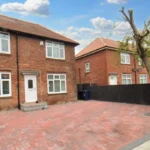
Post-war planning produced large areas of low-rise housing across north-west Newcastle. Newcastle City Council’s character assessment describes this wider zone as predominantly low-rise and low-density housing, generally using brick construction with tiled roofs. It also records flats and maisonettes at Blakelaw and Newbiggin Hall and tower blocks in parts of Cowgate, Blakelaw and West Denton.
The result is a neighbourhood whose built environment reflects several periods: agricultural Blakelaw, Victorian industrial activity, twentieth-century housing expansion and continuing community investment.
What historic evidence survives in Blakelaw and Cowgate today?
Historic evidence survives through mapped archaeological records, former industrial sites, established road patterns, community buildings and the continued use of historic place names. Blakelaw’s documented farm, coal workings and quarry provide direct evidence of the landscape before modern residential development.
The first-edition Ordnance Survey map is particularly important for understanding Blakelaw before large-scale housing construction. Produced in the nineteenth century, Ordnance Survey mapping recorded buildings, roads, farms, fields and industrial features with increasing geographical precision.
Blakelaw’s historic environment record identifies the farm as Victorian and gives its grid reference as NZ421330566900. The database records documentary evidence rather than an archaeological excavation, so the map is the principal evidence for the farm’s documented existence.
The coal-related records provide another layer of evidence. Blakelaw Pit, coal shafts and a mine shaft demonstrate that extraction activity formed part of the area’s earlier land use. A quarry and smithy with cottages add evidence of supporting economic activity.
A heavy anti-aircraft battery is also recorded in the Blakelaw historic environment database. It belongs to the twentieth century and demonstrates the area’s later relationship with wartime defence infrastructure.
Cowgate’s historical identity is also connected with routes and land beyond the modern housing estate. Newcastle’s historic landscape contains numerous place names that preserve earlier economic and geographical functions.
This historical layering provides useful material for genealogical research. Researchers tracing Newcastle families can compare modern addresses with historical maps, electoral material, school records, parish records, trade directories and municipal documentation. Changes in street names and housing layouts need to be checked carefully because modern boundaries do not always correspond with earlier administrative divisions.
Newcastle City Council describes the city itself as a settlement with continuity from Roman and medieval periods through industrialisation and modern regeneration. The wider history helps explain why seemingly modern neighbourhoods can contain evidence from much older landscapes.
Which roads connect Blakelaw and Cowgate with the rest of Newcastle?
Blakelaw and Cowgate are connected by a network centred on major north-west Newcastle roads, including Ponteland Road, Two Ball Lonnen, Silver Lonnen, West Road and Stamfordham Road. These corridors connect residential districts with employment areas, shopping destinations and Newcastle city centre.
Road transport is fundamental to the area’s structure. Newcastle City Council’s character assessment identifies the A1 Western Bypass, A191 Silver Lonnen and B1306 Two Ball Lonnen as principal north-south routes through the wider zone. East-west connections include the A186 West Road, A167/A696 Jedburgh Road and B6324 Stamfordham Road.
Ponteland Road provides another important connection through Cowgate and the surrounding north-western districts. The road links local residential areas with larger retail and employment corridors and forms part of the area’s established transport geography.
Two Ball Lonnen is particularly important for Cowgate because it provides access towards Fenham, Kenton and the wider city. The location of Morrisons Cowgate at 200 Two Ball Lonnen demonstrates the road’s continuing commercial role.
Stamfordham Road connects the area towards Westerhope and other western suburbs. It also links into retail destinations and bus routes serving the north-west of Newcastle.
The A1 Western Bypass provides strategic road access beyond the immediate neighbourhood. It is part of Newcastle’s wider orbital road network and separates some of the residential districts from areas farther west.
These roads also explain why the area functions as a transport intermediary rather than an isolated residential estate. Residents can move between local facilities and larger destinations using several different corridors.
Road access has also shaped the area’s commercial geography. Shops and services developed around roads with sufficient passing traffic, while larger supermarkets and retail centres established themselves along major routes.
Which bus services serve Blakelaw and Cowgate?
Bus services provide the main public transport connection within Blakelaw and Cowgate, linking the neighbourhood with Newcastle city centre, Kingston Park, Westerhope, Fawdon, Gosforth and other districts. Current Nexus timetables show several services serving Blakelaw and Cowgate corridors.
Nexus timetable information records services connecting Blakelaw with Newcastle and surrounding districts. The network changes over time, so current journey information should always be checked against the latest operator timetable before travelling.
The Stagecoach 6 is one documented route serving the wider Blakelaw corridor. Nexus timetable information lists stops including Kingston Park Shops, Blakelaw, Kenton Bar, Fawdon and Gosforth High Street, with the route continuing towards Newcastle Freeman Hospital.
The Stagecoach 54 also connects Blakelaw with Newcastle and the western side of the city. Nexus records a route between Newcastle Haymarket, Kingston Park Shops, Blakelaw, West Denton Shops, Fawdon, Gosforth High Street and other locations.
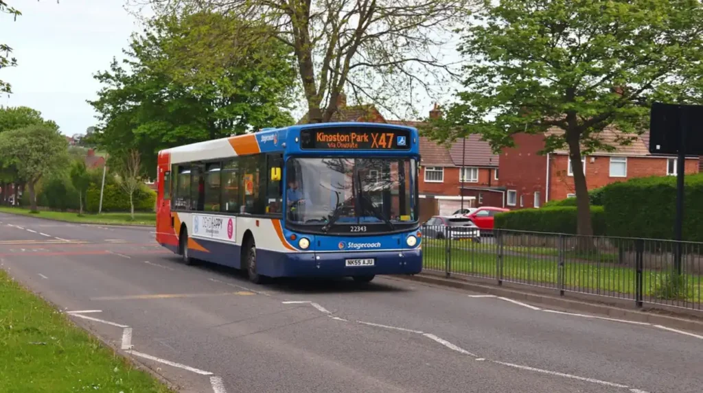
The X47 provides another important connection. Nexus timetable information identifies Cowgate Ponteland Road as a stop and shows the route linking Newcastle Eldon Square with Kingston Park Shops, Cowgate and Newcastle Great Park.
The X87 provides another connection through Blakelaw and Cowgate, with Nexus listing Blakelaw Road, Bedeburn Road, Cowgate and Newcastle Eldon Square among its stops. The route also connects towards Westerhope and Newbiggin Hall.
These routes illustrate how public transport links the neighbourhood to both central Newcastle and neighbouring suburban centres. They also provide connections to schools, retail facilities and employment destinations.
For families, transport access is especially relevant because Newcastle City Council operates a home-to-school travel system for eligible pupils. Eligible children attending government-funded Newcastle schools can receive a Nexus travel permit allowing one free return journey on local buses or Metro services between specified points on school days.
How close are the Metro and railway connections to Blakelaw?
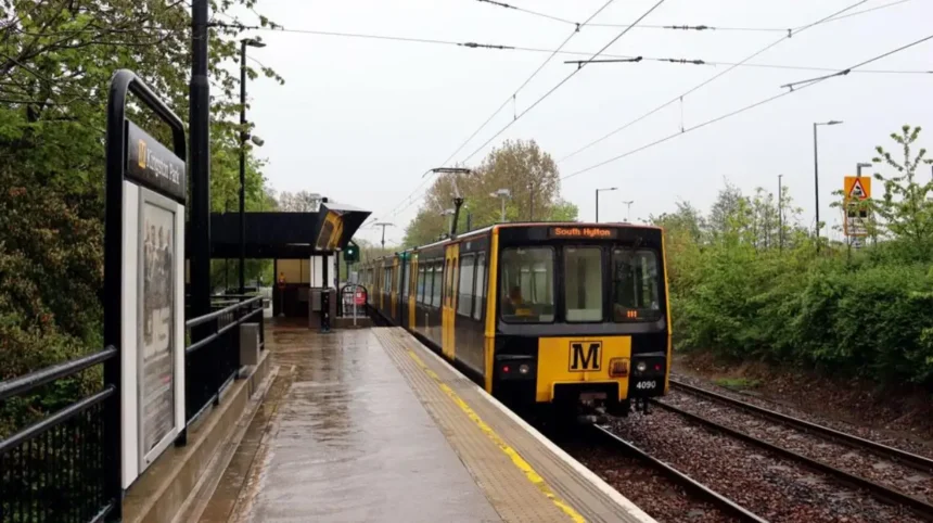
Blakelaw does not have a Metro station within the neighbourhood itself. Kingston Park is identified by Newcastle City Council as the nearest Metro station to Blakelaw Library, while Blaydon is listed as the nearest National Rail station for that facility.
The location of the Metro network is an important part of understanding Blakelaw’s transport pattern. Rather than relying on a station inside the estate, residents use bus connections and roads to reach nearby Metro stations.
Newcastle City Council identifies Kingston Park as the nearest Metro station to Blakelaw Library. The same council information identifies Blaydon as the nearest National Rail station for the library.
The relationship between bus and Metro transport reflects Newcastle’s integrated public transport geography. Buses provide local circulation, while Metro services provide rapid connections across a much larger regional network.
The absence of a station directly inside Blakelaw also explains the importance of routes serving Kingston Park and surrounding neighbourhoods. Bus services connecting Blakelaw with Kingston Park provide a practical interchange opportunity.
For historical research, this transport arrangement also illustrates a major change in Newcastle’s development. Earlier industrial transport systems focused heavily on coal, freight and heavy industry. Modern transport infrastructure is designed around passenger mobility, employment, education and everyday services.
The contrast is significant. Newcastle’s nineteenth-century transport development was closely connected to industrial production and the movement of coal. Modern suburban transport prioritises residents travelling between homes, schools, shops and employment centres. Newcastle City Council identifies the city’s railway history as a major part of its industrial heritage, particularly through the work of George and Robert Stephenson.
Which schools serve children in Blakelaw and nearby areas?
Blakelaw contains established primary schools, including Hilton Primary Academy and Thomas Walling Primary Academy. Nearby schools extend the education network into Kenton, Kingston Park, Newbiggin Hall, Fenham and surrounding districts, creating a wider catchment landscape.
Hilton Primary Academy is located on Hilton Avenue in Blakelaw. Newcastle City Council lists it as an academy with an age range of 2 to 11 and an attached nursery. Its published admission capacity for the year of entry is 60.
The Department for Education identifies Hilton Primary Academy as an open academy sponsored by Northern Education Trust. Its official record gives the school an age range of 2 to 11 and identifies Blakelaw as its ward.
Ofsted inspected Hilton Primary Academy on 16 September 2025. The published inspection record reports outstanding judgements for quality of education, behaviour and attitudes, personal development, leadership and management, and early years provision.
Thomas Walling Primary Academy is located on Lindfield Avenue in Blakelaw. Newcastle City Council’s school directory lists the academy among Newcastle’s primary schools.
Ofsted’s published information identifies Thomas Walling Primary Academy as an academy for pupils aged 2 to 11. The school has a published capacity of 488 pupils, with the inspection record listing 412 pupils in the available data.
The school landscape extends beyond the immediate neighbourhood. Newcastle’s school directory also lists Kenton Bar Primary School, Kingston Park Primary School, St Mark’s Catholic Primary School in Newbiggin Hall and other schools serving surrounding communities.
This wider network matters because school catchment arrangements are not identical to neighbourhood boundaries. Families researching admissions should therefore use Newcastle City Council’s current school directory and individual school admission arrangements rather than relying solely on geographic proximity.
Blakelaw also has a significant educational history. GOV.UK records Blakelaw School as a former community secondary school on Firfield Road. It closed on 1 September 1998 and was linked to Firfield Community School as its successor establishment.
The former school illustrates the changing structure of secondary education in Newcastle. School buildings, names, governance arrangements and catchment areas can change while the surrounding community remains.
Where can shoppers find everyday services in Blakelaw and Cowgate?
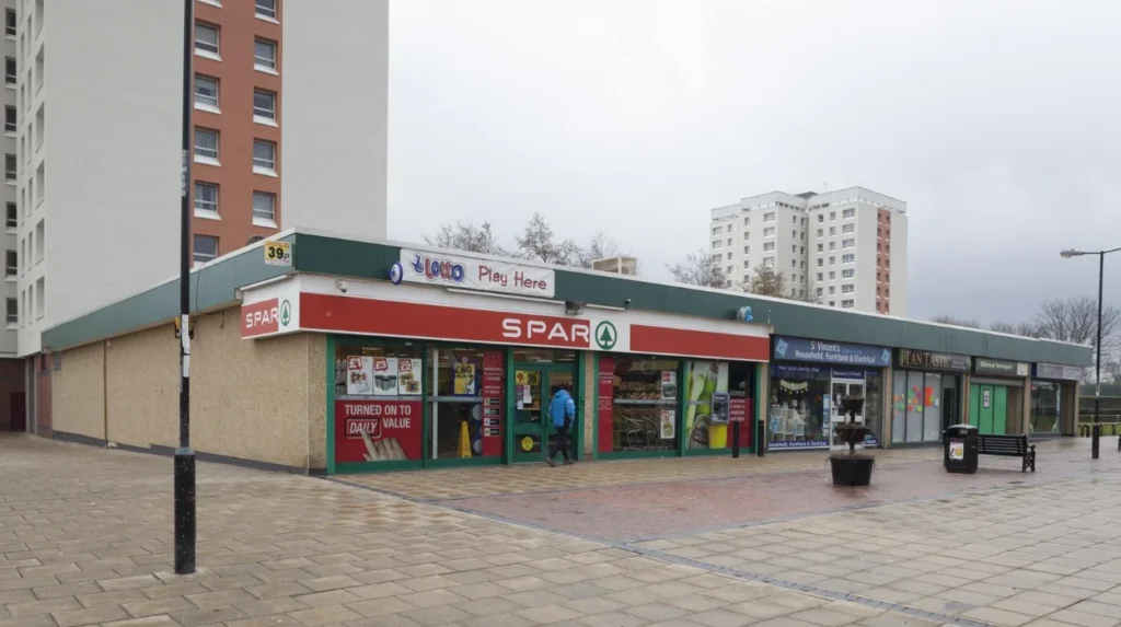
Everyday shopping is concentrated around local neighbourhood centres and major roads, with facilities including a post office and shop at Blakelaw Centre and supermarkets such as Morrisons Cowgate and Aldi in the surrounding Cowgate retail area.
Blakelaw Centre on Binswood Avenue is an important local service hub. Newcastle City Council lists the Blakelaw Centre as a community building, while accessibility information records a library, post office and shop, café and community centre within the building.
This combination of services reflects the traditional neighbourhood-centre model. Residents can access basic retail, postal and community services without travelling to Newcastle city centre.
The Blakelaw Library is currently operated as a pop-up library service at Leisure United Blakelaw on Cragstone Avenue. Newcastle City Council states that a bus stop is within 150 metres of the venue.
Cowgate has a larger supermarket presence. Newcastle City Council identifies Morrisons Cowgate at 200 Two Ball Lonnen as a large supermarket.
Newcastle City Council’s Fairtrade directory also lists Aldi at McKendrick Villas in Cowgate. This provides another supermarket option within the neighbourhood’s wider retail structure.
Local convenience retail is concentrated around Ponteland Road and associated neighbourhood shopping areas. This arrangement gives Cowgate a mixture of supermarket shopping, convenience stores and food businesses rather than a single enclosed shopping centre.
Kingston Park provides another important shopping destination for residents travelling outside the immediate neighbourhood. The Kingston Park Shopping Centre contains a range of services and retailers, including a Boots branch at NE3 2FP.
The shopping pattern therefore follows three scales: neighbourhood facilities for everyday needs, larger supermarkets for weekly shopping, and nearby suburban retail centres for a broader range of goods and services.
How do community facilities support education and local life?
Community facilities connect education, family services, recreation and local history in Blakelaw and Cowgate. Libraries, community centres, sports facilities and family hubs provide places where residents access services without travelling into central Newcastle.
The Cowgate Centre is one of the area’s established community facilities. Newcastle City Council lists it among the city’s community buildings, while Children and Families Newcastle identifies it as a local family hub.
The council also identifies the Cowgate Centre as part of the inner-west community network. This wider service area includes Blakelaw, Benwell and Scotswood, Arthur’s Hill, Elswick, West Fenham and Wingrove.
Blakelaw has its own community infrastructure through the Blakelaw Centre, library services and sports facilities. The community centre model provides a direct link between physical neighbourhood development and social services.
Sport has also become part of the area’s modern regeneration. In 2022 Newcastle City Council announced more than £9.5 million of investment from the Premier League, Football Foundation and Government for new community sports facilities at Blakelaw Park and Bullocksteads Sports Ground.
The Blakelaw Park works included two new small-sided 3G football pitches, a multi-use games area, replacement of an existing full-size 3G pitch, a two-storey pavilion, changing rooms, community café, education room, fitness suite and children’s play area.
Further investment followed. In September 2025 Newcastle City Council approved £1.5 million for improvements to four flagship play spaces, including Blakelaw Park. The programme included sensory, audio and visual equipment and natural play features.
These investments are historically relevant because they show how former estate infrastructure is being adapted to modern community requirements.
To explore the area’s wider attractions and local destinations, consult our comprehensive for itineraries and visiting parameters.
What does the area’s transport and shopping pattern reveal about its history?
Blakelaw and Cowgate demonstrate how Newcastle’s suburban development replaced agricultural and industrial land with planned housing while retaining road corridors, place names and community facilities. Modern buses, schools and shops now occupy a landscape shaped by earlier farming, mining and urban expansion.
The transition from farm to residential district is particularly clear at Blakelaw. The Historic Environment Record identifies the nineteenth-century farm, while later records document coal shafts, quarrying and associated buildings. The modern neighbourhood occupies a landscape that previously supported agriculture and extraction.
Cowgate similarly demonstrates the transformation of Newcastle’s western edge. The modern estate belongs to the city’s twentieth-century housing expansion, while its roads connect into older regional routes.
Transport infrastructure has therefore remained a constant feature even though its purpose changed. Older industrial transport moved coal and industrial materials. Modern buses carry passengers to schools, workplaces and shopping centres.
The shopping pattern reflects the same transformation. Neighbourhood centres support daily services, while supermarkets and larger retail centres serve broader catchments. Community buildings combine practical services with social and educational functions.
Schools provide another marker of urban permanence. Hilton Primary Academy and Thomas Walling Primary Academy serve a residential population created by decades of housing development. Former institutions such as Blakelaw School demonstrate how educational provision has been reorganised as population needs and school structures changed.
For historical researchers, this makes Blakelaw and Cowgate useful examples of layered suburban development. Maps from different periods can reveal changes in fields, roads, industrial sites, housing estates and public facilities.
Why are Blakelaw and Cowgate important for understanding Newcastle’s wider urban history?
Blakelaw and Cowgate are important because they show Newcastle’s expansion beyond its historic core and preserve evidence of agricultural, industrial, wartime, post-war and modern community development. Their transport and service networks demonstrate how suburban districts integrate into the wider city.
Newcastle’s history is often associated with its medieval centre, River Tyne, coal industry, shipbuilding and railway engineering. Yet the city’s development also depends on suburban districts that absorbed housing growth and created new schools, roads, shopping centres and public facilities.
Blakelaw provides direct evidence of this transition. The Victorian farm and industrial records demonstrate the earlier landscape, while the modern school and residential environment demonstrates later urbanisation.
Cowgate adds evidence of twentieth-century housing development and modern neighbourhood infrastructure. Its location along major roads has supported continued access to supermarkets, services and bus routes.
The transport network also connects the area to Newcastle’s wider economic geography. Routes towards Eldon Square, Kingston Park, Gosforth, Westerhope, West Denton and Newcastle Freeman Hospital demonstrate the area’s integration with employment, healthcare, education and commercial destinations.
The area also demonstrates the importance of preserving documentary evidence. Historic maps, archaeological records, school records, planning documents and municipal archives allow researchers to reconstruct changes that are not always visible in today’s streetscape.
Modern community investment provides another historical layer. Sports facilities, inclusive play spaces, libraries and family hubs show how established estates continue to evolve rather than remaining fixed examples of post-war planning.
For educators and students, Blakelaw and Cowgate offer a compact case study in urban geography. The area allows research into land-use change, suburbanisation, industrial archaeology, public transport, education planning, retail geography and community regeneration.
For genealogists, the changing boundaries and institutions require careful source comparison. A family address recorded in an older document should be matched against historical maps and administrative records before being equated with a modern postcode or ward.
For heritage researchers, the surviving Historic Environment Record entries provide a starting point for investigating the landscape before residential expansion.
Blakelaw and Cowgate therefore form more than a modern residential district. Their roads, schools, shops, community facilities and archaeological records preserve a chronological sequence of Newcastle’s growth from rural and industrial land to a connected urban neighbourhood.
The historical record also demonstrates why local history should be studied alongside present-day infrastructure. The bus route on a modern road, the school built within a former agricultural landscape and the supermarket serving a former estate all represent different stages of the same long process: Newcastle’s continuing expansion and adaptation.