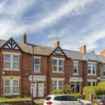
Kingston Park is a planned suburban neighbourhood in northern Newcastle upon Tyne. The area is closely associated with late twentieth-century housing development, the Tyne and Wear Metro, Kingston Park District Centre, schools, community facilities, parks, and Kingston Park Stadium.
- What is Kingston Park in Newcastle?
- What was the area around Kingston Park like before the suburb was built?
- When was Kingston Park developed as a residential neighbourhood?
- How did the Metro change life in Kingston Park?
- What shops and retail facilities define Kingston Park today?
- Why is Kingston Park suited to family life?
- What is the historical importance of Kingston Park Stadium?
- How has Kingston Park changed as Newcastle expanded northwards?
Its history differs from the older urban districts of Newcastle. Kingston Park did not develop primarily from a medieval settlement, Victorian industrial expansion, or nineteenth-century railway suburb. Its physical character emerged mainly during the 1970s and 1980s, when Newcastle expanded into areas beyond established suburban districts.
The neighbourhood also sits within a much older landscape. Gosforth and surrounding northern Newcastle contain evidence of farming, coal working, historic roads, estates, and railway development. Newcastle City Council’s archaeological research records Gosforth’s transformation from a rural and industrial landscape into a modern dormitory suburb.
Today, Kingston Park combines this twentieth-century suburban history with practical infrastructure. Residents have access to a district shopping centre, primary education, public parks, sports facilities, bus routes, the Metro, and road connections towards Newcastle city centre, Newcastle Airport, the A1 and neighbouring communities.
What is Kingston Park in Newcastle?
Kingston Park is a planned suburban neighbourhood in northern Newcastle upon Tyne, largely developed during the 1970s and 1980s. Its identity rests on housing, retail, schools, community facilities, green spaces, the Metro, and connections with surrounding Gosforth and Great Park.
Kingston Park occupies the northern edge of Newcastle’s established urban area. Its development belongs to the period when Newcastle’s housing requirements increasingly encouraged construction beyond older districts.
Newcastle City Council’s recent electoral documentation describes Kingston Park as a relatively new community built in the 1980s, alongside Newcastle Great Park, where housing construction began in the early 2000s. The same document identifies the area through its residential character, transport links, district centre and Metro station.
This distinction is important when understanding the neighbourhood’s architecture. Kingston Park is not principally a Victorian terrace district. Its streets, houses, open spaces and local facilities were planned within the framework of twentieth-century suburban expansion.
The physical layout reflects practical residential planning. Housing areas are connected to local roads, shopping facilities, schools and recreational spaces. Brunton Lane forms an important older route through the area, while Kingston Park Road connects the suburb with the wider northern Newcastle road network.
The surrounding landscape has a considerably longer history. Gosforth developed from a rural settlement into a suburban part of Newcastle, while eighteenth- and nineteenth-century coal workings affected the wider district. Newcastle’s archaeological record identifies Gosforth Colliery, Coxlodge Colliery, Regent Pit and Jubilee Pit among the area’s industrial remains.
Kingston Park therefore represents one stage in a much longer transformation of northern Newcastle: rural land became industrial land in some locations, established villages became suburbs, and later twentieth-century planning created new residential districts.
What was the area around Kingston Park like before the suburb was built?
Before Kingston Park was built, this part of northern Newcastle formed a rural landscape shaped by farms, roads, coal working, and older settlements. The later suburb replaced open land with planned housing, while Brunton Lane preserved an older route through the landscape.
The history of Kingston Park cannot be separated from the wider history of northern Newcastle. Before modern housing estates appeared, land around Gosforth, Brunton and neighbouring settlements contained agricultural fields, farms, roads and industrial sites.
Gosforth provides an important historical reference point. Newcastle’s Historic Environment Record states that the earliest recorded evidence of human activity in Gosforth extends back many centuries. Medieval settlement was concentrated around older village sites, while the nineteenth century brought substantial changes to the local landscape.
Coal also influenced northern Newcastle. Gosforth Colliery opened during the eighteenth century and had ceased operating by 1895. Later workings included Coxlodge Colliery, Regent Pit and Jubilee Pit. These industrial sites were associated with wagonways and other transport infrastructure used to move coal.
The wider district therefore experienced several overlapping land uses. Agricultural land supported farming. Coal extraction introduced industrial activity. Roads connected villages and farms. Railway infrastructure subsequently changed movement across northern Newcastle.
The railway history is particularly relevant to Kingston Park. The Metro route passing through the area follows infrastructure with earlier railway origins. The former Gosforth and Ponteland Light Railway opened in 1905. Passenger services began later that year, although there was no Kingston Park station at that time. Passenger services on the relevant route ended in 1929, while parts of the railway infrastructure continued to support freight activity.
This railway inheritance helped make the later Metro development possible. The modern system did not appear on completely unused transport land. Instead, Metro planners incorporated and modernised existing railway corridors as part of a much larger regional transport project.
The result is a distinctive historical sequence. Older agricultural and industrial landscapes were followed by railway infrastructure and then by planned residential development. Kingston Park belongs mainly to the final stage of this sequence.
When was Kingston Park developed as a residential neighbourhood?
The Kingston Park estate emerged during the late twentieth century as Newcastle expanded beyond older suburban districts. Housebuilding in the 1970s and 1980s created a residential neighbourhood, while roads, schools, shops, recreation areas, and transport infrastructure developed around community needs.
The main residential transformation took place during the 1970s and 1980s. This period was important for Newcastle because suburban expansion created new housing areas beyond established districts such as Gosforth.
Contemporary planning records describe Kingston Park as a community constructed during the 1970s and 1980s. Newcastle’s current warding documentation also places the neighbourhood alongside the much newer Newcastle Great Park development, clearly separating the two phases of suburban expansion.
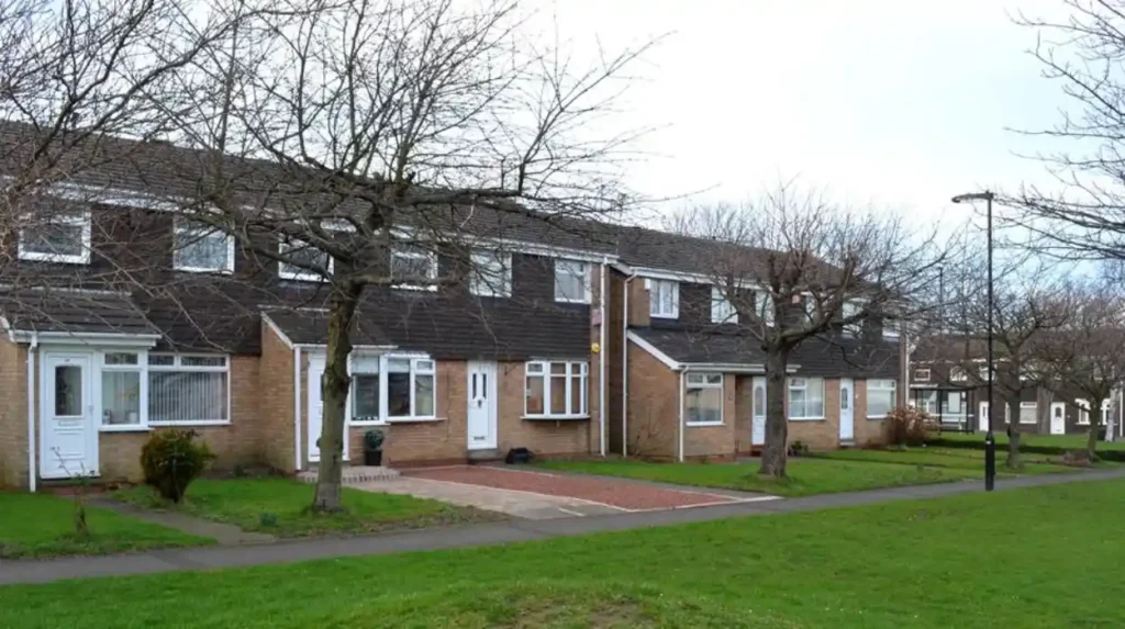
The architecture of Kingston Park reflects this period. The neighbourhood contains predominantly twentieth-century housing rather than concentrations of historic listed buildings. Brick construction, private gardens, estate roads and planned residential layouts form much of its built environment.
The planning logic was functional. Homes were positioned around roads and pedestrian connections. Schools and community facilities were placed within reach of residential streets. Shopping provision was concentrated into a district centre rather than dispersed entirely along traditional high streets.
This approach reflected wider changes in British suburban planning. Post-war Newcastle required additional housing, while increasing car ownership and investment in public transport influenced how new estates were designed.
Kingston Park also developed a relationship with nearby employment areas. The Airport Industrial Estate is located within the wider Kingston Park area, creating an additional connection between residential development and employment land. Newcastle’s local planning documents also recognise the area’s relationship with retail and employment infrastructure.
The community infrastructure developed alongside housing. Kingston Park Primary School now serves children from nursery age through Year 6. Newcastle City Council records the school as an academy with an attached nursery and a published admission number of 60 in its school directory, although current admissions figures can change by year.
The school is therefore part of the suburb’s institutional history as well as its present family infrastructure. Its presence illustrates how the neighbourhood developed beyond being simply a collection of houses.
How did the Metro change life in Kingston Park?
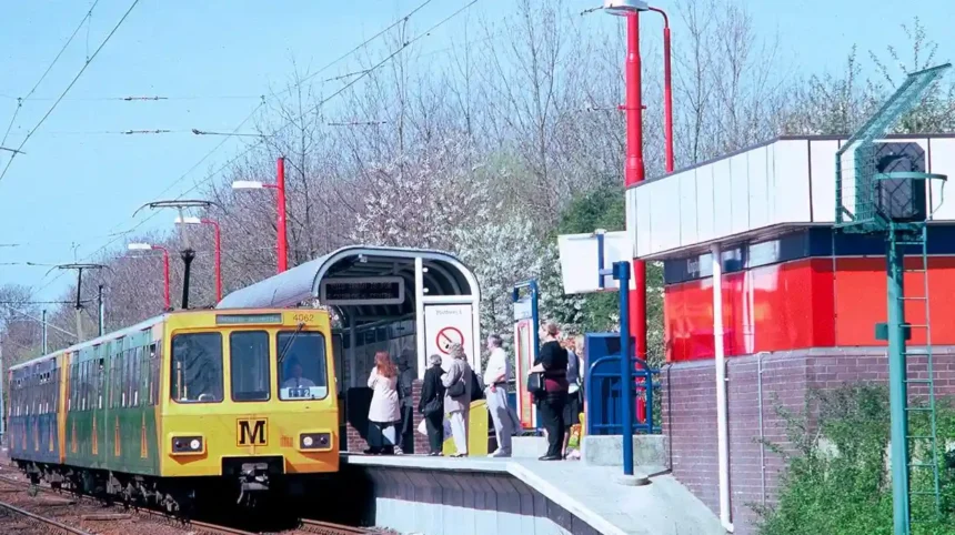
Kingston Park Metro station opened on 15 September 1985, adding a dedicated stop to a route that already carried Metro services. The station improved daily access to Newcastle and later connected residents directly with Newcastle Airport through the Green Line extension opened in 1991.
The Tyne and Wear Metro is central to understanding modern Kingston Park. The regional system opened its first section in August 1980. Nexus describes Metro as Britain’s first light rapid rail transit system, developed through a major regional transport programme during the 1970s.
Kingston Park station opened on 15 September 1985. This date is significant because the Metro route through northern Newcastle had already been operating for several years.
The station was therefore an addition to an established transport corridor rather than part of the original 1980 opening. Newcastle University’s Co-Curate records Kingston Park as one of the later stations added to the system.
The station’s position also reflects the geography of the neighbourhood. It sits beside Brunton Lane, where the Metro route crosses the road. The station uses staggered platforms on opposite sides of the level crossing.
The wider Metro network changed the relationship between northern suburbs and Newcastle city centre. Before the system’s development, public transport relied more heavily on conventional railways and buses. Metro introduced an electrically operated rapid transit network designed around frequent urban connections.
Nexus records that the Metro was originally conceived as an integrated public transport system. Buses were intended to feed passengers into Metro stations for longer journeys, while Metro provided the main rapid-transit routes. That integrated model changed following bus deregulation in 1986.
The Airport connection strengthened Kingston Park’s strategic position. The Metro extension from Bank Foot to Newcastle International Airport opened in 1991. Kingston Park became part of the Green Line linking the airport with Newcastle and the wider Tyne and Wear network.
Metro history also remains relevant today because the original fleet has now entered the region’s railway heritage. Nexus records that the original Metro trains carried approximately 1.7 billion customer journeys between their introduction in 1980 and their final period of guaranteed service in June 2026.
For Kingston Park, the Metro is therefore more than a commuting facility. It represents one of the major infrastructure decisions that shaped the suburb’s long-term accessibility.
What shops and retail facilities define Kingston Park today?
Kingston Park shopping is organised around a district centre serving everyday needs, with larger retail units and nearby retail parks. Newcastle City Council identifies Kingston Park as a district centre, while Tesco Extra anchors its wider shopping role for surrounding residential communities across northern Newcastle.
Kingston Park’s shopping history developed alongside its housing. Instead of relying entirely on an older high street, the suburb received purpose-built retail provision designed around a growing residential population.
Newcastle City Council’s planning documents classify Kingston Park as a district centre within the city’s retail hierarchy. The council has reviewed the centre’s boundaries over time according to retail occupancy, planning evidence, development opportunities and the function of surrounding retail locations.
The distinction between Kingston Park District Centre and other retail locations is important. Newcastle City Council has treated Kingston Retail Park separately because it has its own access from Brunton Lane and contains larger retail units with a different function from the district centre.
The shopping environment therefore operates at several scales. The district centre serves routine local requirements. Larger retail units provide broader shopping options. Nearby retail parks extend the range of goods and services available to residents.
Tesco Extra is one of the most recognisable retail anchors in the area. Newcastle Great Park planning documentation identifies Kingston Park District Centre and its Tesco Extra as an established shopping resource for housing west of the A1.
The retail centre has also changed over time. Newcastle’s monitoring reports record planning activity involving Kingston Park Centre, including the demolition of existing units, construction of a replacement retail unit, alterations to retained units, parking changes and public-realm improvements.
Individual businesses have also changed. Newcastle’s Historic Environment Record documents the former Kingston Court public house, which opened in 1981 within Kingston Park Shopping Centre, became the Brunton Arms around 1997 and was demolished around 2001.
This example demonstrates an important characteristic of planned suburbs. The physical retail framework can remain while individual businesses, building uses and commercial identities change.
For residents, the historical significance of Kingston Park shopping lies in this continuity. The district centre was created as part of the suburb’s original community infrastructure and continues to serve a role within Newcastle’s retail hierarchy.
Why is Kingston Park suited to family life?
Kingston Park Primary School, community facilities, parks, sports grounds, and pedestrian routes support everyday family life. The neighbourhood combines planned residential streets with open recreational land, while nearby schools, retail centres, Metro services, and major roads extend local facilities.
Family life in Kingston Park is closely connected to the neighbourhood’s original planning structure. Residential streets sit near schools, green spaces, shopping facilities and community buildings.
Kingston Park Primary School is located on Cranleigh Avenue. Newcastle City Council lists the school as serving children from ages three to eleven, with an attached nursery and links to secondary education through its feeder arrangements.
The school also illustrates how educational infrastructure became part of the estate’s identity. The presence of a primary school within the residential area reduces the historical separation between housing and community services that characterised some earlier forms of urban expansion.
Green space provides another important component. Kingston Park West is a Newcastle City Council community park located close to residential and retail areas. It contains open grassland, footpaths, a play area and a small-sided informal football pitch.
The park’s design reflects everyday recreation rather than formal historic landscaping. Its paths support walking, informal exercise and access with prams or wheelchairs, giving the space a practical role within the residential neighbourhood.
Community infrastructure has also developed around the estate. Kingston Park Community Centre on Brunton Lane has supported local activities, while historical records show organised childcare provision operating from the community centre during the late twentieth and early twenty-first centuries. Ofsted records the Kingston Park Playgroup registration from 1992 and subsequent inspections.
The wider neighbourhood includes additional recreational opportunities through sports facilities and nearby open land. These features complement rather than replace the area’s principal residential function.
Road access also influences family life. Kingston Park Road connects the neighbourhood towards major roads and the A1. Newcastle City Council has invested in road improvements around Kingston Park because surrounding housing growth increased pressure on transport infrastructure. A £1.5 million package announced in 2019 targeted congestion and access near the A1 roundabout.
This infrastructure demonstrates the continuing relationship between historic development and modern planning. Kingston Park was designed for a particular population and transport environment, but later population growth around Great Park required additional investment.
To experience this historic suburb and its surrounding attractions in person today, consult our comprehensive for itineraries and visiting parameters.
What is the historical importance of Kingston Park Stadium?
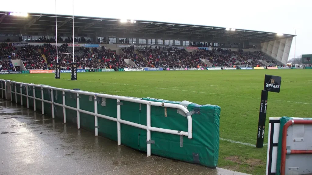
Kingston Park Stadium preserves an important recreational and sporting layer of the suburb’s history. The site began as the Newcastle Chronicle and Journal sports ground, was bought by Gosforth Rugby Football Club in 1989, and developed into a major rugby venue during the 1990s.
Sport became an important part of Kingston Park’s identity during the late twentieth century. The stadium site was originally used as the Newcastle Chronicle and Journal Sports Ground.
Historic England’s archive records that Gosforth Rugby Football Club purchased the site in 1989. The club subsequently developed the ground through the 1990s, adding stands, terraces and clubhouse facilities.
Newcastle’s Historic Environment Record provides additional detail. It records the purchase by Gosforth Rugby Football Club for £55,000 in 1989, the opening of a new stand and clubhouse in 1990, and later redevelopment that increased the stadium’s capacity to approximately 10,000.
The sporting history continued through changes in club identity. Gosforth became Newcastle Falcons, while the ground hosted different forms of professional and semi-professional sport.
During the 1990s, Newcastle United reserve fixtures were played at Kingston Park. Between 2007 and 2009, Newcastle Blue Star also shared the ground. These uses demonstrate the stadium’s broader role as a multi-sport facility rather than a single-purpose venue.
The stadium is historically significant because it represents a different aspect of suburban development. Housing and retail created the everyday structure of Kingston Park, while sport created a regional destination within the same neighbourhood.
The site’s continued use also preserves a physical connection with the suburb’s late twentieth-century development. Although individual buildings and stands have changed, the sporting function remains associated with Kingston Park.
How has Kingston Park changed as Newcastle expanded northwards?
Kingston Park’s present character results from late twentieth-century housing, planned retail, Metro investment, community infrastructure, and nearby urban expansion. Its historical significance lies in showing how Newcastle’s northern edge changed from peripheral land into a connected suburban district today.
Kingston Park did not develop in isolation. Its later history is closely connected with Newcastle Great Park, surrounding employment areas, changes in retail provision and increasing pressure on transport infrastructure.
Newcastle Great Park began construction in 2001, more than two decades after Kingston Park’s principal development period. The contrast between the two communities demonstrates the continuing outward expansion of Newcastle’s northern urban area.
The scale of later development has created new infrastructure requirements. Newcastle City Council identified thousands of additional homes in Great Park and surrounding areas when planning transport improvements around Kingston Park Road and the A1.
Retail planning has also adapted. Kingston Park District Centre remains part of Newcastle’s retail hierarchy, while surrounding retail parks provide larger units and different commercial functions. Council planning documents distinguish these locations according to their scale, access and relationship with the district centre.
Transport remains the strongest historical link between past development and present life. The Metro station opened in 1985. The airport extension followed in 1991. Later road improvements responded to additional residential growth. Each stage altered how Kingston Park connected with the rest of Newcastle.
The neighbourhood’s historical value therefore lies in its clear representation of planned suburban growth. Its story begins with land beyond the established urban core and continues through housing construction, public transport investment, community facilities, retail development and further expansion around it.
Kingston Park also provides a useful case study for understanding twentieth-century urban planning in Newcastle. Its streets and facilities demonstrate how a new suburb was structured around daily needs rather than around the historic street patterns found in older parts of the city.
The surviving railway corridor provides another layer of historical continuity. The Metro route follows infrastructure associated with earlier railway development, while the modern station introduced a new transport function to a rapidly developing residential area.
The area consequently contains several chronological layers: older rural land use, industrial development in the wider district, early railway infrastructure, twentieth-century suburban construction, Metro expansion, retail development and twenty-first-century growth nearby.
For historians and heritage researchers, this layered development is more significant than any single building. Kingston Park demonstrates how Newcastle’s urban boundary has repeatedly changed in response to housing demand, transport investment, economic activity and planning policy.
For residents, those historical processes remain visible in practical ways. The Metro provides regional connections. Kingston Park District Centre supplies everyday shopping. Kingston Park Primary School supports local education. Community parks provide recreation. The stadium maintains the area’s sporting role.
For visitors, the suburb provides a different perspective on Newcastle’s history. Its significance is not concentrated in medieval buildings or monumental Victorian architecture. Instead, its heritage appears through infrastructure, neighbourhood planning, railway reuse, community facilities and the physical organisation of a late twentieth-century residential district.
Kingston Park’s story also remains unfinished. Nearby development continues to change the northern edge of Newcastle, while the Metro network is undergoing its own technological transition. Nexus has introduced new Class 555 trains as the original Metro fleet reaches the end of its service life, preserving the system’s transport function while changing its physical technology.
The historical record therefore places Kingston Park within a much wider pattern of Newcastle’s urban development. It shows how a landscape on the edge of the city became a planned residential community and how transport, retail, education, recreation and further housing growth subsequently reinforced that transformation.
Kingston Park is best understood as a product of modern Newcastle rather than as an isolated housing estate. Its history connects older northern Newcastle landscapes with late twentieth-century planning and twenty-first-century urban expansion. The result is a neighbourhood where shops, Metro services, schools, parks and family infrastructure are all part of the historical development of the place.
For Newcastle Times, Kingston Park offers a useful example of how local history extends beyond listed buildings. The suburb’s heritage survives through streets, railway corridors, community facilities, retail centres, sports grounds and the continuing relationship between housing and transport. Its everyday landscape records the modern expansion of Newcastle upon Tyne.