Denton Burn and West Denton are neighbouring residential areas in west Newcastle upon Tyne with different historical development patterns. Denton Burn retains stronger evidence of Roman, medieval and industrial landscapes, while West Denton reflects planned post-war estate development, schools and modern suburban expansion.
- What is the historical difference between Denton Burn and West Denton?
- How did Denton Burn develop before modern housing?
- When did Denton Burn become a residential suburb?
- Why did West Denton expand so rapidly after the Second World War?
- What types of houses are found in Denton Burn and West Denton?
- Which area has the stronger Roman heritage?
- How did coal mining influence Denton Burn and West Denton?
- How do the schools in Denton Burn and West Denton compare?
- How does transport differ between Denton Burn and West Denton?
- How have roads and public transport shaped the two neighbourhoods?
- What historic buildings and landscapes survive in Denton Burn?
- How has West Denton changed since the original estate was built?
- What should visitors know about the historical character of both areas?
- What does the Denton Burn and West Denton comparison reveal about Newcastle’s urban history?
What is the historical difference between Denton Burn and West Denton?
Denton Burn developed from an older rural and industrial landscape shaped by Hadrian’s Wall, coal mining, farms and the Denton Burn watercourse. West Denton developed mainly through twentieth-century suburban expansion, particularly post-war council housing and planned residential estates.
The distinction begins with chronology. Denton Burn belongs to the wider historic Denton landscape, which existed long before modern Newcastle housing estates. The name Denton refers to a settlement associated with a valley, while Denton Burn is the watercourse that runs through the landscape.
The Tyne and Wear Historic Environment Record identifies Denton Burn as a stream running west of, and roughly parallel with, Silver Lonnen and Denton Road before passing through Denton Dene towards the River Tyne at Scotswood. Parts of the burn were culverted during the twentieth century.
West Denton developed on a different timetable. Newcastle City Council’s character assessment describes the wider north-west part of the city as changing during the twentieth century from an agricultural landscape containing villages, farms and industrial workings into a built-up urban area. West Denton was one of the major post-war council estates in this transformation.
This difference remains visible in the built environment. Denton Burn contains older roads, archaeological remains and surviving historic structures alongside twentieth-century houses. West Denton contains a more deliberately planned suburban pattern associated with post-war housing, community facilities and later residential changes.
The two areas therefore share geography but not identical historical origins.
How did Denton Burn develop before modern housing?
Denton Burn began as part of a wider rural Denton landscape containing prehistoric evidence, Roman frontier remains, medieval landholding and later coal workings. Its transformation into an urban suburb followed Newcastle’s westward expansion, road building, industrial activity and twentieth-century house construction.
Archaeological evidence demonstrates that human activity around Denton predates the Roman period. The Tyne and Wear Historic Environment Record records a Bronze Age cremation burial discovered near Denton Hall in 1813 or 1814. Three short cists were identified, with one containing an urn or food vessel associated with the burial.
Roman history provides the area’s most prominent archaeological connection. Hadrian’s Wall crossed the Denton landscape during the second century AD. The frontier system extended approximately 73 miles across northern England and formed part of the Roman Empire’s northern defensive infrastructure. Historic England identifies surviving remains at Denton Burn as part of this World Heritage Site.
The Historic Environment Record documents sections of the wall between Benwell Hill and West Denton Hall. Archaeological investigations exposed surviving Roman fabric at several locations, while a 1987 investigation near Copperas Lane revealed 49 metres of wall before construction of the Western Bypass.
The landscape later became associated with medieval landholding and coal extraction. Research presented by the Newcastle branch of the Northumberland and Durham Family History Society records the manor as divided historically into East and West Denton. The Widdrington family, the Errington family and the Montagu family feature in the documented ownership history.
Coal changed the economic geography. The Historic Environment Record identifies Victorian coal workings at Denton Burn and a nineteenth-century quarry documented through Ordnance Survey mapping.
This industrial phase established a landscape that differed substantially from the later suburban streets.
When did Denton Burn become a residential suburb?
Denton Burn became substantially suburban during the late nineteenth and twentieth centuries as Newcastle expanded westward. Interwar and later housebuilding replaced farmland and older industrial land, while West Road, schools, services and public transport integrated the district into Newcastle.
Newcastle’s wider urban expansion created demand for residential land beyond the historic core. Denton Burn occupied an important position along West Road, connecting the city with settlements further west.
The Newcastle Character Assessment describes Denton Burn as predominantly suburban, with mostly standard private 1930s semi-detached houses and bungalows. It also records some 1970s housing and identifies East Denton Hall as an older element predating much of the surrounding built environment.
The architecture reflects this chronology. Brick construction, clay roof tiles, bay windows and semi-detached layouts dominate much of the interwar housing. These features correspond with the broader expansion of private suburban housing during the early twentieth century.
Public infrastructure reinforced the transition. Schools, shops, religious buildings, roads and community facilities developed around the expanding residential population.
The Denton Burn Hotel provides a useful surviving example of this suburban phase. Arrol’s acquired land on West Road and opened the Denton Burn Hotel in June 1937. The building was designed for a motor-oriented market, with bedrooms, landscaped grounds and later dining facilities.
Denton Burn therefore developed incrementally rather than emerging as one single planned estate.
Why did West Denton expand so rapidly after the Second World War?
West Denton expanded rapidly because Newcastle required large quantities of housing after the Second World War. The city developed major council estates in outer areas, including West Denton, while private housebuilding and improved transport extended Newcastle’s urban footprint.
The post-war housing shortage was a national issue. The Housing Act 1919, known as the Addison Act, had already established housing as a national responsibility and encouraged local authorities to build council homes. Newcastle City Council describes the legislation as a major foundation of municipal housing.
The post-1945 period intensified this process. Newcastle’s north-west character assessment records a series of large council estates built after the war, including West Denton, Blakelaw and Newbiggin Hall. It also identifies private estates constructed particularly during the 1950s to 1980s.
Academic research into Newcastle’s post-war housing development provides further context. A Durham University thesis records West Denton among the major council estates developed in the two decades following the Second World War. The estate housed miners and ex-miners from Northumberland coalfields as well as skilled workers from Newcastle’s West End.
This housing programme altered the area’s population geography. Families were relocated into purpose-built residential environments with roads, schools and community facilities designed around the new estates.
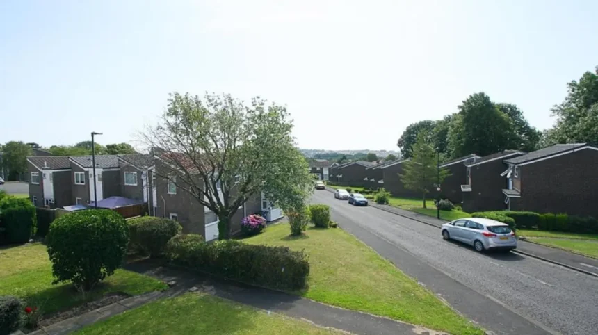
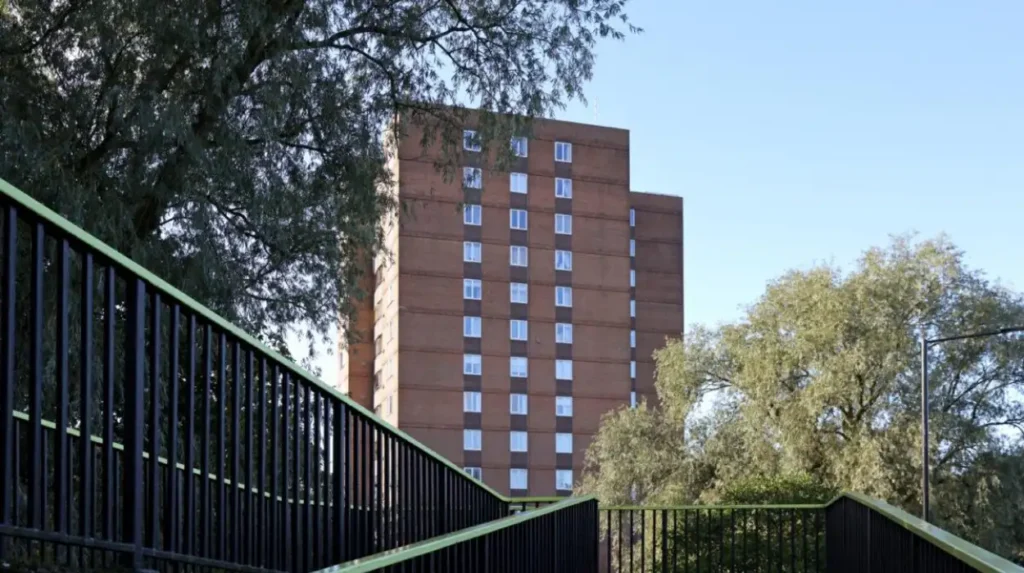
West Denton’s physical appearance reflects this planning history. The wider north-west Newcastle zone is characterised largely by low-rise, low-density housing, with brick construction and tiled roofs. The council assessment also records flats, maisonettes and some tower blocks within the wider zone.
The estate therefore represents a specific phase in Newcastle’s twentieth-century housing history.
What types of houses are found in Denton Burn and West Denton?
Denton Burn contains a substantial stock of interwar semi-detached houses and bungalows alongside later homes, while West Denton contains post-war estate housing, later private development and mixed residential forms. Their housing differences reflect separate periods of Newcastle’s suburban growth.
Denton Burn’s housing character is closely connected with interwar private development. Newcastle’s urban character assessment describes the area as dominated by 1930s semi-detached houses and bungalows, with some 1970s properties in the south-west.
The semi-detached form became common across Britain because it combined private gardens with relatively efficient land use. Denton Burn’s surviving streets demonstrate this suburban model.
West Denton’s housing stock reflects a different planning environment. Large areas were built through public-sector estate development after the Second World War. These schemes were designed around housing need rather than the incremental private development that shaped many interwar streets.
The distinction is not absolute. Both areas contain different property types because housing construction continued for decades. West Denton also experienced private development, while Denton Burn gained later twentieth-century housing.
The Newcastle Character Assessment records extensive refurbishment, improvement and demolition across council estates in the wider north-west zone. Private estates generally remained more physically stable apart from normal maturation and alteration.
For historical research, the construction period of an individual street is therefore more useful than assuming every property within a named district belongs to one housing phase.
Which area has the stronger Roman heritage?
Denton Burn has particularly visible Roman heritage because Hadrian’s Wall survives within the modern residential landscape. West Denton also contains archaeological evidence connected with the Wall, showing that the Roman frontier crossed both areas rather than stopping at Denton Burn.
Hadrian’s Wall is the defining archaeological feature of the comparison. Historic England records a surviving turret associated with the Wall at Denton Burn, located between Tree Drive and Brignall Gardens off the A186.
The wall itself was constructed during the reign of Emperor Hadrian in the second century AD. It formed part of a frontier system containing forts, milecastles, turrets, roads and other military infrastructure.
At Denton, the wall followed the high ground south of the modern West Road. Archaeological records document visible and buried sections, including the area around Denton Burn.
West Denton also has Roman archaeological evidence. Historic England published a 2001 archaeomagnetic report following evaluation excavations on the course of Hadrian’s Wall at West Denton. Excavators discovered a burnt clay surface interpreted as a possible Roman ground surface, although the scientific analysis could not securely date the firing event.
This evidence demonstrates an important historical point: modern neighbourhood boundaries do not correspond to ancient land divisions.
The Roman landscape extended across the wider area and has survived beneath and beside modern development.
How did coal mining influence Denton Burn and West Denton?
Coal mining influenced Denton Burn through extraction sites, land ownership and industrial transport, while West Denton was later shaped by housing demand generated by Newcastle’s industrial economy. The two areas therefore represent different stages of the region’s coal-related transformation.
Coal extraction formed part of Denton’s post-medieval economic history. The Historic Environment Record identifies a Denton Burn coal pit classified within the Victorian period.
Historical research also connects the Montagu family with coal exploitation in Denton. Edward Montagu developed mining activity by sinking new shafts, while his widow Elizabeth managed the family’s coal interests after his death.
Mining required transport infrastructure. Waggonways carried coal from pits towards markets and transport connections. The historical development of Denton Burn therefore involved more than underground extraction. Roads, tracks, settlements and industrial land were interconnected.
West Denton’s major transformation came later. Post-war estate construction placed housing on land at the urban edge and accommodated workers connected to Newcastle’s industrial economy. Academic research specifically records miners and ex-miners among West Denton’s early residents.
The relationship between mining and housing is therefore central to understanding the difference. Denton Burn retains physical evidence of extraction within an older landscape. West Denton demonstrates how post-war planning responded to the social consequences and labour requirements of an industrial region.
How do the schools in Denton Burn and West Denton compare?
Denton Burn has primary schools serving established residential streets, including Broadwood Primary School and St Bede’s Catholic Primary School. West Denton has West Denton Primary School and secondary-age provision including Studio West, alongside nearby schools serving the wider west Newcastle area.
School provision reflects the age and scale of residential development.
Broadwood Primary School is located on Broadwood Road in Denton Burn. Newcastle City Council lists it as a foundation school for children aged 3 to 11, with a published admission number of 60 and an attached nursery.
St Bede’s Catholic Primary School is located on Howlett Hall Road in Denton Burn. The council lists it as an academy serving pupils aged 4 to 11, with a published admission number of 30. Its listed feeder links include Sacred Heart Catholic High School for girls and St Cuthbert’s Catholic High School for boys.
West Denton Primary School is on Hillhead Road. Newcastle City Council lists it as an academy for children aged 3 to 11, with a published admission number of 45 and an attached nursery. Its listed feeder link is Walbottle Academy.
West Denton also has Studio West on West Denton Way. The council describes it as a studio school serving ages 11 to 19, with a published admission number of 100.
Admission figures change annually. Newcastle’s 2026 admissions information records West Denton Primary School among the schools included in the reception allocation process.
School proximity therefore depends on the exact street, catchment arrangements and school type rather than the neighbourhood name alone.
How does transport differ between Denton Burn and West Denton?
Denton Burn is strongly connected by West Road and local bus services, while West Denton is served by West Denton Way and several bus routes linking the estate with Newcastle, Chapel House, the Metrocentre and other north-west districts. Neither area has a local Metro station.
Road transport is fundamental to both neighbourhoods. West Road is classified as the A186, while West Denton Way is a local classified road within Newcastle’s highway network.
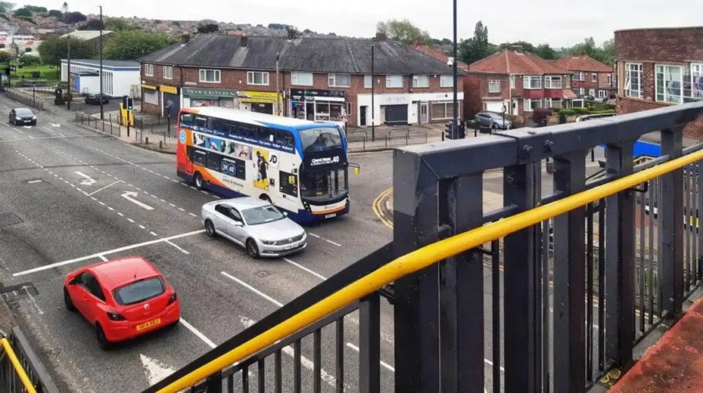
Denton Burn has a direct relationship with West Road, providing an east-west connection towards Newcastle city centre and westwards towards the outer districts.
Denton Burn Library illustrates this accessibility. Newcastle City Council states that the library sits on West Road near Hadrian’s Wall and is served by local bus routes in both directions.
West Denton is connected by bus routes operating along West Denton Way. Nexus timetable information lists services connecting West Denton Way and West Denton Shops with locations including Chapel House, Metrocentre Interchange and Lemington. Other services connect the area with Newcastle and wider north-east destinations.
The wider north-west Newcastle transport structure is also road-oriented. Newcastle’s character assessment identifies the A1 Western Bypass, A191 Silver Lonnen and B1306 Two Ball Lonnen as major north-south routes. East-west routes include the A186 West Road and A167/A696 Jedburgh Road.
The Metro network crosses the northern edge of the wider zone towards Kenton Bank Foot rather than providing a station within Denton Burn or West Denton.
How have roads and public transport shaped the two neighbourhoods?
Transport infrastructure helped convert both areas from peripheral settlements and farmland into connected suburbs. Denton Burn grew along established westward routes, while West Denton’s estate development depended on planned roads and public transport connections serving a larger post-war residential population.
Transport and housing developed together. Early suburban growth required reliable routes between residential districts and employment centres.
Denton Burn’s location beside West Road gave it a direct connection with Newcastle. The road also followed a historic corridor across the Roman frontier landscape, creating an unusual overlap between ancient infrastructure and modern transport.
West Denton emerged within a much more planned transport environment. Large post-war estates required internal roads, bus stops, schools and local services.
Newcastle’s character assessment explicitly connects the growth of north-west suburban areas with the introduction of public transport routes during the first half of the twentieth century. It identifies Fenham, West Denton, Kenton Bank Foot and Westerhope among places whose popularity and development benefited from these connections.
Modern transport continues to shape daily access. Bus services connect West Denton with several outer Newcastle districts, while Denton Burn’s position on West Road provides access to the city and surrounding communities.
The result is a suburban landscape where historical roads and twentieth-century transport networks overlap.
What historic buildings and landscapes survive in Denton Burn?
Denton Burn retains Roman wall remains, East Denton Hall, the historic burn, archaeological sites, West Road buildings and the twentieth-century West Road cemetery and crematorium. These surviving features provide physical evidence of successive Roman, rural, industrial and suburban phases.
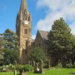
East Denton Hall represents an older architectural layer within the modern suburb. Newcastle’s character assessment identifies the hall and its large trees as predating most of the surrounding residential development.
The Roman frontier provides another layer. Sections of Hadrian’s Wall survive in visible or buried form around Denton Burn and West Denton.
The West Road cemetery and crematorium provide an important twentieth-century example. The crematorium opened in October 1934 at a cost of nearly £54,000. Architect J. J. Hill designed the building, which included a loggia, memorial tablets, a Garden of Remembrance and a Book of Remembrance.
The cemetery also contains a Second World War memorial with approximately 40 headstones and includes a Muslim burial area.
Denton Burn itself remains part of the area’s physical geography even where sections were culverted. Its route through Denton Dene towards the Tyne provides evidence of the pre-urban landscape.
These features are valuable for historical interpretation because they demonstrate that the modern suburb did not replace history completely. It incorporated parts of an older landscape.
How has West Denton changed since the original estate was built?
West Denton has evolved from a major post-war council estate into a mixed suburban district containing established housing, schools, community facilities, later redevelopment and continuing planning pressures around open land and residential demand.
Post-war construction established the basic physical framework of West Denton. Housing estates were built alongside schools, roads and community facilities.
The area’s history did not stop when the original houses were completed. Council estates across north-west Newcastle have undergone refurbishment, improvement and, in some locations, demolition. Newcastle’s character assessment records these changes across the wider zone.
Open space has also become part of planning debates. In 2020 Newcastle City Council reviewed proposals for a West Denton site near the community centre. The proposal involved 60 affordable homes and a specialist home for looked-after children. The council paused the process to reconsider options and engage with residents.
The site had previously been associated with West Denton Middle School playing fields. After the school became a primary school, part of the field was retained as open space. The council’s account shows how changes in educational provision affected land use within the estate.
This illustrates a continuing feature of planned suburbs: schools, recreation areas, housing and community facilities change together as population needs evolve.
What should visitors know about the historical character of both areas?
Denton Burn provides the clearest concentration of archaeological and historic evidence, particularly around Hadrian’s Wall and East Denton. West Denton provides stronger evidence of post-war planning, council housing and twentieth-century suburban expansion within Newcastle’s outer west.
For heritage researchers, Denton Burn offers a long chronological sequence. Prehistoric burial evidence, Roman frontier remains, medieval landholding, coal extraction, Victorian infrastructure and interwar housing all occur within the wider landscape.
West Denton is particularly important for studying twentieth-century social and architectural history. Its development demonstrates how Newcastle responded to post-war housing shortages and how large estates accommodated workers from industrial communities.
Newcastle City Council’s West Newcastle Picture History Collection also preserves photographs and documents covering Denton Burn and neighbouring districts. The collection contains more than 20,000 photographs and documents relating to the history and heritage of west Newcastle from the nineteenth century to the present.
To explore the area’s surviving attractions and local landmarks, consult our comprehensive for itineraries and visiting information.
This connection between archival research and physical places is important. Streets, schools, archaeological remains and public buildings allow researchers to compare historic maps with the modern landscape.
What does the Denton Burn and West Denton comparison reveal about Newcastle’s urban history?
Denton Burn and West Denton demonstrate two connected stages of Newcastle’s westward expansion: Denton Burn preserves a layered landscape shaped by Roman defence, rural settlement and industry, while West Denton records the planned post-war response to housing demand and urban growth.
The comparison is therefore historical as well as residential.
Denton Burn’s identity developed over many centuries. The Roman frontier established an early strategic landscape. Medieval landholding created administrative and agricultural structures. Coal extraction introduced industrial activity. Victorian and interwar expansion then converted much of the countryside into suburbia.
West Denton’s principal transformation occurred later. The post-war state required large housing programmes, and Newcastle developed West Denton as one of its major estates. Academic research connects its early residents with mining communities and skilled workers from the West End.
Housing remains the clearest physical expression of this difference. Denton Burn’s 1930s semi-detached streets represent private interwar suburban development. West Denton’s estate pattern represents large-scale post-war planning.
Schools also reveal different stages of growth. Broadwood and St Bede’s serve Denton Burn, while West Denton Primary School and Studio West form part of West Denton’s educational infrastructure.
Transport connects the two histories. West Road remains an important east-west corridor, while West Denton Way supports bus connections across the outer west and north-west of Newcastle.
For historians, genealogists and students, the two neighbourhoods provide a useful case study in urban change. Their streets show how ancient frontier infrastructure, agricultural land, industrial extraction, public housing, private development, education and transport became part of one continuously changing Newcastle landscape.
The distinction between Denton Burn and West Denton is therefore not simply a matter of house type or location. It reflects the different historical forces that produced modern west Newcastle.