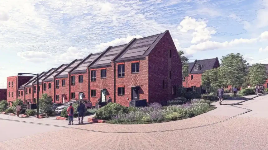
Benwell and Scotswood form a historically important part of Newcastle upon Tyne’s western urban area. The neighbourhoods combine Roman archaeology, Victorian industrial expansion, interwar council housing, post-war redevelopment and a major 21st-century regeneration programme.
- What is the history of Benwell and Scotswood?
- How did industrialisation change Benwell and Scotswood?
- Why was the Scotswood regeneration programme created?
- How many homes are planned through the Scotswood regeneration?
- How has new housing affected property values in Scotswood?
- What is The Rise at Scotswood?
- What other housing developments are changing Benwell?
- How important is Benwell’s existing council housing?
- How is Newcastle City Council addressing housing conditions in Benwell?
- What role does heritage play in Benwell and Scotswood regeneration?
- How accessible are Benwell and Scotswood from Newcastle city centre?
- What is happening to local shopping and community facilities in Benwell?
- What factors will influence Benwell and Scotswood house prices?
- What is the long-term outlook for Benwell and Scotswood?
The area’s current housing market is closely connected to this long history. Regeneration has introduced new homes, brownfield redevelopment, improved public spaces, investment in older housing and new community facilities. At the same time, Benwell and Scotswood retain a substantial stock of older terraced housing and council-built estates.
Understanding future house prices therefore requires more than looking at recent transactions. It requires an understanding of the area’s regeneration framework, housing supply, transport connections, employment geography, heritage assets and the long-term transformation of the west end of Newcastle.
What is the history of Benwell and Scotswood?
Benwell and Scotswood developed from Roman frontier settlement and rural estates into industrial and residential districts shaped by Newcastle’s expansion, with their modern form reflecting Victorian industry, 20th-century council housing and major regeneration programmes.
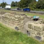
Benwell has roots extending back to the Roman period. The Roman fort of Condercum occupied a strategic position on Hadrian’s Wall. The fort was constructed around AD 122–124 and covered approximately 5.6 acres. Archaeological evidence records occupation into the fourth century.
The Roman landscape included more than military buildings. A temple dedicated to Antenociticus, a local deity, stood close to the fort. English Heritage dates the construction of the temple to approximately AD 178–180. Three altar inscriptions provide evidence of the religious activity associated with the site.
The Roman frontier remains important to the modern identity of Benwell because sections of Hadrian’s Wall and its associated archaeological remains survive beneath and around later development. The Benwell fort itself is designated as a Scheduled Monument.
Scotswood followed a different historical trajectory. Newcastle City Council’s character assessment records Scotswood as a medieval deer park of about 200 acres. It was enclosed in 1367 by Richard Scot, a wealthy merchant and landowner.
During the Victorian period, the landscape changed rapidly. Industrial development concentrated along the River Tyne while housing expanded onto the surrounding slopes. Terraced houses were built for industrial workers, while larger Victorian villas served wealthier residents.
This combination of industrial employment and dense housing created the physical pattern that still influences property values. Much of the older housing stock survived, while other properties and industrial sites were later demolished as economic conditions changed.
How did industrialisation change Benwell and Scotswood?
Industrialisation transformed Benwell and Scotswood by replacing agricultural land with factories, workers’ housing, transport infrastructure and expanding streets, creating the dense urban environment that later regeneration programmes were designed to restructure.
The industrialisation of Newcastle concentrated economic activity around the River Tyne. Scotswood’s location close to the river made it part of the wider industrial landscape, while Benwell became increasingly connected to Newcastle through expanding roads and residential development.
Housing demand followed employment. Terraced properties provided relatively dense accommodation for industrial workers. This housing pattern became a defining feature of Newcastle’s west end.
The contrast between industrial land, workers’ terraces and larger Victorian houses also created a socially varied neighbourhood. Newcastle’s historic character assessment identifies substantial Victorian villas in Benwell, including Pendower Hall and Benwell Towers, although several large estates were later reduced, redeveloped or demolished.
The industrial economy subsequently declined. Manufacturing employment reduced, older industrial premises became redundant and sections of housing experienced physical decline.
These changes established the conditions that eventually led to comprehensive regeneration. The issue was not simply a shortage of houses. It involved housing quality, tenure, employment, public realm, land use, infrastructure and the relationship between residential areas and former industrial sites.
Why was the Scotswood regeneration programme created?
The Scotswood regeneration programme was created to address housing-market decline, replace obsolete housing and regenerate a large brownfield area through new homes, infrastructure, community facilities and improved environmental conditions.
Large-scale regeneration in Scotswood developed from concerns about declining housing demand and the condition of the existing built environment.
A major milestone came with the Scotswood masterplan. Urban Initiatives records that Newcastle City Council commissioned a regeneration framework covering a 60-hectare site, with a long-term plan for approximately 1,800 new homes. The masterplan work took place between 2005 and 2009.
The plan used a plot-based approach intended to allow different architectural solutions while maintaining an overall neighbourhood structure. It incorporated housing, transport, environmental assessment and community considerations.
The Benwell Scotswood Area Action Plan was adopted in 2009. Newcastle City Council describes it as the spatial planning framework for regeneration across Benwell, Scotswood and the West Road neighbourhoods, covering the period from 2009 to 2024 and beyond.
The regeneration programme therefore represented a long-term restructuring of the housing market rather than a single development project.
Its objectives included improving the physical environment, supporting new housing and coordinating public and private investment.
How many homes are planned through the Scotswood regeneration?
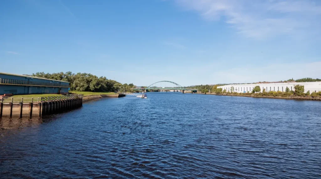
The Scotswood masterplan established an ambition for approximately 1,800 new homes across a 60-hectare regeneration area, making housing delivery one of the central mechanisms for restructuring the neighbourhood and its long-term property market.
The scale of the masterplan is important when assessing future house prices.
A development of 1,800 homes introduces substantial new housing supply. It also changes the range of properties available to households, including modern family homes with contemporary layouts, energy standards and private outdoor space.
The regeneration framework was designed around a new neighbourhood rather than an isolated housing estate. The masterplan incorporated public spaces, transport considerations, environmental improvements and community infrastructure alongside residential development.
The New Tyne West Development Company was subsequently established as a partnership involving Newcastle City Council and private-sector development interests. Government documentation records the ambition for 1,800 new homes and a new neighbourhood centre on the 60-hectare site over a long-term delivery period.
Delivery has continued in phases rather than through one construction programme.
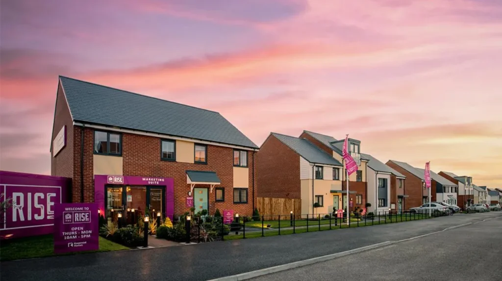
The Rise at Scotswood represents a major component of this regeneration. A 2025/26 annual report from Keepmoat describes the wider project as a £265 million regeneration scheme that began in 2013, with more than 500 homes delivered at the time of the report and an ultimate ambition of 1,800 family homes.
This phased approach matters for the housing market because new supply enters the area gradually.
How has new housing affected property values in Scotswood?
New housing has expanded the range of properties available in Scotswood, introduced modern family housing and helped reposition previously declining land, while established streets continue to contain older properties with different prices and tenure characteristics.
House prices in Scotswood cannot be represented by one figure because the neighbourhood contains different property types, ages and tenure arrangements.
The existing market includes traditional terraces, semi-detached properties, council housing, converted accommodation and newer homes. Regeneration has added modern family housing to this mix.
Current transaction data provides evidence of individual sales rather than a single regeneration premium. For example, HM Land Registry data published through Rightmove records a semi-detached property on Armstrong Road selling for £224,995 in July 2025. The underlying transaction data covers registered sales through May 2026.
Individual transactions should not be treated as a complete market average. Property condition, size, tenure, garden provision, parking, street location and construction date all influence sale prices.
The significance of regeneration lies in the wider market structure. New developments create a modern price reference for the neighbourhood while investment in surrounding infrastructure can improve the attractiveness of existing streets.
At the same time, a large supply of new properties can limit rapid price escalation if buyers have many comparable homes to choose from.
What is The Rise at Scotswood?
The Rise is a major phased housing development within the Scotswood regeneration programme, combining new family homes with community investment, sustainability measures and planned neighbourhood facilities on land previously affected by industrial decline.
The Rise represents the physical transition from regeneration planning to completed residential development.
The wider Scotswood site experienced extensive demolition following industrial decline. Keepmoat’s account records large-scale demolition in 2002 before the regeneration programme moved into its development phase.
The project began construction activity in 2013 under the partnership framework involving Newcastle City Council and the New Tyne West Development Company.
Its long-term housing target is approximately 1,800 family homes. More than 500 had been delivered according to the developer’s 2025/26 reporting.
The development also includes sustainability infrastructure. A combined heat and power plant provides heating and hot water for residents, according to the developer’s published project information.
Community investment forms another part of the programme. The project includes plans for a neighbourhood centre with facilities including a convenience store and health provision. It has also supported employment and apprenticeship initiatives.
These facilities are relevant to future property values because residential regeneration depends on more than the construction of houses.
What other housing developments are changing Benwell?
Benwell is experiencing additional housing investment beyond the Scotswood masterplan, including brownfield redevelopment and new rental housing that adds modern accommodation while reusing previously developed land within Newcastle’s western urban area.
One notable project is Benwell Dene, a 146-home build-to-rent neighbourhood.
The scheme is being developed by Placefirst on a 2.75-hectare brownfield site that had remained vacant for more than a decade. Planning permission was granted before construction began in 2024. The development provides two-, three- and four-bedroom rental homes.
The project illustrates another mechanism of regeneration: brownfield land reuse.
Instead of extending Newcastle’s urban footprint into undeveloped countryside, brownfield development brings vacant or previously developed land back into residential use.
This approach also diversifies the housing market. The presence of professionally managed rental housing gives households an alternative to traditional private rented terraces and owner-occupied properties.
Scotswood has also received specialist housing investment. Newcastle City Council developed 45 wheelchair-standard apartments and nine bungalows for older people as part of its housing programme.
The council described the Scotswood development as providing high-quality homes with views towards the River Tyne, alongside facilities designed to support community activity.
How important is Benwell’s existing council housing?
Council housing remains an important part of Benwell’s built environment, with estates such as Pendower demonstrating how Newcastle’s interwar housing policies shaped the neighbourhood and continue to influence its housing stock and regeneration needs.
Pendower Estate provides an important historical example.
Newcastle Corporation purchased the 60-acre Pendower Estate in 1919 for £37,500. The council intended to use 45 acres for housing, with the remaining land allocated to educational purposes and community uses.
The first houses were constructed under the Housing, Town Planning, etc. Act 1919, commonly associated with the Addison Act.
The early Pendower development followed the Garden Suburb model. Approximately 150 houses formed the first stage, and the first tenants moved into their homes at the end of 1922. By completion in 1931, 589 council houses had been built across the estate.
This historical housing programme demonstrates that public investment in Benwell housing is not a recent development.
The architecture and layout also distinguish Pendower from the tighter Victorian terraces elsewhere in the west end.
Today, maintaining older council housing, improving energy performance, managing public spaces and addressing building safety form part of the wider housing policy environment.
How is Newcastle City Council addressing housing conditions in Benwell?
Newcastle City Council is using property licensing, estate management and neighbourhood investment to improve housing conditions, particularly where privately rented properties require stronger management and older residential areas need environmental improvement.
Housing quality remains a central part of regeneration.
In 2025, Newcastle City Council carried out a major engagement and clean-up initiative around the Benwell Terraces. More than 100 residents allowed council teams into their homes during the programme, helping identify properties requiring follow-up support.
Selective licensing is another mechanism.
The council uses selective licensing under the Housing Act 2004 to regulate privately rented properties in designated areas where housing conditions and neighbourhood problems require intervention. A new licensing scheme includes parts of Benwell, including Howdene Road and sections of Howlett Hall Road, Ravenburn Gardens and Swinley Gardens.
Licensing does not directly determine sale prices. Its influence is connected to property standards and neighbourhood management.
Improved property condition reduces the contrast between neglected and renovated housing. Over time, stronger management can support a more stable residential environment.
The council also operates estate walkabout programmes covering Scotswood, Pendower Estate and other west Newcastle neighbourhoods.
What role does heritage play in Benwell and Scotswood regeneration?
Heritage gives Benwell and Scotswood a distinctive historical identity, with Roman remains, medieval landscapes, Victorian buildings and interwar housing providing physical evidence that regeneration must integrate with an established historic environment.
Benwell’s archaeological significance is particularly strong.
The former Condercum fort formed part of Hadrian’s Wall frontier. The fort itself is no longer visible above ground in its complete Roman form because later development covered much of the site. A reservoir occupies part of the northern area, while 20th-century housing covers much of the southern section.
The Roman temple dedicated to Antenociticus remains visible within the modern residential environment. English Heritage identifies it as part of the civilian settlement outside the fort.
Scotswood also retains archaeological evidence associated with Hadrian’s Wall. Historic England lists sections of the wall and vallum in the Scotswood area as Scheduled Monuments.
This heritage environment creates planning constraints but also provides cultural value.
For visitors seeking to understand how the area’s Roman, industrial and residential history connects with its present-day landscape, [Insert Anchor Text for Things to Do Article Here] provides a suitable visitor-focused route through the area’s attractions and historic sites.
Heritage protection therefore forms part of the long-term regeneration equation rather than existing separately from housing development.
How accessible are Benwell and Scotswood from Newcastle city centre?
Benwell and Scotswood are established western neighbourhoods within Newcastle’s urban area, with West Road, local bus routes and connections towards the city centre forming important parts of their accessibility and housing-market context.
West Road is one of the principal transport corridors through Benwell and the wider west end.
Its importance is historical as well as modern. The route follows the approximate alignment of Hadrian’s Wall across parts of Benwell, illustrating how ancient infrastructure and modern urban movement overlap in the area.
The neighbourhood’s proximity to central Newcastle gives it a different market position from more peripheral settlements.
Residents can access the city centre while living in an area characterised by lower-density sections, established residential streets, green spaces and riverside views.
Scotswood’s position near the River Tyne also creates distinctive environmental characteristics.
Accessibility alone does not determine house prices. Buyers consider journey times alongside property condition, schools, local services, parking, neighbourhood environment and housing type.
Future improvements to streets, public spaces and local facilities can therefore reinforce existing accessibility advantages.
What is happening to local shopping and community facilities in Benwell?
Local regeneration increasingly combines housing investment with high-street and community improvements, including work around Adelaide Terrace designed to strengthen business activity, public spaces and the future function of Benwell’s local centre.
Housing regeneration is more sustainable when residents have access to everyday services.
Newcastle City Council has extended its high-street improvement approach to Adelaide Terrace in Benwell. The programme works with local partners to re-energise the high street and plan for its future development.
This matters because the condition of local shopping streets contributes to the practical attractiveness of residential areas.
The relationship between housing and high streets is particularly important in established neighbourhoods. Residents need shops, services and community facilities within reasonable reach, while businesses benefit from a stable local population.
The Scotswood regeneration programme also includes a planned neighbourhood centre, providing another example of community infrastructure being incorporated into housing development.
These projects indicate that regeneration is being approached as neighbourhood restructuring rather than simply housebuilding.
What factors will influence Benwell and Scotswood house prices?
Future house prices will depend on housing supply, property quality, regeneration delivery, local services, employment access, borrowing conditions and buyer demand, with new development creating both investment opportunities and additional competition between properties.
The first factor is housing quality.
New homes generally offer modern layouts, newer building standards, contemporary insulation and lower maintenance requirements than many older properties. This creates a distinct segment within the local market.
The second factor is supply.
The Scotswood regeneration target of approximately 1,800 homes represents a substantial increase in housing provision. New supply gives buyers greater choice and can moderate price pressure if construction continues at scale.
The third factor is neighbourhood improvement.
Better-managed private rentals, improved public spaces, local shopping investment and new community facilities can strengthen the wider residential environment.
The fourth factor is employment access.
Benwell and Scotswood benefit from their location within Newcastle’s established urban area. Access to employment in central Newcastle and the wider Tyneside economy remains relevant to housing demand.
The fifth factor is heritage.
Roman monuments and historic buildings create a distinctive local identity. Protected archaeological sites also impose development requirements, ensuring that regeneration is managed within a historic landscape.
What is the long-term outlook for Benwell and Scotswood?
The long-term outlook is defined by continued housing delivery, brownfield redevelopment, neighbourhood management and infrastructure investment, with the regeneration programme gradually shifting the area from housing-market decline towards a more diverse and modern residential market.
The regeneration of Benwell and Scotswood is a long-term process.
The original masterplan established a framework for approximately 1,800 homes across 60 hectares. Delivery has already produced new housing and supporting infrastructure, while further development remains part of the area’s regeneration trajectory.
The Rise demonstrates the scale of the housing transformation. Benwell Dene demonstrates the role of brownfield rental development. Pendower demonstrates the continuing importance of older council estates. Adelaide Terrace demonstrates the connection between housing and high-street renewal.
Together, these projects create a more diverse housing market.
The future performance of individual properties will still vary. A renovated Victorian terrace, an interwar council property, a modern family house and a new rental home occupy different parts of the market.
Regeneration does not produce identical price outcomes across every street.
The strongest long-term indicator is the combination of physical investment and sustained demand. New homes, improved neighbourhood management, better community facilities, employment access and heritage protection collectively determine how the area develops.
Benwell and Scotswood therefore represent an important case study in Newcastle’s urban regeneration. Their history stretches from Roman frontier infrastructure through medieval landholding, Victorian industrialisation and 20th-century public housing to contemporary brownfield redevelopment.
The same geography that once supported Roman military control and later industrial employment now supports a large-scale residential renewal programme.
For house-price analysis, that historical continuity matters. Regeneration is not replacing the identity of Benwell and Scotswood with an entirely new district. It is restructuring an established urban neighbourhood while retaining archaeological monuments, historic housing, community institutions and long-standing street patterns.
The future outlook consequently depends on delivery over time. Continued construction, property improvement, local services and infrastructure investment will shape the next phase of Benwell and Scotswood’s housing market, while the area’s Roman and industrial heritage will remain an important part of its identity.