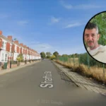
Blakelaw is a residential area in the western part of Newcastle upon Tyne. Its present identity comes from post-war housing development, but the area has a much older landscape history shaped by farming, coal mining, quarrying and transport routes. Today, Blakelaw combines established council housing, private homes, community facilities, green space and newer residential development.
- What is the history of Blakelaw in Newcastle?
- When did council housing become important in Newcastle?
- How did Blakelaw change during the twentieth century?
- What types of affordable housing are found in Blakelaw?
- Is Blakelaw connected to Newcastle’s wider housing strategy?
- What community facilities support everyday life in Blakelaw?
- How accessible is Blakelaw for Newcastle residents?
- What historic features remain in and around Blakelaw?
- What does Blakelaw’s housing history mean for affordability today?
- What should researchers consider when studying Blakelaw’s housing history?
- What is the long-term significance of Blakelaw for Newcastle housing?
The question of whether Blakelaw is worth considering for affordable housing requires more than a comparison of property prices. Housing tenure, the area’s development history, transport connections, community infrastructure, building types and current investment all contribute to its residential character.
Blakelaw also provides a useful example of how Newcastle expanded beyond its historic urban core during the twentieth century. The landscape changed from agricultural and industrial land into a planned residential district, while older traces of farming and mining remained within the wider area.
Newcastle City Council’s historical and planning records show that the district sits within a wider western urban zone characterised largely by low-rise housing, extensive green areas and twentieth-century development. The same planning evidence records former mining activity around Blakelaw and neighbouring districts.
What is the history of Blakelaw in Newcastle?
Blakelaw developed from a rural and industrial landscape into a planned residential district during Newcastle’s twentieth-century expansion, with earlier evidence including a Victorian farm, coal workings, quarrying, a smithy and transport connections associated with the surrounding mining landscape.
The name Blakelaw has a documented presence before the modern housing estate. Newcastle’s Tyne and Wear Historic Environment Record identifies Blakelaw as a farm shown on the first edition Ordnance Survey map of 1850. The recorded farm stood on land that later became part of the modern urban landscape. The historic record identifies the site as post-medieval and specifically Victorian.
Industrial activity also formed part of the area’s earlier history. The Historic Environment Record identifies Blakelaw Pit, a coal shaft, a quarry and a separate smithy and cottages. These records demonstrate that the landscape contained several different forms of nineteenth-century economic activity rather than functioning solely as farmland.
One recorded coal shaft was already described as “Old” on the first edition Ordnance Survey material, indicating that the working had probably ceased before the later nineteenth-century mapping period. The Historic Environment Record associates the shaft with documentary evidence from the 1864 Ordnance Survey map.
This industrial background connects Blakelaw with Newcastle’s wider coal economy. Coal extraction transformed much of the land west and north-west of Newcastle, while wagonways provided routes for moving coal towards the River Tyne and other destinations.
Newcastle City Council’s Character Assessment identifies coal mining at Blakelaw and Slatyford as part of this wider landscape. It records former wagonway connections and states that the area before rapid twentieth-century development contained agricultural and mining buildings.
The transformation into a residential area therefore represented a major change in land use. Fields, mining infrastructure and older rural buildings gradually gave way to planned streets, houses, flats, schools, community facilities and open spaces.
When did council housing become important in Newcastle?
Council housing became an important part of Newcastle’s residential history after the Housing Act 1919 established national support for municipal housebuilding, with later decades producing estates, flats and planned communities that reshaped districts across the city.
The Housing Act 1919, commonly called the Addison Act, established housing as a national responsibility and provided a major framework for local authority housebuilding. Newcastle City Council identifies the legislation as a foundational point in the history of council housing.
Newcastle’s first council houses associated with the 1919 programme were built at Pendower in the west and Walker in the east. The programme formed part of a national response to poor housing conditions following the First World War.
The city’s council-housing history subsequently expanded through different architectural and planning approaches. These included traditional houses, prefabricated homes, tower blocks, maisonettes and large planned estates.
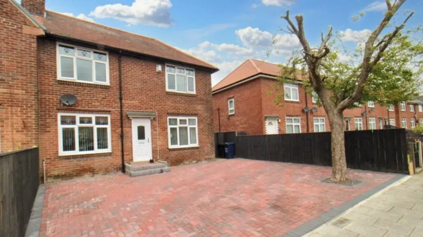
Blakelaw belongs to this broader history of municipal and planned residential expansion. Its housing stock includes low-rise properties alongside flats and taller buildings. Newcastle’s Character Assessment describes the wider western zone as predominantly low-rise and low-density, with brick houses and tiled roofs, while also recording three-to-five-storey flats, maisonettes and tower blocks in Blakelaw and neighbouring districts.
This mixture matters when examining affordability. A neighbourhood containing different building types provides a wider range of housing arrangements than an area dominated by one form of property.
Newcastle’s council-housing history also demonstrates why affordability cannot be separated from public policy. Social housing was created to provide secure accommodation for households unable to access suitable housing through the private market. Over time, ownership patterns changed through policies including Right to Buy, while new council and affordable housing programmes continued.
Newcastle City Council states that almost 28% of Newcastle’s population lived in council or social housing when the city marked the centenary of council housing, compared with 18% across England at that time.
How did Blakelaw change during the twentieth century?
Blakelaw changed most dramatically when Newcastle expanded residential development into former agricultural and industrial land, creating planned housing streets, community facilities, open spaces and larger apartment buildings during the city’s twentieth-century suburban growth.
The physical structure of Blakelaw reflects this transition. Earlier maps recorded farms, mining features and other rural buildings. Later development introduced a substantially different pattern based on residential streets and planned neighbourhood facilities.
The wider western Newcastle landscape experienced rapid twentieth-century development. Newcastle City Council’s Character Assessment describes the area before this expansion as containing agricultural and mining buildings, with Westerhope established as an early nineteenth-century settlement.
Residential expansion required supporting infrastructure. Schools, shops, community centres, roads and recreational spaces became essential parts of the new neighbourhood structure.
Housing design also changed. Traditional brick houses remained important, but blocks of flats and taller residential buildings appeared in parts of Blakelaw. Brockwell House provides a clear surviving example. Newcastle City Council records that Brockwell House was built in 1967 and contains 66 flats across 11 floors.
The building represents the high-rise phase of post-war housing development. Such buildings addressed housing demand by concentrating a larger number of homes on smaller sites than traditional low-rise estates.
Blakelaw’s modern housing landscape therefore contains evidence of several stages of twentieth-century planning. Low-rise houses, maisonettes, flats and later infill developments form part of the area’s architectural record.
The district’s housing history also reflects changes in standards. Modern housing programmes increasingly emphasise accessibility, energy performance, building safety and suitability for different household needs.
What types of affordable housing are found in Blakelaw?
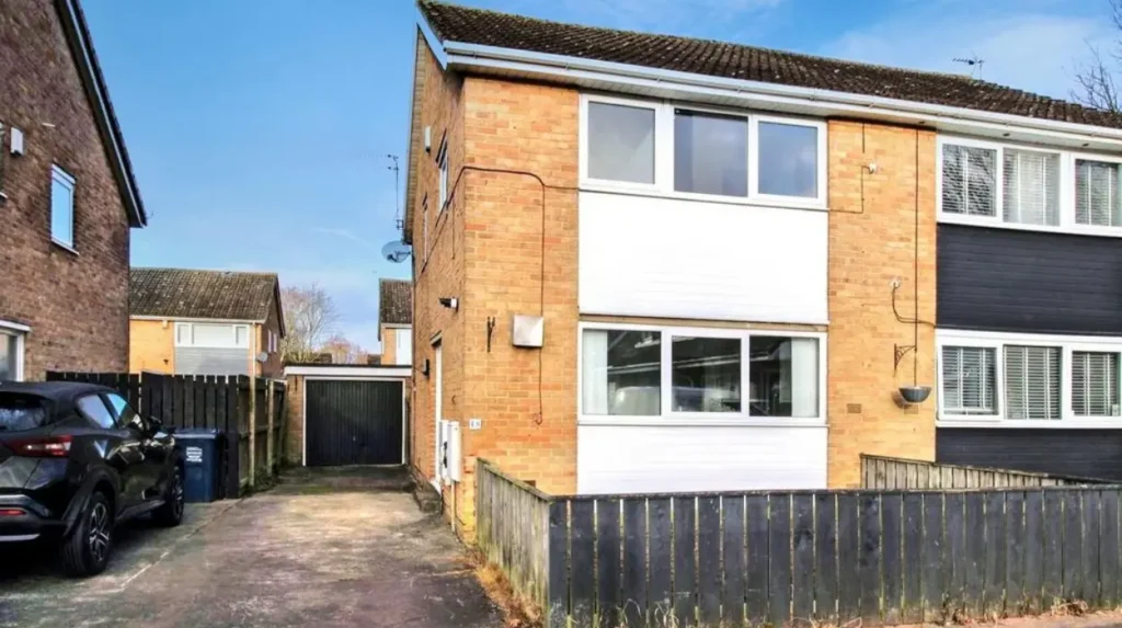
Affordable housing in Blakelaw includes social housing, council-associated accommodation, accessible homes and newer developments designed for specific household needs, alongside privately owned and privately rented properties within the wider residential area.
Housing tenure provides an important measure of Blakelaw’s residential structure. Newcastle City Council’s housing evidence recorded 43.2% of occupied housing in the Blakelaw ward as social housing, 34.8% as owner occupied and 22.0% as privately rented in the cited ward-level dataset.
Those figures come from the council’s published housing evidence and describe the ward at the time of that assessment. They should not be treated as a current 2026 property-market measurement.
The figures nevertheless demonstrate the significance of social housing within Blakelaw. The area has historically contained a substantial proportion of publicly provided housing compared with many Newcastle neighbourhoods.
Newer affordable developments have added different forms of accommodation. In 2021, Newcastle City Council reported the completion of 14 accessible homes at Wansfell Avenue. The development consisted of 10 two-bedroom bungalows and four two-bedroom Tyneside flats.
The homes were designed for older residents who did not require sheltered accommodation but wanted additional housing-management support. The development formed part of Newcastle’s Housing Plus – Community service.
This demonstrates how affordable housing provision has expanded beyond conventional family houses. Accessible bungalows, adapted homes and supported housing form part of the modern housing system.
For prospective residents, the distinction between social rent, affordable rent, shared ownership, private renting and open-market ownership remains important. These categories have different eligibility requirements, costs, legal arrangements and allocation mechanisms.
Is Blakelaw connected to Newcastle’s wider housing strategy?
Blakelaw remains part of Newcastle’s continuing housing strategy, with the city identifying the area for additional council housing and development as part of a wider programme designed to increase housing supply across Newcastle.
Housing development in Blakelaw has continued beyond the original estate-building period. Newcastle’s planning records identify several residential sites in the area, including brownfield land and developments associated with existing neighbourhood infrastructure.
A significant example is land south of Brockwell House. Government planning data records a 0.62-hectare brownfield site in Blakelaw with planning permission associated with accessible and adaptable houses for affordable rent. The site was identified as deliverable and owned by a public authority.
Newcastle’s housing-land assessments have also identified residential capacity around Blakelaw. A council assessment for land south of Brockwell House recorded an estimated capacity of 27 homes in its relevant housing-land schedule.
Another major site is the Springfield Centre and land around Blakelaw Road and Sunnyway. Council housing-land documentation recorded an estimated capacity of 308 homes for the 7.9-hectare site, with development progressing through planning and construction stages in the relevant assessment period.
The city’s current housing programme gives Blakelaw continued strategic importance. Newcastle City Council announced plans in 2026 for 15,000 homes across Newcastle, including council-housing developments in Blakelaw alongside projects in Walker, Elswick and Forth Yards. The programme also includes private development and affordable housing delivered through planning arrangements.
This continuing development gives Blakelaw a direct connection with Newcastle’s present housing policy rather than making it solely a legacy council estate.
What community facilities support everyday life in Blakelaw?
Blakelaw has established community infrastructure that includes a local centre, library provision, sports facilities, green space and housing services, giving the neighbourhood facilities beyond its residential streets and linking modern life with its planned-estate history.
Blakelaw Library operates within the Blakelaw Centre and provides access to books, children’s activities, information services and community support. Newcastle City Council describes the current service as a pop-up library located at Leisure United Blakelaw on Cragstone Avenue.
The library also provides access to Universal Credit support and children’s activities. Its services demonstrate the role of community facilities within a residential district where everyday services are concentrated locally.
Sport has also become part of the area’s regeneration. In 2022, work began on new sports-community facilities at Blakelaw Park and Bullocksteads Sports Ground. Newcastle City Council reported investment of more than £9.5 million from the Premier League, the Football Association and the Football Foundation for the two hubs.
Green-space investment has continued. In 2025, Newcastle City Council approved a £1.5 million programme covering four flagship play-space projects, including Blakelaw Park. The programme included accessible play equipment and sensory, audio and visual features.
These facilities are relevant to housing because residential affordability involves more than the cost of a property. Access to recreation, education, libraries, public space and community services affects the practical functioning of a neighbourhood.
For visitors researching the district’s physical environment and local history, consult our comprehensive for itineraries and visiting parameters.
How accessible is Blakelaw for Newcastle residents?
Blakelaw is connected to Newcastle through a network of major roads and local bus services, while the wider western area is served by routes including the A1 Western Bypass, Silver Lonnen, Two Ball Lonnen and connections towards Newcastle’s central districts.
Road transport has played an important role in the area’s development. Newcastle’s Character Assessment identifies the A1 Western Bypass, A191 Silver Lonnen and B1306 Two Ball Lonnen as major north-south routes serving the wider zone. East-west connections include the A186 West Road, A167/A696 Jedburgh Road and B6324 Stamfordham Road.
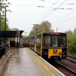
Public transport access is also part of the area’s residential infrastructure. The current Blakelaw Library information identifies a bus stop within 150 metres of the library venue. It lists Kingston Park as the nearest Metro station and Blaydon as the nearest National Rail station.
The area’s relationship with the road network has historical roots. Older mining activity was linked with wagonways, while modern roads later supported suburban expansion.
Accessibility therefore forms part of the long-term story of Blakelaw. Industrial transport infrastructure served coal extraction and movement. Later roads served housing estates and commuters. Current public transport connects residents with services beyond the immediate neighbourhood.
For people assessing affordable housing, transport costs should be considered alongside rent or mortgage payments. The practical cost of living depends on travel requirements, employment location, school journeys and access to services.
What historic features remain in and around Blakelaw?
Blakelaw retains archaeological and historic evidence of its agricultural and industrial past, including recorded farm sites, coal workings, a quarry, a smithy and surviving landscape traces associated with Newcastle’s former western mining districts.
The Tyne and Wear Historic Environment Record provides an important source for identifying these remains. Its Blakelaw entries include a farm, coal pit, coal shafts, quarry and smithy and cottages.
The former Blakelaw farm is especially important because its location appears on the first edition Ordnance Survey map from 1850. The Historic Environment Record states that the site is now occupied by a school field.
The former mining features show that the present residential district occupies a landscape with an earlier industrial identity. These sites are not simply historical names. They provide evidence for understanding how land use changed before the housing estate was created.
The wider western Newcastle landscape also contains historic buildings from earlier periods. Newcastle’s Character Assessment identifies St John’s Church, Whorlton, Fenham Hall and surviving farmhouses around locations including Kenton Bar, Blakelaw and Newbiggin Hall as evidence of the earlier landscape.
The area’s heritage therefore consists largely of archaeological records, landscape traces and surviving structures rather than a single monumental historic attraction.
This distinction is important for historical research. A neighbourhood’s heritage can survive through maps, place names, field boundaries, archaeological records and former industrial sites even when the original buildings have disappeared.
What does Blakelaw’s housing history mean for affordability today?
Blakelaw’s housing history explains why affordability remains closely connected with social housing, varied property types, brownfield development, public investment and access to services rather than relying on a single measure such as house prices.
Blakelaw’s housing stock developed through successive periods of public planning. Post-war construction created substantial residential capacity. Later programmes introduced accessible housing and redevelopment of previously used land.
The presence of social housing is particularly significant. Newcastle has historically maintained a comparatively large social-housing sector, and Blakelaw has formed part of that system. The council’s published ward-level evidence recorded 43.2% social housing in Blakelaw within the dataset cited above.
Affordable housing provision also depends on new construction. The brownfield site south of Brockwell House illustrates how previously developed land has been incorporated into modern housing plans. Government data records the site’s intended affordable-rent housing and public-authority ownership.
Accessibility is another part of affordability. The 14-home Wansfell Avenue development demonstrates investment in housing designed around the needs of older residents and accessible living.
Community investment adds another layer. Sports facilities, play areas, library services and local infrastructure reduce the need to treat housing as an isolated commodity. They form part of the wider residential environment.
The result is a neighbourhood where affordability has a strong historical connection with public housing policy. The present housing landscape reflects decisions made across more than a century, from the 1919 national council-housing programme to contemporary brownfield and council-housebuilding strategies.
What should researchers consider when studying Blakelaw’s housing history?
Researchers studying Blakelaw should combine historic maps, council planning documents, housing records, the Tyne and Wear Historic Environment Record and contemporary demographic evidence to distinguish the area’s rural, industrial, post-war and modern residential phases.
The Historic Environment Record is a starting point for archaeological and landscape research. Its entries provide site numbers, locations, historical periods, evidence types and documentary sources for former Blakelaw sites.
Historic Ordnance Survey maps are particularly useful for tracing changes in land use. The 1850 first edition map records the former Blakelaw farm, while later mapping can be used to follow the disappearance of agricultural and mining features and the emergence of modern housing.
Council planning documents provide a second layer of evidence. Housing-land assessments identify development sites, estimated capacities, planning status and infrastructure considerations. These documents reveal how land was evaluated for residential development.
Housing evidence provides a third layer. Tenure statistics help establish the balance between social housing, owner occupation and private renting at particular points in time. Such data requires a clear date because neighbourhood housing patterns change.
Building records also help identify surviving twentieth-century structures. Brockwell House, for example, has a documented construction date of 1967 and a recorded configuration of 66 flats over 11 floors.
Together, these sources create a chronological framework: Victorian agriculture and mining, post-war housing expansion, late twentieth-century estate changes, twenty-first-century regeneration and current housing development.
What is the long-term significance of Blakelaw for Newcastle housing?
Blakelaw demonstrates how Newcastle’s housing landscape developed through successive changes in land use, public policy and community infrastructure, making the district an important example of the city’s transition from industrial outskirts to established residential neighbourhood.
Blakelaw’s significance lies in the continuity of change visible across its landscape. The nineteenth-century record documents farming and coal-related activity. The twentieth century introduced planned residential development. The twenty-first century has added accessible homes, sports facilities, play-space investment and further housing proposals.
This sequence reflects Newcastle’s broader urban history. The city evolved from a Roman and medieval settlement into a major industrial centre and later into a diversified modern city. Newcastle City Council describes the city’s historical identity through its Roman frontier, Norman stronghold, medieval town and industrial development.
Blakelaw represents one part of that wider transformation. Its earlier mining landscape contributed to Newcastle’s industrial economy. Its post-war housing helped accommodate population growth and changing housing needs. Its current development demonstrates continuing pressure to provide suitable and affordable homes.
The area’s future historical record will therefore include both preservation and development. Existing structures such as Brockwell House document the post-war period, while archaeological records preserve evidence of the earlier landscape. New affordable homes and public facilities document the current phase of Newcastle’s housing policy.
For anyone examining affordable housing in Newcastle, Blakelaw provides a clear case study of how affordability, planning, public housing and local history intersect.
Its present character cannot be separated from its past. The former farm, coal workings, quarry and smithy belong to an earlier landscape. The council estate, flats, community facilities and modern housing schemes belong to later stages of urbanisation.
Blakelaw is consequently best understood as a layered residential district. Its housing history records the movement from rural and industrial land towards planned suburban development, while current investment continues to reshape the neighbourhood within Newcastle’s wider housing strategy.