Chapel House and Westerhope are neighbouring areas in the western part of Newcastle upon Tyne, but they developed from different historical foundations. Chapel House is primarily a planned twentieth-century suburb built from the 1960s, while Westerhope has a documented village history reaching back to nineteenth-century planned settlement, agriculture, coal mining and earlier rural land use.
- How did Chapel House and Westerhope develop?
- What was Chapel House like before the modern estate was built?
- When was Chapel House Estate built?
- Why is Westerhope historically different from Chapel House?
- How did coal mining shape Westerhope?
- How did twentieth-century planning connect Chapel House with Westerhope?
- What architectural differences can be seen between Chapel House and Westerhope?
- How did transport influence both NE5 areas?
- What schools and community institutions reveal about the two areas?
- What historic evidence survives in Westerhope and Chapel House?
- What does the history of Chapel House and Westerhope tell us about modern NE5?
Their modern identities reflect these different origins. Chapel House belongs to the wave of post-war private suburban development that expanded Newcastle beyond its older urban districts. Westerhope combines a historic village core with industrial-era housing, former mining landscapes and later suburban expansion. Understanding that distinction provides a useful framework for comparing the two NE5 areas today.
How did Chapel House and Westerhope develop?
Chapel House developed mainly as a planned private housing estate from the 1960s, while Westerhope developed earlier as a planned working community and later expanded through coal mining, village growth and twentieth-century suburban housing. Their contrasting origins remain visible in their built environments today.
The history of both places is connected to Newcastle’s westward expansion. Newcastle upon Tyne grew rapidly during the Industrial Revolution, creating demand for housing beyond the dense central districts. Newcastle City Council records the city’s wider transformation from an industrial centre into an expanding modern city, with population growth, engineering, coal-related industries and large-scale twentieth-century development reshaping surrounding settlements.
Westerhope’s modern foundation is particularly distinctive. Newcastle’s Historic Environment Record states that the Northern Allotment Society was formed in 1890. Its purpose included promoting fruit growing, flowers and smallholdings for educational and practical purposes. Land from Red Cow Farm was subsequently acquired and divided into lots where working men could establish houses and smallholdings.
The Red Cow Estate was named Westerhope in 1895–96. The name reflected the founders’ stated intention of moving west from Newcastle’s crowded streets and creating a new community. Joseph Wakinshaw was an important figure in this process and became closely associated with the development of Westerhope.
Chapel House followed a very different development pattern. Its older landscape was agricultural, and Chapel House Farm provides the historical connection behind the modern name. Academic research records the farm under the name Chapel-on-the-Hill or Chapel House Farm from at least 1559. The farm was later sold as a development site in 1953, before the modern estate was constructed.
This difference is fundamental. Westerhope began as a planned community for working people at the end of the nineteenth century. Chapel House emerged as a planned suburban estate during the expansion of Newcastle after the Second World War.
What was Chapel House like before the modern estate was built?
Before the twentieth-century estate appeared, Chapel House was associated with Chapel House Farm, a long-established agricultural property whose documented name dates to at least 1559 and whose land was later transformed into one of Newcastle’s major private suburban developments.
The history of Chapel House therefore extends much further back than its familiar residential architecture suggests.
Academic research into Newcastle’s settlement and buildings identifies Chapel-on-the-Hill or Chapel House Farm as the earliest named farm associated with the area. Documentary evidence places the name at least as early as 1559. The farm stood north of the historic turnpike road, close to the wider Walbottle and West Denton landscape.
The farm was connected with prominent regional landholding families. The Errington family of Denton Hall and the Fenwick family of Kenton leased the property from the lord of the manor. This places Chapel House within the agricultural and estate-based landscape that preceded modern Newcastle’s suburban expansion.
The site also sits within a much older archaeological landscape. Heritage records identify Milecastle 9, a Roman fortification associated with Hadrian’s Wall, close to Chapel House Farm. Excavations in 1929 identified a gateway, masonry and sections associated with the Roman military road. Coins including examples from the reigns of Valentinian I and Tetricus were also recorded.
The archaeological evidence is important because it places the Chapel House area within the wider Roman frontier landscape of northern Britain. Newcastle City Council identifies Hadrian’s Wall and the Roman settlement of Pons Aelius as fundamental elements of the region’s ancient history.
Chapel House therefore represents several chronological layers. The farm belongs to the medieval and post-medieval agricultural landscape, the nearby Roman remains belong to the second-to-fourth-century frontier system, and the present residential estate belongs largely to the twentieth-century suburban period.
When was Chapel House Estate built?
Chapel House Estate was developed from the 1960s, with construction beginning in 1964 and continuing into the early 1970s. The estate was planned primarily as private housing and formed part of Newcastle’s large westward suburban expansion after the Second World War.
The modern Chapel House Estate is associated with developer and designer John T. Bell and dates principally from 1964 onwards. Available historical records describe the estate as a private residential development approximately five miles from Newcastle city centre.
Its development reflected wider changes in British housing after 1945. Rising household expectations, increased car ownership, demand for private gardens and the expansion of urban populations encouraged new suburban housing.
Research into Newcastle’s post-war settlement history shows the importance of Chapel House within this wider process. A Durham University study records that private housebuilding after the Second World War was particularly extensive around Chapel House, with almost 3,000 private homes completed in the wider Newburn study area between 1945 and 1966 and Chapel House described as the location of an entire new suburb.
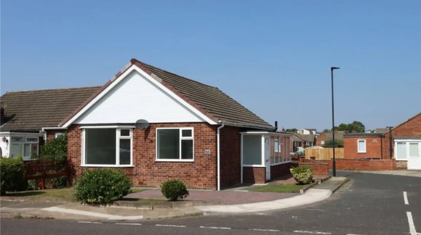
The architecture of Chapel House reflects this suburban planning model. The estate includes different forms of low-rise housing, including semi-detached properties, terraces, bungalows and detached houses. Gardens, garages and residential roads form important elements of its physical character.
The estate was also designed around the requirements of everyday family life. Schools, churches, local shopping facilities and other services developed alongside residential construction.
This explains why Chapel House looks substantially different from older Newcastle districts. Its streets were planned during a period when planners and developers had more land available for low-density suburban housing.
The result is a neighbourhood whose physical character belongs primarily to the post-war period rather than to the Victorian industrial city.
Why is Westerhope historically different from Chapel House?
Westerhope has a longer documented modern settlement history because it was established in the 1890s as a working community, expanded through Victorian coal mining, developed village institutions and retained a recognisable historic core before later suburban estates transformed its surrounding landscape.
The foundation of Westerhope is closely connected with the Northern Allotment Society. The organisation’s activities demonstrate how land reform, smallholding and working-class housing were linked during the late Victorian period.
The early settlement was not simply a conventional mining village. Its founders intended residents to have access to land for cultivation. This distinguishes Westerhope from communities that developed solely around a colliery.
The settlement remained surrounded by agricultural land for decades. Newcastle’s Historic Environment Record states that Westerhope remained relatively isolated in an agricultural landscape until the 1950s.
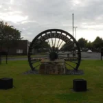
Coal mining then became a major force in the surrounding area. North Walbottle Colliery and other industrial sites changed employment patterns, settlement density and transport requirements. The Historic Environment Record identifies North Walbottle Colliery and Whindykes Quarry as important elements of the area’s industrial history.
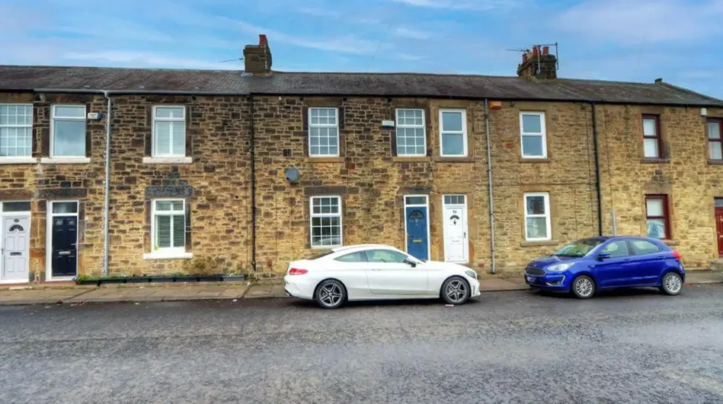
The surviving historic layout contains evidence of this transformation. James Street, for example, is recorded as a row of stone houses associated with nearby colliery activity. A tramway connected the houses with the industrial site and supported coal delivery and refuse removal.
Westerhope also developed community infrastructure. The Methodist chapel was built in 1901, schools were established on Hillhead Road in 1907, and a Westerhope store opened in 1908 as a branch of the Throckley Co-operative Society. A cinema opened in 1912.
These structures show how quickly Westerhope developed from a planned settlement into an established community with religious, educational, commercial and recreational facilities.
How did coal mining shape Westerhope?
Coal mining transformed Westerhope from an agricultural settlement into an industrially connected community. North Walbottle Colliery and related workings created employment, housing and transport infrastructure, while mining later declined and left a landscape increasingly dominated by residential development.
Coal extraction forms one of the clearest historical differences between Westerhope and Chapel House.
The western Newcastle landscape contained accessible coal measures, and industrial activity expanded during the eighteenth and nineteenth centuries. Newcastle’s Historic Environment Record identifies old mine shafts and wagonways around Whindykes, demonstrating the physical infrastructure required to move coal and other extracted materials.
Whindykes Quarry also illustrates the area’s geological importance. Quarrying of whinstone was active during the nineteenth century, with documentary evidence placing the operation in the period before 1847. The quarry was eventually filled during the late twentieth century.
North Walbottle Colliery became one of the area’s major industrial sites. Historical accounts record that the colliery produced 21.5 million tons of coal before closing in 1968. Further extraction was restricted because of the potential effect on Newcastle Airport’s runway.
The closure represented more than the end of a single industrial site. It formed part of the wider decline of coal mining across North East England.
As mining employment disappeared, Westerhope’s economic relationship with Newcastle changed. The area increasingly became residential, with residents travelling elsewhere for employment.
The physical landscape also changed. Industrial sites disappeared, agricultural land was reduced and new residential developments filled large areas around the older village.
The modern Westerhope landscape therefore contains a strong historical sequence: agriculture, allotment settlement, coal mining, industrial housing, mining decline and suburban expansion.
How did twentieth-century planning connect Chapel House with Westerhope?
Twentieth-century planning physically connected Chapel House and Westerhope by expanding Newcastle westward across former agricultural and industrial land. The resulting suburbs transformed separate historical landscapes into a continuous residential area served by roads, schools, shops and bus services.
The major transformation occurred after the Second World War.
Newcastle needed additional housing as its population and economy expanded. Available land around western settlements provided opportunities for large-scale residential construction.
Chapel House formed part of this process. Its development from the 1960s introduced a large planned private estate into a landscape previously dominated by farms and open land.
Westerhope experienced a different but related process. Its historic village already existed, but new housing expanded around it.
The 1970s were particularly important. Westerhope was incorporated into the City of Newcastle as part of the local government reorganisation associated with the period. The change coincided with major housing development west of the existing village.
The result was a continuous suburban environment rather than a collection of isolated settlements.
This historical process explains the close geographical relationship between Chapel House, Chapel Park, Westerhope and surrounding districts.
It also explains why residents today can experience different architectural periods within a relatively small area. A short journey can pass from late nineteenth-century workers’ housing to twentieth-century private estates and later suburban construction.
For history enthusiasts, this makes the NE5 area particularly useful for studying urban expansion.
To connect the historical development with the present-day neighbourhood, see our comprehensive for local context, amenities and the modern residential environment.
What architectural differences can be seen between Chapel House and Westerhope?
Chapel House is dominated by planned twentieth-century suburban housing, while Westerhope contains a wider architectural sequence including Victorian houses, early twentieth-century workers’ terraces, community buildings and later residential estates built during Newcastle’s suburban expansion.
Architecture provides one of the clearest ways to identify the different histories of the two areas.
Chapel House’s dominant built form belongs to the 1960s and early 1970s. Its houses reflect post-war suburban design, with low-rise construction, private gardens, garages and planned residential streets.
The architecture is functional and closely linked to the housing requirements of the period.
Westerhope contains greater chronological variety.
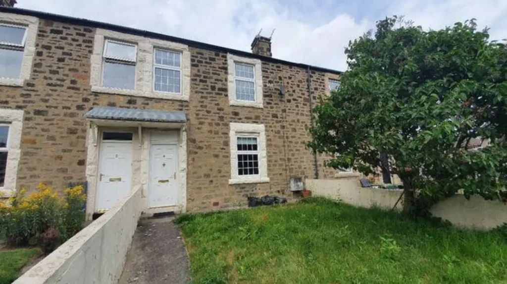
The Historic Environment Record identifies early streets including Stamfordham Road, North Avenue, West Avenue and Highfield Road. Ellergill Cottage in North Avenue carries a date of 1897 above its bay window. Belmont Cottages followed from 1901.
Industrial housing adds another architectural layer. Beaumont, Boyd and Rogerson Terraces were built between 1901 and 1910 by the North Walbottle Coal Company. These houses demonstrate the connection between employment, housing and industrial development.
The former Picture Palace, built in 1912, represents another stage in community development. Its later use as a bingo hall demonstrates how buildings can survive while their social functions change.
Westerhope’s architectural record therefore provides stronger evidence of nineteenth- and early twentieth-century community formation.
Chapel House, by contrast, provides a concentrated example of planned post-war suburban architecture.
How did transport influence both NE5 areas?
Transport helped integrate Chapel House and Westerhope into Newcastle’s wider urban system. Westerhope benefits from its position near the A1 and A69, while both areas rely heavily on road and bus connections because neither sits directly on the Tyne and Wear Metro network.
Transport has shaped the western suburbs throughout their history.
Earlier communities depended on roads, tracks, wagonways and local industrial transport. Coal mining required routes for moving coal and materials, while farms depended on roads connecting them with Newcastle and surrounding settlements.
Modern transport operates on a much larger scale.
Westerhope occupies a strategically important position near the junction of the A1 and A69. This provides road connections towards Newcastle, the west and northern parts of the region. Historical descriptions of the area identify this road position as one of its defining modern characteristics.
The area does not have a Tyne and Wear Metro station. Its terrain and existing transport geography have influenced this situation, leaving buses and road transport as important parts of daily travel.
Chapel House similarly developed around the assumptions of post-war road-based suburban planning.
Its streets were constructed for residential access rather than the dense pedestrian and industrial patterns found in older inner Newcastle districts.
This distinction remains important when studying the history of suburban Newcastle. The expansion of private housing did not simply increase the number of houses. It changed the relationship between residential areas, workplaces, roads and the city centre.
What schools and community institutions reveal about the two areas?
Schools, churches, shops and recreational buildings demonstrate different stages of community formation. Westerhope developed these institutions from the early twentieth century, while Chapel House acquired comparable facilities during its post-war suburban expansion and later adapted to changes in Newcastle’s education system.
Community infrastructure provides evidence of how residential areas mature.
Westerhope’s early institutions appeared soon after the settlement was established. The village schools opened on Hillhead Road in 1907, while the Methodist chapel was built in 1901. A cooperative store followed in 1908.
These buildings indicate that Westerhope had developed into a self-contained community by the early twentieth century.
Chapel House’s institutional history belongs mainly to the second half of the twentieth century.
The estate had Chapel House Middle School before Newcastle’s outer-west education system changed in 2005. The school served approximately 500 children before its closure as the area moved from a first-middle-upper structure to a two-tier system.
Religious architecture also records the estate’s development. St John Vianney’s church in West Denton was associated with the Chapel House development. The first church opened in 1964 and was later replaced in 1984–85 because of concrete problems.
These changes show that suburban communities are not static. Schools close or reorganise, churches are replaced, shops change function and older buildings acquire new uses.
What historic evidence survives in Westerhope and Chapel House?
Westerhope retains a broader range of visible historical evidence, including early housing, community buildings and industrial traces. Chapel House retains archaeological associations, its historic place-name and the built character of its 1960s estate, although much of the earlier farm landscape disappeared during development.
Heritage survival differs between the two areas.
Westerhope’s historic village remains an important source of evidence. Newcastle’s Historic Environment Record identifies the village as a post-medieval settlement with a strong Victorian component.
The industrial landscape also survives through archaeological records. Old shafts, wagonways and quarry sites document earlier extraction activity even where surface structures have disappeared.
Chapel House presents a different preservation challenge.
The historic farm that gave the estate its name was lost during twentieth-century development. Academic research describes the disappearance of the farm site as regrettable because archaeological excavation could have provided evidence about earlier settlement.
The nearby Roman archaeology provides an important surviving connection to the distant past. Milecastle 9 remains associated with the landscape around Chapel House, although modern roads have covered substantial parts of the archaeological site.
This distinction matters for heritage researchers.
Westerhope is particularly useful for studying the evolution of a planned Victorian settlement and coal-mining community.
Chapel House is particularly useful for studying the conversion of an older rural landscape into a large post-war private suburb, alongside the survival of archaeological evidence from earlier periods.
What does the history of Chapel House and Westerhope tell us about modern NE5?
The modern identity of NE5 reflects successive layers of Roman frontier activity, medieval and post-medieval agriculture, Victorian settlement, coal mining, post-war housing and metropolitan expansion. Chapel House and Westerhope represent different stages within this longer urban history.
The comparison becomes clearer when the two areas are viewed as parts of one regional process.
Newcastle did not expand uniformly. Its growth occurred through successive phases that absorbed agricultural land, industrial settlements and smaller communities.
Westerhope demonstrates how a planned nineteenth-century community could become part of an expanding metropolitan city.
Its original purpose was connected to working families, smallholdings and access to land. Coal mining then changed the local economy and built environment. Later suburban expansion reduced the physical separation between Westerhope and Newcastle.
Chapel House represents the next major phase.
Its 1960s development converted former agricultural land into a planned private suburb. Its houses, roads, schools and churches reflected post-war expectations about family housing and suburban life.
The two areas therefore provide complementary evidence.
Westerhope preserves stronger connections with Victorian settlement and industrial history. Chapel House preserves the physical character of post-war suburban planning and retains an important connection with the earlier Chapel House Farm name and Roman frontier archaeology.
For genealogical researchers, these distinctions also matter. Records relating to older Westerhope families can intersect with mining, allotment and village institutions, while Chapel House’s twentieth-century development means many property and household histories begin with the suburban expansion of the 1960s.
For educators, the areas offer a compact case study in urban change.
For heritage researchers, they demonstrate how archaeological sites, surviving buildings, historic street patterns and documentary records can reveal different phases of development.
The comparison is therefore not simply between two residential areas. It is between two stages of Newcastle’s westward growth.
Chapel House represents planned post-war suburbanisation.
Westerhope represents Victorian community formation, industrialisation and later metropolitan integration.
Both remain part of the same modern NE5 landscape, but their historical identities developed through different processes. That distinction explains the different architecture, settlement patterns and heritage evidence visible across the area today.