


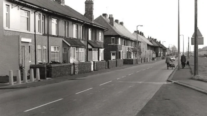
Hazlerigg is a village on the northern outskirts of Newcastle upon Tyne, North East England. Its identity reflects Northumberland’s rural heritage, the growth of coal mining and industrial employment, and the expansion of modern residential communities around Newcastle. Today, Hazlerigg attracts interest from residents, local historians, walkers and visitors exploring the countryside north of the city.
- Where is Hazlerigg village, and what makes its location historically significant?
- What is the historical background of Hazlerigg village?
- How did Hazlerigg Colliery transform the village?
- What happened to Hazlerigg after the coal industry declined?
- What local amenities and community facilities does Hazlerigg offer?
- Does Hazlerigg village have traditional pubs, and where can visitors find them nearby?
- Where can visitors enjoy countryside walks around Hazlerigg?
- How does Hazlerigg connect with nearby villages and historic walking routes?
- How can visitors reach Hazlerigg and plan a countryside visit?
- Where can researchers find reliable historical records about Hazlerigg?
- Why does Hazlerigg’s history matter to the future of North East heritage?
- What should readers remember about Hazlerigg village?
This Newcastle Times guide examines Hazlerigg’s historical development, village amenities, pub culture, surrounding landscapes and connections to the wider North East. It explains how an agricultural settlement became part of Newcastle’s expanding urban region while retaining its village identity and access to open countryside.
Where is Hazlerigg village, and what makes its location historically significant?
Hazlerigg is a village and civil parish north of Newcastle upon Tyne, in North East England. Its location connects the historic Northumberland coalfield with Newcastle’s expanding residential districts, while nearby countryside preserves evidence of the area’s industrial and agricultural past.
Hazlerigg lies approximately five miles (eight kilometres) north of Newcastle city centre, close to the A1, a major road connecting northern England and Scotland with the wider British motorway network. The village sits within the modern metropolitan landscape of Tyne and Wear, near Dinnington, Wideopen and Newcastle Great Park.
Its administrative geography reflects the expansion of Newcastle and neighbouring communities. The A1 forms an important boundary in the locality, with areas on opposite sides falling under different local authorities. Hazlerigg Civil Parish covers the Newcastle-administered part of the area and includes substantial sections of Newcastle Great Park.
The village’s position is significant because it represents a transition between countryside and city. Historic agricultural land, former coal-mining sites, modern housing and protected natural spaces occupy the wider landscape. These features provide a practical starting point for understanding Hazlerigg’s development from a small rural settlement into a community connected to Newcastle’s urban economy.
For visitors, the location also provides access to the wider North East heritage landscape. Newcastle’s historic centre, the former mining settlements of Northumberland and the countryside surrounding the Great Park each illustrate different stages in the region’s development.
What is the historical background of Hazlerigg village?
Hazlerigg originated as a small agricultural community before coal mining transformed its population, housing and economy during the late nineteenth and twentieth centuries. The opening of Hazlerigg Colliery in 1892 marked the decisive turning point in the village’s documented industrial history.
Before industrial expansion, Hazlerigg formed part of a rural landscape shaped by farming, landownership and settlement patterns associated with northern England. Agricultural communities depended on cultivated land, livestock, local labour and connections with nearby market centres. The surviving historical record identifies Hazlerigg as a small agricultural settlement, although a complete account of its earliest inhabitants requires further archival research.
The industrial transformation gathered pace during the nineteenth century, when growing demand for coal supported mining investment across Northumberland and County Durham. Newcastle’s commercial connections and the wider coalfield encouraged the development of new collieries and mining settlements.
Hazlerigg’s modern village identity emerged through this industrial process. The establishment of a colliery created demand for workers’ accommodation, transport infrastructure and everyday services. Housing constructed for miners formed the foundation of the settlement that developed around the mine. In this case, the colliery gave its name to the growing village rather than the village simply lending its name to an existing industrial site.
This history places Hazlerigg within a wider regional pattern. Mining settlements often grew rapidly when companies opened new workings, recruited employees and built housing close to employment. Hazlerigg’s later residential expansion followed a different pattern as mining employment disappeared and Newcastle’s urban area expanded northwards.

How did Hazlerigg Colliery transform the village?
Hazlerigg Colliery opened in 1892 under the Burradon and Coxlodge Coal Company. It generated substantial employment, encouraged the construction of miners’ housing and shaped local life until closure in 1964, leaving a landscape that later underwent ecological restoration and redevelopment.
The colliery represents the central historical landmark in Hazlerigg’s industrial development. Mining records identify its opening in 1892, when the Burradon and Coxlodge Coal Company began developing the site. The operation extracted coal used for household consumption, manufacturing and steam production. Fireclay and shale also appeared among the materials recorded in different periods of its working life.
How many people worked at the colliery?
Employment figures demonstrate the scale of the mine’s influence. By 1902, the colliery employed approximately 1,010 people, including 826 underground workers and 184 surface workers. In 1910, its workforce reached a reported peak of 1,156 people, with 960 working underground. These figures show how closely the village’s economic life became connected to coal production.
Mining also involved serious occupational risks. Underground work exposed employees to hazards associated with falling rock, machinery, haulage systems and difficult working conditions. The Durham Mining Museum’s historical register records 66 names associated with deaths at Hazlerigg Colliery, while explicitly warning that its list is incomplete. The record demonstrates the importance of preserving individual miners’ histories alongside production and employment statistics.
How did ownership change?
The colliery’s ownership changed twice during its industrial life. In 1929, it passed to Hazlerigg and Burradon Coal Company Ltd. Nationalisation transferred it to the National Coal Board in 1947, when Britain’s coal industry entered a new public ownership structure following the Coal Industry Nationalisation Act 1946.
The National Coal Board managed the colliery during its final years. The mine closed in 1964, ending a period of more than seven decades of industrial activity. Historical references differ on the precise closure date: the Durham Mining Museum records 25 April 1964, while the Tyne and Wear Historic Environment Record gives 25 November 1964. The consistent historical fact is the closure year, 1964.
The closure changed Hazlerigg’s relationship with employment, land and industry. The colliery ceased to function as an economic centre, and its former ground eventually became part of the area’s natural landscape.
What happened to Hazlerigg after the coal industry declined?
Hazlerigg’s post-mining transformation replaced an industrial landscape with woodland, nature conservation areas and expanding residential development. The former colliery grounds now form part of Havannah and Three Hills Nature Reserve, connecting the village’s mining history with contemporary environmental management.
The end of mining did not erase the physical effects of industrial activity. Spoil heaps, altered ground levels and depressions associated with mining operations continued to influence the landscape. These features became part of the area’s post-industrial geography rather than disappearing completely after the colliery closed.
The Havannah and Three Hills site illustrates this process. Newcastle City Council identifies the nature reserve as being located on the former Hazlerigg Colliery site. Its name refers to Havannah Drift Mine and three slag heaps that remain prominent features of the landscape. The reserve therefore preserves a visible connection between mining activity and modern countryside.
The wider area also experienced residential growth. Newcastle Great Park developed across land south and east of Hazlerigg, changing the relationship between the village, nearby open spaces and the expanding city. Modern development has increased the importance of understanding how historic settlement boundaries and rural land uses changed over time.
This transition has long-term historical significance. Former industrial sites provide evidence of earlier economic activity, while restored landscapes demonstrate how communities manage land after heavy industry ends. Hazlerigg’s history is therefore not limited to the operational life of a coal mine. It also includes the subsequent reuse, ecological recovery and development of its former industrial land.
What local amenities and community facilities does Hazlerigg offer?
Hazlerigg provides everyday village amenities, including convenience shopping, postal services, personal care businesses and community facilities. Its community centre and social club support local activities, while nearby Newcastle districts provide access to a wider range of education, retail, healthcare and leisure services.
Hazlerigg retains a recognisable village centre despite residential growth across the surrounding area. Local directories identify a post office, convenience store, fish-and-chip shop, hairdresser, beauty salon and garage among the village’s amenities. These businesses support routine shopping and services without requiring every journey to Newcastle city centre. Individual business operations and opening hours should be checked before visiting.
What role does Hazlerigg Community Centre play?
Hazlerigg Community Centre stands towards the western side of the village, next to the show field. The adjoining open area formerly hosted the annual village gala, a community gathering associated with local recreation and village identity. The site demonstrates how shared public spaces preserve community traditions even as the surrounding settlement changes.
Community centres generally provide space for meetings, organised activities and social gatherings. Current activities at Hazlerigg should be confirmed through local community notices or the relevant organisers rather than assumed from the building’s presence.
How does modern development affect village life?
Newcastle Great Park has expanded residential development south and east of Hazlerigg. This growth connects the village more closely with Newcastle’s housing market and services while placing pressure on the distinction between established village streets and newer suburban neighbourhoods.
Hazlerigg’s history therefore remains relevant to contemporary planning. Its former miners’ housing, community spaces and neighbouring countryside form part of a local identity that predates the latest development. Understanding that history helps explain why preserving green corridors, public paths and community facilities matters alongside the provision of new homes.
Does Hazlerigg village have traditional pubs, and where can visitors find them nearby?
Hazlerigg has historically been unusual because it developed without a traditional public house within the village. A local social club provides a separate community venue, while neighbouring settlements such as Wideopen and Dinnington offer additional hospitality options within the wider area.
The absence of a traditional pub is an important distinction in any accurate Hazlerigg village guide. Although the village developed around a colliery and housed a substantial industrial workforce, local historical summaries state that Hazlerigg has never had a pub. The presence of a social club does not make it a conventional public house.
What is the role of Hazlerigg’s social club?
Hazlerigg and District Victory Society is listed among the nearby hospitality and social venues. Social clubs traditionally provide members and local communities with spaces for gatherings, recreation and organised events. Their admission policies, public access arrangements and facilities differ from those of commercial pubs, so visitors should check current conditions before planning a visit.
Which neighbouring areas have pub options?
Wideopen and Dinnington provide alternatives beyond Hazlerigg itself. The Coach and Horses in Wideopen and the Masons Arms and White Swan Inn in Dinnington appear in local pub directories. These establishments belong to neighbouring communities rather than forming part of Hazlerigg’s historic village centre.
Visitors should confirm opening times, menus, accessibility and current operating status directly with each venue. The wider lesson is historical as well as practical: Hazlerigg’s local identity developed around mining, housing and community institutions rather than a traditional village pub.
Where can visitors enjoy countryside walks around Hazlerigg?
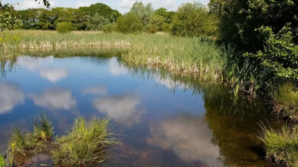
Havannah and Three Hills Nature Reserve is the principal countryside destination associated with Hazlerigg’s industrial heritage. The reserve contains public rights of way, permissive footpaths and bridleways, offering opportunities for walking, wildlife observation and exploration of a restored former mining landscape.
What is Havannah and Three Hills Nature Reserve?
The reserve occupies land associated with the former Hazlerigg Colliery and takes its name from the Havannah Drift Mine and three industrial spoil heaps. These elevated landforms preserve evidence of mining activity while supporting a landscape now managed for nature conservation. Newcastle City Council identifies the reserve as a habitat for great crested newts, badgers and birds of conservation concern.
The site demonstrates how industrial land can acquire a new environmental function. Rather than removing every physical trace of mining, the landscape retains features shaped by extraction and subsequent land changes. The reserve’s ecological value also shows why former industrial areas require careful management after their original economic use ends.
What walking routes are available?
The council identifies public rights of way and permissive footpaths and bridleways within the reserve. These routes support walking, cycling and horse riding, although permitted activities depend on the particular path and any posted restrictions. Visitors should follow local signs and remain on designated routes.
The council also warns that paths become muddy. Suitable footwear is important after wet weather, particularly on unpaved sections. A car park is available at Coach Lane, and the council identifies a nearby bus stop. There are no toilets within the reserve, so visitors should plan accordingly.
The reserve is suitable for visitors interested in combining outdoor recreation with industrial history. The former mining landscape provides context for understanding the area’s changing economy, while its wildlife and vegetation reveal how the land functions today.
To explore more attractions and outdoor activities across the surrounding area, consult our comprehensive [Insert Anchor Text for Things to Do Article Here] for itineraries and visiting information.
How does Hazlerigg connect with nearby villages and historic walking routes?
Hazlerigg’s surrounding footpaths connect the village with neighbouring settlements and landscapes shaped by former mining transport. Routes towards Brunswick Village and nearby countryside reflect the historical relationship between industrial employment, coal movement and the development of local connections.
One particularly interesting local feature is the path between Hazlerigg and Brunswick Village. Local historical information identifies this route with a former wagonway used to transport coal. The path preserves the alignment of an industrial transport corridor that once served a very different purpose.
Why were wagonways important?
Wagonways were transport routes designed to move mineral loads between mines and destinations such as railways, industrial facilities or shipping connections. In coal-producing districts, these routes reduced the difficulty of transporting heavy materials and supported the commercial operation of collieries.
The former wagonway connection illustrates the relationship between Hazlerigg and the wider Northumberland coalfield. Mining required more than underground workings. It depended on transport systems, workers’ housing, commercial organisation and connections to markets. The surviving path provides a starting point for interpreting these relationships within the modern landscape.
What should walkers know before setting out?
The former wagonway route offers historical interest alongside outdoor recreation. However, the precise distance, surface conditions and accessibility of individual sections depend on the chosen starting point and route. Visitors should check current local mapping and follow any access restrictions.
Walking routes around Hazlerigg and the nature reserve are particularly relevant to heritage visitors because they reveal how industrial infrastructure becomes part of everyday countryside. A path that once served the movement of coal can subsequently function as a recreational connection between communities.
How can visitors reach Hazlerigg and plan a countryside visit?
Hazlerigg is accessible from Newcastle by road, with the A1 providing a major regional connection. Visitors exploring the village and Havannah and Three Hills Nature Reserve should check transport services, parking arrangements, weather conditions and path accessibility before travelling.
Hazlerigg’s location approximately eight kilometres north of Newcastle city centre makes it a practical destination for a local heritage excursion. The A1 provides the principal regional road reference, while Coach Lane gives access to the nature reserve’s designated car park. Newcastle City Council also identifies a bus stop on Coach Lane.
What should a day visit include?
A visit can combine three complementary elements: the historic village, the former mining landscape and the nature reserve. The village provides context for the residential community that developed around coal employment. The former colliery site explains the economic forces that shaped the settlement, while the reserve demonstrates the area’s environmental transformation.
Allow additional time for reading local historical material and observing the landscape. The visible terrain does not necessarily reveal the full extent of former underground workings, and industrial remains should not be entered or disturbed. Designated paths provide the appropriate framework for exploring the reserve.
When is the best time to walk?
The most suitable time depends on weather, daylight and personal walking preferences. Dry conditions generally make unpaved paths easier to negotiate, while wet weather increases the likelihood of mud. Visitors should check the forecast, wear suitable footwear and allow enough time to return before daylight fades.
The reserve is a nature conservation site rather than a formal heritage museum. There are no toilets within the reserve, according to Newcastle City Council, and facilities should be planned around this limitation.
For visitors combining a walk with research, a map and notes on the former colliery, wagonway and surrounding settlements help establish the historical context of the landscape.
Where can researchers find reliable historical records about Hazlerigg?
Hazlerigg’s industrial history is documented through the Tyne and Wear Historic Environment Record, Durham Mining Museum and regional archive collections. These resources preserve information about colliery ownership, employment, abandoned mine plans and historical photographs for researchers investigating the village’s development.
Historical research benefits from combining institutional records with local community knowledge. Each source provides a different type of evidence, and cross-checking information helps distinguish documented facts from later interpretations.
Which heritage records are most useful?
The Tyne and Wear Historic Environment Record contains an entry for Hazlerigg Colliery, identified as HER 4240. Its record establishes the site’s industrial classification, location and ownership history. It also records the colliery’s closure in 1964.
The Durham Mining Museum provides additional information about employment, production, management and mining fatalities. Its historical material helps researchers understand the human and economic dimensions of colliery life. Researchers should note its explicit warning that the list of fatalities is incomplete.
Regional archive collections also provide a route into documentary research. The Tyne and Wear Archives user guide to colliery records lists historical photographs of Hazlerigg dating to approximately 1970. Such material can support comparisons between the former industrial landscape and later residential or environmental changes.
How can these records support local heritage preservation?
Preservation depends on recording more than surviving buildings. Hazlerigg’s former colliery structures have not been identified as surviving at the original site, but documentary evidence and the altered landscape still provide important historical information.
Old maps, employment records, mine plans, photographs and oral histories can collectively explain how the settlement developed. They also help identify former transport corridors and the relationship between industrial activity and housing.
For educators, these records support studies of industrialisation, labour history and environmental change. For genealogical researchers, employment registers and related archival documents provide potential avenues for investigating ancestors who lived or worked in the mining district. Individual records require careful interpretation, and a connection to Hazlerigg should be established through corroborating evidence rather than assumed from a shared surname.
Why does Hazlerigg’s history matter to the future of North East heritage?
Hazlerigg demonstrates how industrial communities evolve after their original economic foundations disappear. Its mining history, former transport routes, community facilities and restored nature reserve preserve evidence of regional change, making the village relevant to heritage education, landscape conservation and future local planning.
The village’s historical significance rests on the connection between people, industry and landscape. Coal mining created employment and housing, shaped community life and altered the surrounding ground. After the colliery closed, residential development and environmental restoration introduced new uses for land that had previously supported industrial production.
Havannah and Three Hills Nature Reserve provides a particularly clear example of this transition. The site retains the influence of former mining activity while supporting wildlife and public recreation. Its current role demonstrates that industrial heritage and nature conservation are not necessarily competing objectives. A landscape can preserve evidence of its past while supporting contemporary environmental priorities.
Hazlerigg’s future heritage value also depends on accurate documentation. Historic records, community memories, maps and photographs help maintain connections between the village’s mining origins and its modern residential identity. Preserving these resources gives future generations a reliable basis for understanding the settlement.
For Newcastle Times readers, Hazlerigg offers a useful example of North East England’s wider historical development. It links agricultural settlement, industrial growth, working-class housing, transport infrastructure and ecological recovery within one local landscape.
What should readers remember about Hazlerigg village?
Hazlerigg is more than a residential settlement north of Newcastle upon Tyne. Its development reflects the industrial transformation of the Northumberland coalfield, particularly the establishment of Hazlerigg Colliery in 1892 and its closure in 1964.
The village’s local amenities and community facilities support everyday life, while nearby hospitality venues serve visitors seeking options beyond the village itself. Havannah and Three Hills Nature Reserve provides the strongest physical connection between Hazlerigg’s industrial past and its contemporary countryside.
For history enthusiasts, walkers and educators, the combination of former mining land, historic transport routes, documentary records and modern green space makes Hazlerigg a valuable destination for understanding the changing landscape of North East England.